Case study:SEE River Project
Project overview
| Status | In progress |
|---|---|
| Project web site | http://www.see-river.net |
| Themes | Flood risk management, Hydropower, Land use management - agriculture, Land use management - forestry, Social benefits, Spatial planning, Urban |
| Country | Albania, Austria, Bosnia and Herzegovina, Croatia, Hungary, Italy, Romania, Serbia, Slovakia, Slovenia |
| Main contact forename | Aleš |
| Main contact surname | Bizjak |
| Main contact user ID | |
| Contact organisation | Institute for water of the Republic of Slovenia |
| Contact organisation web site | http://izvrs.si |
| Partner organisations | IZVRS, IRSNC, PRC, AKL-SchWW, BMLFUW, WWF, WBV, DDVIZIG, NEKI, NARW, SHI, DZZP, HR. VODE, KCKZZ, HEIS, AGS, IJC |
| Parent multi-site project | |
| This is a parent project encompassing the following projects |
No |
Project summary
SEE River Project is intended to reach a common agreement on river corridor management for harmonisation of both – development and conservation interests. This will be achieved by close cooperation of experts from wide range of fields from different countries and active involvement of stakeholders from local river areas and national or regional authorities. The project is introducing a new approach to river and land management by focusing on the river corridor as the selected, local river area where most pressures occur.
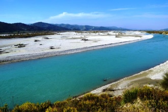
Project activities and findings will result in the SEE River Toolkit, a generally applicable and innovative model and guidance on how to reach future sustainable use of river corridors by taking into account and harmonizing different stakeholder interests. To develop and implement the SEE River Toolkit, project research, field work and active involvement of stakeholders will be performed in river corridors of 6 SEE rivers: Drava, Bodrog, Neretva, Prut, Soča and Vjosa. The project lasts from October 2012 until September 2014.
Monitoring surveys and results
Main objective:
To empower the multi-sectoral stakeholders sharing the territory of an international river corridor to gain knowledge on river corridor management, exceeding sectoral, local and national interests in order to ensure good water status and flood protection, preserve nature, biodiversity and ecosystems, and to enable development at the same time.
Specific objectives of the project are: To develop a joint approach (SEE River Tolkit) for integrative management of international river corridors; the Toolkit will give guidance on planning and implementing procedures for harmonisation and prioritisation of heterogeneous sectoral policies, plans and programmes related to management of international rivers.
To apply the joint approach (Toolkit) to agree on future joint actions that will ensure integrative management of the International Drava River Corridor (Drava River Action Plan); key institutions from all five Drava-riparian countries will work together to reach consensus on vision, goals and actions for future management of the international Drava River Corridor.
To work together with local, regional and national stakeholders in the five Drava-riparian countries to reach multi-sectoral agreements on concrete actions to implement the internationally agreed Drava River vision; the agreed Local Action Plans will be the basis for management of the selected river corridors on local levels.
To use and promote the Toolkit on 5 additional international river corridors for Bodrog, Neretva, Prut, Soca, and Vjosa rivers; Draft Action Plans for future cooperation in management of these rivers will be prepared by establishing transboundary stakeholder partnerships in all riparian countries.
To improve the transboundary and cross-sectoral cooperation of existing bodies responsible for managing international rivers by involving them in the process of seeking consensus on future action plans for integrative management on all 6 rivers.
To facilitate the implementation of relevant EU legislation, in particular the Water Framework Directive, the Flood Directive, the Habitat Directive, the Birds Directive and the Renewable Resources Directive.
To increase capacity and raise awareness of stakeholders along international river corridors on importance of transboundary and cross-sectoral approach to sustainable integrative management of river corridors by organising partner trainings, stakeholder workshops and capacity building seminars for addressed stakeholders.
Lessons learnt
Image gallery
|
Catchment and subcatchment
Site
Project background
Cost for project phases
Reasons for river restoration
Measures
MonitoringHydromorphological quality elements
Biological quality elements
Physico-chemical quality elements
Any other monitoring, e.g. social, economic
Monitoring documents
Additional documents and videos
Additional links and references
Supplementary InformationEdit Supplementary Information
| ||||||||||||||||||||||||||||||||||||||||||||||||||||||||||||||||||||||||||||||||||||||||||||||||||||||||||||||||||||||||||||||||||||||||||||||||||||||||||||||||||||||||||||||||||


