Case study:Reopening side channels along the Saône in Jassans-Riottier
Project overview
| Status | Complete |
|---|---|
| Project web site | |
| Themes | Environmental flows and water resources, Flood risk management, Habitat and biodiversity, Social benefits |
| Country | France |
| Main contact forename | Noël |
| Main contact surname | Corget |
| Main contact user ID | |
| Contact organisation | Voies navigables de France (VNF) |
| Contact organisation web site | http://www.vnf.fr/vnf/home.vnf?action=vnf |
| Partner organisations | Rhône-Méditerranée-Corse water agency, Ain departmental territorial directorate (DDT 01). Saône and Doubs public river-basin territorial agency, “Porte Ouest de la Dombe” intermunicipal association. |
| Parent multi-site project | |
| This is a parent project encompassing the following projects |
No |
Project summary
As part of a programme in the Saone River, an assessment was run in
2003 to identify problems along the river and propose
solutions adapted to the local issues.
The assessment pinpointed the areas suitable for ecological development work, with a low topographic level, without any major projects or issues nearby, and having worthwhile ecological potential (alluvial areas, etc.). It also identified areas of interest for tourism infrastructure along the river (boating sites, etc.).
Subsequently, VNF, the managing authority for the waterway, decided to work on the wetlands that were filling in along the Saône in the town of Jassans-Riottier. This project was part of the contract for the floodable Saône valley and met one of its objectives, namely to restore and protect natural environments.
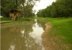
Works were done on the remains of wetlands that still existed along the Saône. In 2007, secondary channels and ponds that were continuously or intermittently linked to the Saône were restored by moving 12,000 m³ of earth.
Then the worked and graded sites and banks were planted with 8 000 clumps of helophytes comprising a total of ten species.
The foot of the bank at the connection point with the Saône was bio-engineered over a distance of 40 metres to limit erosion and the effects of ships’ wakes on the restored alluvial zone.
A sluice ensures continuous connection between the river bed and the side channel.
In 2008, all the worked surfaces, not including the low areas, were planted with grass and the service road was restored with a stone surface.
Monitoring surveys and results
A brief pre-works report was drafted in the framework
of the preliminary study. It contained topographical
measurements and an analysis of the terrestrial
vegetation in the side channels that were
slowly filling in.
Following the works, ecological monitoring by a consulting firm was carried out over four years from 2009 to 2012.
Monitoring addressed the physical compartment, e.g. with topographic, temperature and physical-chemical surveys, and the biological compartment with an analysis on phytoplankton, zooplankton, fish and the aquatic and riparian vegetation. An analysis on visits to the site and on site maintenance (number of visits, damage done to installations, etc.) was also carried out.
The topographic profiles prepared in 2009 revealed a high level of local sedimentation causing a narrowing of the side channel. On the basis of the results from 2010 to 2012, this sedimentation is apparently caused by readjustments on the worked site where successive floods and the wakes of ships even out the profile of the side channels.
The modifications made at the foot of the embankment limited erosion as planned.
However, the analysis also revealed that the wakes of ships produced effects in the side channel and represented a significant pressure on the environment by limiting biological development. Fine sediment in the side channel was regularly resuspended in the water by the wakes, which may reduce the environmental value of the area.
Monitoring of the fish populations revealed an increase in the number of species caught in the side channel, from 17 species in 2010 to 21 in 2012. In the spring, the time of rising water levels, the side channel remains a calm environment that is favourable for small species. At the beginning of the fall of 2012, the side channel was home to a diversified and more abundant community than in the spring, due to the hydrology of the Saône and to the development of the grass beds that enhanced site attractiveness. In addition, a number of fish-eating species were noted, including perch, pikeperch and pike, re-observed for the first time in 2012.
The aquatic vegetation in the continuously filled pond underwent considerable change with respect to the observations made from 2009 to 2011. The dominant Nuttall’s pondweed, an invasive alien species, gave way to significant development of rigid hornwort, a native species. The number of inventoried plant species remained virtually identical. A stabilisation process would seem to be under way in some of the side channels.
The VNF technical department and the town are satisfied with the operation. However, the large number of visits to the site have resulted in vandalism creating pressure on the vegetation and incurring additional costs for maintenance and the installation of systems to limit access.
Lessons learnt
Image gallery
|
Catchment and subcatchment
Site
Project background
Cost for project phases
Reasons for river restoration
Measures
MonitoringHydromorphological quality elements
Biological quality elements
Physico-chemical quality elements
Any other monitoring, e.g. social, economic
Monitoring documents
Additional documents and videos
Additional links and references
Supplementary InformationEdit Supplementary Information
| ||||||||||||||||||||||||||||||||||||||||||||||||||||||||||||||||||||||||||||||||||||||||||||||||||||||||||||||||||||||||||||||||||||||||||||||||||||||||||||||||||||||||||


