Case study:Renaturation of Stržen's riverbed on intermittent Cerknica Lake

From RESTORE
Jump to navigation Jump to search
4.00
(one vote)


To discuss or comment on this case study, please use the discussion page.


Location: 45° 44' 52.48" N, 14° 22' 57.90" E
Loading map...
Left click to look around in the map, and use the wheel of your mouse to zoom in and out.


Project overview

Edit project overview
Status In progress
Project web site http://life.notranjski-park.si/en/
Themes Environmental flows and water resources, Habitat and biodiversity, Hydromorphology, Social benefits
Country Slovenia
Main contact forename Irena
Main contact surname Likar
Main contact user ID
Contact organisation Notranjska Regional Park
Contact organisation web site http://www.notranjski-park.si/en
Partner organisations Institute of the Republic of Slovenia for Nature Conservation, The Fisheries Research Institute of Slovenia, DOPPS – BirdLife Slovenia
Parent multi-site project
This is a parent project
encompassing the following
projects
No
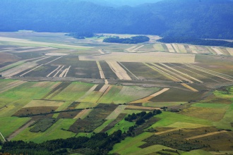
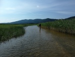
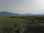
View of the project area. Stržen's riverbed (straight channel and former meanders) is visible in the top half of the photo.

Project summary

Edit project overview to modify the project summary.


The main objective of the LIFE STRŽEN project is to improve the conservation status of the Habitats Directive priority habitat, Turloughs, by restoring the former Stržen riverbed. The watercourse will be prolonged by 1.5 km. This will have several positive effects, including an increased saturation of soil with water that will improve conditions for characteristic species of fish, invertebrates, birds and mammals. The project also aims at reducing the negative impact of visitors on the restored riverbed area and establishing quiet zones in the breeding habitat of the Eurasian bittern (Botaurus stellaris) in order to improve its breeding success. A further aim is to gain long-term support for its conservation actions among the general public, and a positive change of attitude among key stakeholders. Thus, the objectives are strongly linked to the EU Habitats and Birds directives, Biodiversity Strategy 2020, and Water Framework Directive.

Funding - EU Contribution: € 2,863,212.00

Monitoring surveys and results

This case study hasn’t got any Monitoring survey and results, you can add some by editing the project overview.

Lessons learnt

This case study hasn’t got any lessons learnt, you can add some by editing the project overview.


Image gallery


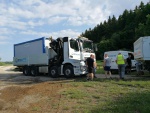
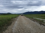
Arrival of mechanisation at the entry to the lake
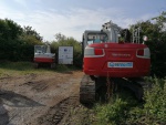
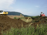
Excavators are waiting at the entry to the lake for suitable conditions to start work
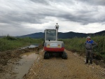
Preparation of access roads proved to be tricky due to rainfall.
Due to the wet terrain we had to strenghten the access road with gravel.
In 2020, unfortunately the works could not continue due to high water levels.
Making a new access road over the straight channel to land inside the meander.
Before we could start filling in the straight channel, we had to rescue any fish and crustaceans and pump out as much water as possible, so the soil wouldn't turn to mud.
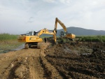
After rescuing as much fish and crustaceans as possible, the construction crew started filling in the channel with soil they had dug out two years back.
Part of the channel is finally filled up with soil.
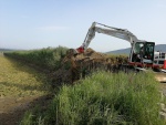
The straight channel was being filled in from both sides with excavators.
Progress in filling in the now-dry straight channel.
First layer of soil is in the straight channel
The final part of the lower part of the channel is being filled in - this was the trickiest part, since it was very muddy.
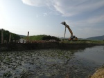
Making of the third barrier at the crossing of the renewed meander and straight channel.
ShowHideAdditionalImage.png


Catchment and subcatchment

Catchment

River basin district Danube
River basin Danube

Subcatchment

River name Sava River
Area category more than 10000 km²
Area (km2)
Maximum altitude category 500 - 1000 m
Maximum altitude (m) 833833 m <br />0.833 km <br />83,300 cm <br />
Dominant geology Calcareous
Ecoregion Dinaric Western Balkan, Alps
Dominant land cover
Waterbody ID


Other case studies in this subcatchment: Conservation of alluvial, Hainburg River Restoration, INTERREG MED WETNET - Memoradum on Participation in Wetland Conservation in Ljubljansko Barje Nature Park, Marsh protection in Egyek–Pusztakócs, National Park Danube-Auen, Regelsbrunner Aue, Renaturation of Stržen's riverbed on intermittent Cerknica Lake, The Bulgarian Wetlands Restoration and Pollution Reduction Project, Witzelsdorf Pilot Project


Site

Name Watercourse Stržen on intermittent Cerknica Lake
WFD water body codes SI141VT2
WFD (national) typology Class III - Slightly Modified Rivers, JDP
WFD water body name VTJ Cerkniško jezero - Stržen
Pre-project morphology Artificial channel, Straightened
Reference morphology Sinuous - original natural riverbed (double meander)
Desired post project morphology Sinuous - double meander, Low gradient passively meandering
Heavily modified water body No
National/international site designation All - multiple designations across the site
Local/regional site designations Regional Park – protected area
Protected species present Yes
Invasive species present No
Species of interest Great Bittern (Botaurus Stellaris), Common snipe (Gallinago gallinago), Spotted crake (Porzana porzana), Little Crake (Porzana parva), Marsh Harrier (Circus aeruginosus), Ruff (Philomachus pugnax) Red-necked grebe (Podiceps grisegena), Great white egret (Ardea alba), Purple heron (Ardea purpurea), Savi's warbler (Locustella luscinioides), Water rail (Rallus aquaticus), Great reed warbler (Acrocephalus arundinaceus), Northern shoveler (Anas clypeata), Ferruginous duck (Aythya nyroca), Wood Sandpiper (Tringa glareola), Italian crested newt (Triturus carnifex), Otter (Lutra lutra), Lesser Ramshorn Snail (Anisus vorticulus)…
Dominant hydrology surface water hydrology, Groundwater
Dominant substrate Earth, ice-age clay deposits, Peat
River corridor land use Wetland, Rough unimproved grassland/pasture
Average bankfull channel width category 10 - 50 m
Average bankfull channel width (m)
Average bankfull channel depth category 0.5 - 2 m
Average bankfull channel depth (m)
Mean discharge category 10 - 100 m³/s
Mean annual discharge (m3/s) 10.910.9 m³/s <br />10,900 l/s <br />
Average channel gradient category Less than 0.001
Average channel gradient
Average unit stream power (W/m2)


Project background

Reach length directly affected (m) 15001,500 m <br />1.5 km <br />150,000 cm <br />
Project started 2017/09/01
Works started 2019/07/21
Works completed 2021/09/30
Project completed 2023/12/31
Total cost category 1000 - 5000 k€
Total cost (k€) 38633,863 k€ <br />3,863,000 € <br />
Benefit to cost ratio
Funding sources European Union, Slovenian Ministry for environment and spatial planning, Municipality of Cerknica, Ebmpapst d.o.o., Elgoline d.o.o., Alpod d.o.o.

Cost for project phases

Phase cost category cost exact (k€) Lead organisation Contact forename Contact surname
Investigation and design
Stakeholder engagement and communication
Works and works supervision
Post-project management and maintenance
Monitoring


Reasons for river restoration

Mitigation of a pressure Land drainage
Hydromorphology Quantity & dynamics of flow, Width & depth variation
Biology Fish, Invertebrates
Physico-chemical Temperature, Oxygen balance, Nutrient concentrations
Other reasons for the project


Measures

Structural measures
Bank/bed modifications Riverbed restoration
Floodplain / River corridor Establishing of quiet zones
Planform / Channel pattern Re-instatement of old course – double meander
Other
Non-structural measures
Management interventions Quiet zone establishment (fishing is forbiden, visiting discouraged), plan for quiet zone management, Mowing management
Social measures (incl. engagement) Education of youth – admission-free field trips, ornithological camps, creative competitions; Active communication with key stakeholders – landowners, hunters, fishermen and tourism providers; Education of tourism providers.
Other Popularization of the project; information provision – project website, Information Bulletins, social media etc.


Monitoring

Hydromorphological quality elements

Element When monitored Type of monitoring Control site used Result
Before measures After measures Qualitative Quantitative
Channel pattern/planform Yes Yes No No Yes Improvement
Flow velocities Yes Yes No No No Improvement
Quantity & dynamics of flow Yes Yes No No Yes Improvement
Width & depth variation Yes Yes No No No Improvement

Biological quality elements

Element When monitored Type of monitoring Control site used Result
Before measures After measures Qualitative Quantitative
Macrophytes Yes Yes No No Yes Improvement
Macrophytes and/or phytobenthos: Taxonomic composition Yes Yes No No Yes Improvement
Macrophytes and/or phytobenthos: Average abundance Yes Yes No No Yes Improvement
Invertebrates Yes Yes No No Yes Improvement
Invertebrates: Abundance No No No No No Improvement
Invertebrates: Diversity Yes Yes No No Yes Improvement
Invertebrates: Taxonomic composition Yes Yes No No Yes Improvement

Physico-chemical quality elements

Element When monitored Type of monitoring Control site used Result
Before measures After measures Qualitative Quantitative
PH Yes Yes No No Yes Improvement
Temperature Yes Yes No No Yes No change
Oxygen balance Yes Yes No No Yes Improvement

Any other monitoring, e.g. social, economic

Element When monitored Type of monitoring Control site used Result
Before measures After measures Qualitative Quantitative
Habitat mapping Yes Yes No No No Improvement


Monitoring documents


Additional documents and videos


Additional links and references

Link Description
http://ec.europa.eu/environment/life/project/Projects/index.cfm?fuseaction=search.dspPage&n proj id=6296#EI European Commission article about the project
http://life.notranjski-park.si/en/ Official project website (English)

Supplementary Information

Edit Supplementary Information