Case study:Removal of Maisons-Rouges dam over the River Vienne

From RESTORE
Jump to navigation Jump to search
0.00
(0 votes)


To discuss or comment on this case study, please use the discussion page.


Location: 47° 0' 42.79" N, 0° 33' 49.74" E
Loading map...
Left click to look around in the map, and use the wheel of your mouse to zoom in and out.


Project overview

Edit project overview
Status Complete
Project web site
Themes Fisheries, Hydropower
Country France
Main contact forename ONEMA
Main contact surname ONEMA
Main contact user ID
Contact organisation Onema-Delegation Interregional Centre - Poitou - Charentes
Contact organisation web site
Partner organisations
Parent multi-site project
This is a parent project
encompassing the following
projects
No
This case study hasn’t got a picture, you can add one by editing the project overview.

Project summary

Edit project overview to modify the project summary.


The Vienne is a tributary of the Loire and drains a catchment area covering 21,105 km². The Creuse, a main tributary of the Vienne, flows into it around fifty kilometres upstream of theconfluence of the Loire and Vienne. Situated approximately 250 km from the sea, both of these sub-basins historically attracted salmon, shad, sea lamprey and eels. At the start of the 1920s, Maisons-Montrouge dam was built to a height of 3.8 metres over the Vienne in order to meet the power requirements of the paper mills. This dam created a blockage in both of these basins. The virtually stagnant impoundment caused by the dam was estimated to cover 15 km in total: 8 km on the Creuse and 7 km on the Vienne. The consequences were immediate, because since the building of the structure, not a single salmon or shad had been caught in the waters upstream of Maisons-Rouges. The successive installation of three fish-passes had very little effect. In 1948, EDF (French electricity supply company) took over the concession and automated the dam in 1980. In January 1994, a “Plan Loire Grandeur Nature” (long-term management plan for the River Loire) was launched; it included the removal of the Maisons-Rouges dam due to its numerous effects on river continuity and its low level of economic benefit. The project did not meet with universal approval, but after four years of negotiations and enquiries, the removal of the Maisons-Rouges dam was scheduled. The project consisted of partially removing the oblique dam and the mill building. The operation was carried out in three phases: • Installation of protective dikes and removal of the transversal dam. • Gradual lowering of the impoundment and removal of the protective dikes on the right bank. • Installation of protective dikes on the left bank in order to maintain dry conditions on the worksite and for the demolition of the buildings. The transversal dam, the three sluice gates and the flap were dismantled. A concrete slab was laid on the bottom of the river in order to limit the effects of bed scouring and slow down the downstream migration of sediments.

Monitoring surveys and results

This case study hasn’t got any Monitoring survey and results, you can add some by editing the project overview.

Lessons learnt

This case study hasn’t got any lessons learnt, you can add some by editing the project overview.


Image gallery


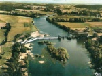
Maisons Rouges dam before the removal.
Satellite photo of the former site of the Maisons-Rouges dam. Alluvial banks have appeared and vegetation has grown on the banks.
The former impoundment of the Maisons-Rouges dam in July 2008 – nine years after its removal.
The Maisons-Rouges site in 2009 – ten years after its removal.
ShowHideAdditionalImage.png


Catchment and subcatchment

Catchment

River basin district Loire-Bretagne
River basin Loire

Subcatchment

River name Vienne
Area category 100 - 1000 km²
Area (km2)
Maximum altitude category 500 - 1000 m
Maximum altitude (m)
Dominant geology Siliceous
Ecoregion Western Plains
Dominant land cover
Waterbody ID


Site

Name Ports and Nouâtre
WFD water body codes FRGR0356
WFD (national) typology
WFD water body name
Pre-project morphology Single channel
Reference morphology Single channel
Desired post project morphology
Heavily modified water body true
National/international site designation
Local/regional site designations
Protected species present
Invasive species present
Species of interest
Dominant hydrology Quick run-off, Artificially regulated
Dominant substrate
River corridor land use Intensive agriculture
Average bankfull channel width category more than 50 m
Average bankfull channel width (m) 100100 m <br />0.1 km <br />10,000 cm <br />
Average bankfull channel depth category
Average bankfull channel depth (m)
Mean discharge category
Mean annual discharge (m3/s) 198198 m³/s <br />198,000 l/s <br />
Average channel gradient category
Average channel gradient 0
Average unit stream power (W/m2) 00 W/m² <br />


Project background

Reach length directly affected (m) 15000 m15 km <br />1,500,000 cm <br />
Project started 1994/01/01
Works started 1998/06/01
Works completed 1999/04/01
Project completed
Total cost category 1000 - 5000 k€
Total cost (k€) 2600 k€2,600,000 € <br />
Benefit to cost ratio
Funding sources French State, EDF French Electricity Supply Company, Water Agency

Cost for project phases

Phase cost category cost exact (k€) Lead organisation Contact forename Contact surname
Investigation and design 100 - 500 k€ 172.27 k€172,270 € <br />
Stakeholder engagement and communication
Works and works supervision 1000 - 5000 k€ 2160 k€2,160,000 € <br />
Post-project management and maintenance
Monitoring


Reasons for river restoration

Mitigation of a pressure Hydropower, Reservoir impoundment
Hydromorphology Continuity for organisms
Biology Fish: Species composition, Fish: Disturbance-sensitive species, Fish: Age structure
Physico-chemical
Other reasons for the project


Measures

Structural measures
Bank/bed modifications Dam removal
Floodplain / River corridor
Planform / Channel pattern
Other
Non-structural measures
Management interventions
Social measures (incl. engagement) Media
Other Information provision, Participation in decision process, Participation in monitoring


Monitoring

Hydromorphological quality elements

Element When monitored Type of monitoring Control site used Result
Before measures After measures Qualitative Quantitative
Continuity for organisms Yes Improvement
Continuity for sediment Yes

Biological quality elements

Element When monitored Type of monitoring Control site used Result
Before measures After measures Qualitative Quantitative
Fish: Species composition Yes Yes Improvement

Physico-chemical quality elements

Element When monitored Type of monitoring Control site used Result
Before measures After measures Qualitative Quantitative

Any other monitoring, e.g. social, economic

Element When monitored Type of monitoring Control site used Result
Before measures After measures Qualitative Quantitative


Monitoring documents


Additional documents and videos


Additional links and references

Link Description

Supplementary Information

Edit Supplementary Information