Case study:Remeandering of the Drésine and of the Remoray stream
Project overview
| Status | Complete |
|---|---|
| Project web site | |
| Themes | Environmental flows and water resources, Habitat and biodiversity, Hydromorphology, Peat |
| Country | France |
| Main contact forename | Bruno |
| Main contact surname | Tissot |
| Main contact user ID | |
| Contact organisation | Association des amis du site naturel du lac de Remoray |
| Contact organisation web site | http://www.maisondelareserve.fr/association.php |
| Partner organisations | |
| Parent multi-site project | |
| This is a parent project encompassing the following projects |
No |
Project summary
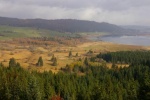
The Remoray stream is a 1.7 km long tributary of the Drésine . The Drésine flows 7.6 kilometers before getting into Lake Remoray, located in the nature reserve, which includes a glacial lake and wide peat bogs . It is home to numerous protected , rare and/or endangered species in France. Between the early XIX century and the late 1980s, several streams were straightened and widened in order to drain the swamp and create new agricultural plots. In the end, no agricultural land was obtained, despite the negative effects on the environment: the groundwater table was lowered and the swamp gradually dried, reducing habitats and species, both in the peat bogs and in the streams, especially birds and amphibians, but also fish: the lake trout was no longer spawning in the area.
The main goals of the project were to restore the hydraulic conditions in the marsh, raising the groundwater level, and to recreate aquatic habitats especially for lake trout and invertebrates. The restoration measures took place from downstream to upstream between 1999 and 2000.
A new mouth of the Drésine was constructed, using 650 acacia stakes in order to obtain a stable section at the confluence with the lake, which is subject to strong level fluctuations, thus avoiding any possibility of regressive erosion. Starting from this stabilized section the meanders were reopened following the old course.
The extracted material was deposited in the straight bed, at each end of which a waterproof sill was constructed, consisting of a wooden frame covered with a PVC tarpaulin and 300 m3 of silt, so as to stop any erosion of the marsh from this low point. A complete filling of the straight bed would have been preferable, but it would have required a too large volume of material. Upstream of the straightened stretch, three sills are built to stop the regressive erosion, and raise the river bed.
Works on the Remoray stream were carried out at the end of winter 2001. A sinuous channel 5 to 40 meters east was realized using a mini-excavator. Little sills to compensate the steep slope were built. The old bed is filled with materials of the path used for the remeandering works of Drésine.
Monitoring surveys and results
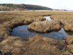
The remeandering works allowed to multiply by three the length of the Drésine . The piezometric monitoring shows that the groundwater table has raised by 50 cm. The restoration of the marsh water regime has allowed the recolonization by several species formerly present (especially Odonata, Lepidoptera, red frogs and birds). The self re-vegetation of the restored meanders provided a cooling effects on waters and contributed to the diversification of flows, favorable for aquatic fauna. A better structured population of trout and a high number of smolts were also observed.
Lessons learnt
Image gallery
|
Catchment and subcatchmentSelect a catchment/subcatchment
Catchment
Subcatchment
Site
Project background
Cost for project phases
Reasons for river restoration
Measures
MonitoringHydromorphological quality elements
Biological quality elements
Physico-chemical quality elements
Any other monitoring, e.g. social, economic
Monitoring documents
Additional documents and videos
Additional links and references
Supplementary InformationEdit Supplementary Information
| |||||||||||||||||||||||||||||||||||||||||||||||||||||||||||||||||||||||||||||||||||||||||||||||||||||||||||||||||||||||||||||||||||||||||||||||||||||||||||||||||||||||||||||||||||||||||||||||||||||||||||||||||||||||||||||||||


