Case study:Floodplain recreation on the Montone River at San Tomè (Forlì)
Project overview
| Status | Complete |
|---|---|
| Project web site | |
| Themes | Flood risk management, Habitat and biodiversity, Hydromorphology, Monitoring |
| Country | Italy |
| Main contact forename | Fausto |
| Main contact surname | Pardolesi |
| Main contact user ID | |
| Contact organisation | Regione Emilia Romagna – Servizio Tecnico di Bacino “Fiumi Romagnoli |
| Contact organisation web site | |
| Partner organisations | |
| Parent multi-site project | |
| This is a parent project encompassing the following projects |
No |
Project summary
The interventions carried out on the Montone river are part of a general project dating back to the '90s called "Fiumi Puliti” (Clean Rivers); the main goals of that project were the “maintenance” of river beds of the Romagna area, the reduction of flood risk and the implementation of the Montone River Natural Park, in the Municipalities of Forlì and Castrocaro.
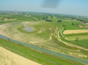
The main tool put in place to achieve these objectives was to return to the river part of the floodplains, both public domain and private, that were , separated from the river due to construction of embankments. Since 1992, this strategy has allowed to recover, within a relatively short stretch of the river, a storage capacity of more than 2,500,000 cubic meters. This space was returned to the natural flood dynamics lowering the alluvial plane and/or displacing the embankments to the external borders of the floodplain.
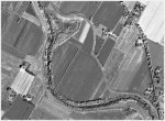
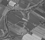
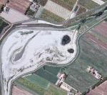
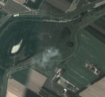
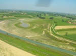
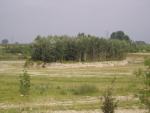
The San Tomè area, located near Forlì, before the project was private cultivated land (orchards), former floodplain, surrounded by a main embankment and separated from the river by a secondary one, strongly reducing its flooding frequency. The works, carried out between 2004 and 2007 by the Servizio Tecnico di Bacino Romagna (River Basin Technical Services part of the Emilia Romagna regional administration) included the removal of the internal (secondary) embankment and lowering and reshaping the floodplain, on 9 hectares. This allows an increased flooding frequency, with a positive effect on flood risk downstream.
Project costs included approximately 440,000 € for land expropriation. The estimated 2 million € for earth moving were compensated for by part of the excavated material, that was made available to the company performing the works. This funding approach may be considered negatively under a geomorphological perspective. However, it has to be underlined that the sediment extraction (ranging between 2 and 5 m) from the (former) floodplain has not reduced the amount of material potentially available for erosion and transport downstream (and finally for coastal sediment supply); in fact the excavated areas were already outside the river mobility corridor, they had become terraces, mostly protected against erosion along all the banks. Moreover part of the fine material with no commercial interest was introduced in the river bed during some ordinary flood events, in order to increase (at least occasionally) the sediment supply downstream.
Monitoring surveys and results
The ecosystem improvements are under monitoring through the M.A.I.S.O.N. project.
Lessons learnt
Image gallery
|
Catchment and subcatchmentSelect a catchment/subcatchment
Catchment
Subcatchment
Other case studies in this subcatchment: Floodplain recreation on the Montone River at the confluence with the Rabbi Stream
Site
Project background
Cost for project phases
Supplementary funding informationApproximately 440,000 € for land expropriation. The earth moving works (approximately 2 million €) have been carried out in a "compensation" way.
Reasons for river restoration
Measures
MonitoringHydromorphological quality elements
Biological quality elements
Physico-chemical quality elements
Any other monitoring, e.g. social, economic
Monitoring documents
Additional documents and videos
Additional links and references
Supplementary InformationEdit Supplementary Information
| ||||||||||||||||||||||||||||||||||||||||||||||||||||||||||||||||||||||||||||||||||||||||||||||||||||||||||||||||||||||||||||||||||||||||||||||||||||||||||||||||||||||||||||||||||||||||||||||||||||||||

