Case study:Enler River enhancement project

From RESTORE
Jump to navigation Jump to search
0.00
(0 votes)


To discuss or comment on this case study, please use the discussion page.


Location: 54° 35' 23.38" N, 5° 47' 23.51" W
Loading map...
Left click to look around in the map, and use the wheel of your mouse to zoom in and out.


Project overview

Edit project overview
Status Complete
Project web site
Themes Fisheries, Habitat and biodiversity, Hydromorphology
Country Northern Ireland
Main contact forename Judith
Main contact surname Bankhead
Main contact user ID User:Judithbankhead
Contact organisation Rivers Agency Northern Ireland (DARDNI)
Contact organisation web site http://www.dardni.gov.uk/rivers
Partner organisations Rivers Agency Northern Ireland (DARDNI), DCAL Inland Fisheries, Castlereagh Borough Council
Parent multi-site project
This is a parent project
encompassing the following
projects
No
finished reach Enler River

Project summary

Edit project overview to modify the project summary.


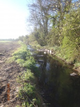
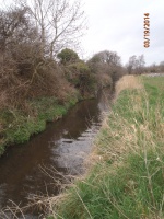
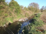
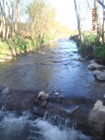
The Enler River is a typical arterially drained channel with laminar flow, regular depth and silt deposition. Compensation money from a fish kill prosecution allowed fishery enhancement measures to be planned and implemented. These included deflector groynes to narrow the channel and creat a thalweg, addition of spawning gravels and plums, and the creation of deeper water via a small cross river groyne

Monitoring surveys and results

Edit project overview to modify the Monitoring survey and results.


Pre works fishery assessment and river habitat assessment were carried out, along with photographs. Post works photographs have been taken and this will continue. One year plus fishery assessment and habitat assessment planned for 2015.

Lessons learnt

Edit project overview to modify the lessons learnt.


Opportunisitc work due to compensation monies and public land ownership. The proximity of the Greenway cycle way, and high value market gardening land meant that the reach length had to be limited, and work constrained within the current channel dimensions. Lunkers that had been obtained for inlcusion in the scheme could not be used due to size issues - used elsewhere.


Image gallery


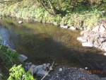
pre works channel
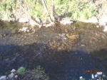
addition of spawning gravel
channel narrowing
scour pool
groyne and plums
ShowHideAdditionalImage.png


Catchment and subcatchment

Catchment

River basin district Northern Ireland North Eastern
River basin Enler

Subcatchment

River name Enler
Area category
Area (km2) 79.6779.67 km² <br />7,967 ha <br />
Maximum altitude category
Maximum altitude (m) 21.2721.27 m <br />0.0213 km <br />2,127 cm <br />
Dominant geology
Ecoregion Ireland and Northern Ireland
Dominant land cover Improved/semi-improved grassland/pasture, Intensive agriculture (arable)
Waterbody ID GBNI1NE050504080


Site

Name Enler River
WFD water body codes GBNI1NE050504080
WFD (national) typology
WFD water body name Comber
Pre-project morphology Over deepened, Over-widened, Straightened, Single channel
Reference morphology
Desired post project morphology Low gradient passively meandering
Heavily modified water body No
National/international site designation
Local/regional site designations None
Protected species present No
Invasive species present No
Species of interest Salmonids
Dominant hydrology Artificially regulated
Dominant substrate Clay
River corridor land use Grassland, Intensive agriculture (arable)
Average bankfull channel width category 2 - 5 m
Average bankfull channel width (m)
Average bankfull channel depth category 0.5 - 2 m
Average bankfull channel depth (m)
Mean discharge category 1 - 10 m³/s
Mean annual discharge (m3/s)
Average channel gradient category 0.01 - 0.1
Average channel gradient
Average unit stream power (W/m2)


Project background

Reach length directly affected (m) 200200 m <br />0.2 km <br />20,000 cm <br />
Project started 2013/11/04
Works started 2014/03/10
Works completed 2014/04/18
Project completed 2014/04/25
Total cost category 10 - 50 k€
Total cost (k€)
Benefit to cost ratio
Funding sources Compensation monies due to fih kill, plus Rivers Agency maintenance budget

Cost for project phases

Phase cost category cost exact (k€) Lead organisation Contact forename Contact surname
Investigation and design Less than 1 k€ DCAL Inland Fisheries John Kane
Stakeholder engagement and communication Less than 1 k€ Department of Agriculture & Rural Development Rivers Agency Judith Bankhead
Works and works supervision 10 - 50 k€ Department of Agriculture & Rural Development Rivers Agency Ryan Deegan
Post-project management and maintenance Less than 1 k€ Department of Agriculture & Rural Development Rivers Agency Judith Bankhead
Monitoring Less than 1 k€ NIEA Mary Toland


Reasons for river restoration

Mitigation of a pressure
Hydromorphology
Biology Fish
Physico-chemical
Other reasons for the project


Measures

Structural measures
Bank/bed modifications Deflectors, Creation of groynes, Riffle creation, Introduction of spawning gravels, Fish habitat restoration
Floodplain / River corridor
Planform / Channel pattern
Other
Non-structural measures
Management interventions
Social measures (incl. engagement)
Other


Monitoring

Hydromorphological quality elements

Element When monitored Type of monitoring Control site used Result
Before measures After measures Qualitative Quantitative
Channel pattern/planform Yes Yes Yes No No Improvement
Freshwater flow regime Yes Yes Yes No No Improvement
Width & depth variation Yes Yes Yes No No Improvement

Biological quality elements

Element When monitored Type of monitoring Control site used Result
Before measures After measures Qualitative Quantitative
Fish Yes No No No No
[[]] No No No No No

Physico-chemical quality elements

Element When monitored Type of monitoring Control site used Result
Before measures After measures Qualitative Quantitative

Any other monitoring, e.g. social, economic

Element When monitored Type of monitoring Control site used Result
Before measures After measures Qualitative Quantitative


Monitoring documents


Additional documents and videos


Additional links and references

Link Description

Supplementary Information

Edit Supplementary Information