Case study:Creating a fishpass at Włocławek dam
Project overview
| Status | Complete |
|---|---|
| Project web site | http://https://amber.international/portfolio-item/the-wloclawek-dam-poland/ |
| Themes | Habitat and biodiversity, Hydropower |
| Country | Poland |
| Main contact forename | Zdzisław |
| Main contact surname | Zakęś |
| Main contact user ID | |
| Contact organisation | |
| Contact organisation web site | http://www.infish.com.pl/en/content/about-institute |
| Partner organisations | |
| Parent multi-site project | |
| This is a parent project encompassing the following projects |
No |
Project summary
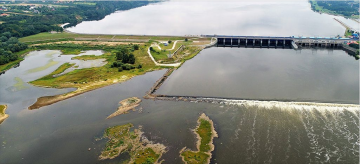
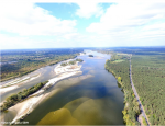
The Włocławek dam was equipped with a conventional step-pool fishpass, which initially was functional, but not enough to sustain free fish migration through the dam. After few years of hydropower plant exploitation the bottom erosion below the dam caused gradual decline of fishpass efficiency due to lowering of water level, so it was functional only at high flows. Finally, all but one entrance windows were situated above the water surface at average flow.
- First action to prevent bottom erosion, undertaken by water authorities, was construction of a stabilizing stone ramp of two meters high just 500 m below the dam. This slowed down the bottom erosion, but created a new obstacle for fish migration, especially at low water flows. However there are vivid plans to build a new dam located about 20 km below the existing one to stop the bottom erosion and ensure safety of the existing dam. Such new dam and reservoir will create an additional barrier for fish migration, which was recently improved by the reconstruction of the Włocławek fishpass.
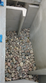
The fishpass at Włocławek dam was recently (2014) reconstructed into vertical slot type, with new entrance window and additional attractive current provided with a pipe. It was equipped with monitoring system, including VAKI scanner that enables constant monitoring of fish passage and fish trap in top fishpass chamber which provides possibility of individual fish measurements, condition assessment and tagging.
Monitoring surveys and results
In 2016, a total 7818 fish were recorded migrating upstream, mainly in April-May and October. Bream Abramis brama dominated with almost 5000 individuals, followed by anadromous species – sea trout Salmo trutta L., and vimba Vimba vimba at 8111 and 1123 respectively. Asp Aspius aspius, barbel Barbus barbus, catfish Silurus glanis, carp Cyprinus carpio, ide Leuciscus idus, perch Perca fluviatilis, atlantic salmon Salmo salar, chub Leuciscus cephalus, grass carp Carassius gibelio and roach Rutilus rutilus were also noted. The total number of fish were almost two times higher than in 2015 (Dębowski 2017). During present year tens of thousands of records were collected and still under analyzing. Much more numerous in this year is vimba and white bream Abramis bjoerkna. Also, white-eye bream Ballerus sapa was recorded.
In 2016, system with six PIT antennas was lunched in fishpass. First antennae on the entrance, second on the first corner, two next below and above Vaki scanner, fifth on last corner and last on the exit. Nine adult sea trout were caught in trap installed in last fishpass chamber and tagged with 12 mm PITs in November during spawning migration. Tagged fish were released after anesthesia below dam. Four of them again entered a fishway and move upstream. One female which successfully passed was recaptured half year later in Gulf of Gdańsk by commercial fisherman. In 2017 new experiment with three antennae system has been conducted. In 18 October, 112 specimens from nine species included; bream, asp, vimba, sea trout, dace, barbel, ide, white-eyed bream and bleak were tagged and released below the weir. The system is already running.
Lessons learnt
Image gallery
|
Catchment and subcatchment
Site
Project background
Cost for project phases
Reasons for river restoration
Measures
MonitoringHydromorphological quality elements
Biological quality elements
Physico-chemical quality elements
Any other monitoring, e.g. social, economic
Monitoring documents
Additional documents and videos
Additional links and references
Supplementary InformationEdit Supplementary Information References Dębowski P (2017). Fish passage through the Włocławek Dam fishway in 2016. Kom. Ryb. 2:1-6. (in Polish with English summary)
| ||||||||||||||||||||||||||||||||||||||||||||||||||||||||||||||||||||||||||||||||||||||||||||||||||||||||||||||||||||||||||||||||||||||||||||||||||||||||||||||||||||||||||


