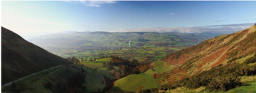
Case study:Afon Clywdd
This case study is pending approval by a RiverWiki administrator.
Project overview
| Status | Planned |
|---|---|
| Project web site | http://www.therrc.co.uk/sites/default/files/projects/40_afonclwyd.pdf |
| Themes | Flood risk management, Habitat and biodiversity, Land use management - agriculture, Land use management - forestry, Water quality |
| Country | Wales |
| Main contact forename | Jacques |
| Main contact surname | Sisson |
| Main contact user ID | |
| Contact organisation | Natural Resources Wales |
| Contact organisation web site | http://naturalresources.wales/?lang=en |
| Partner organisations | AECOM |
| Parent multi-site project | |
| This is a parent project encompassing the following projects |
No |
Project summary
The Clwyd (Photo 1 and Map 1) is a large catchment in north-east Wales, discharging north into the Irish Sea. The confluence of the Afon Clwyd with the Afon Elwy is downstream of St Asaph, which in November 2012 was subject to severe flooding resulting in a fatality. The impact of flooding from the Afon Elwy, which flows through the town, was exacerbated by the backing up of flow at the confluence with the Afon Clwyd, which was also in spate.
In 2015, Natural Resources Wales commissioned AECOM Consultants to identify potential Working with Natural Processes (WWNP) in the Elwy catchment which would provide climate resilience to the proposed improvements to engineered flood defences in St Asaph (AECOM Consultants 2015). Following the study, AECOM wanted to develop techniques for rapid assessment of WWNP that could be applied to different types of catchments. AECOM used EU innovation funding to test techniques in a number of catchments, including this study of potential WWNP in the Vale of Clwyd.
A systematic review of the aerial imagery, Ordnance Survey (OS) mapping and flood zone/flood extent information was carried out to identify the most important morphological features in the catchment and to identify locations where the WWNP measures could potentially be implemented across the catchment. In contrast to the Elwy, the identification process included an assessment of implementation and shortlisting to streamline the process.
The overall impact of the modelled WWNP is a reduction in peak flow and an increase in time-to-peak (TP). Peak flow reduction was approximately 6% for the 5-year design event and approximately 1% for the 200-year design event.
Monitoring surveys and results
Lessons learnt
Image gallery
|
Catchment and subcatchment
Site
Project background
Cost for project phases
Reasons for river restoration
Measures
MonitoringHydromorphological quality elements
Biological quality elements
Physico-chemical quality elements
Any other monitoring, e.g. social, economic
Monitoring documents
Additional documents and videos
Additional links and references
Supplementary InformationEdit Supplementary Information
| ||||||||||||||||||||||||||||||||||||||||||||||||||||||||||||||||||||||||||||||||||||||||||||||||||||||||||||||||||||||||||||||||||||||||||||||||||||||||||||||||||||||||||||||||||

