Case study:Hierdense Beek

From RESTORE
Revision as of 16:46, 25 March 2021 by Bas Wullems (talk | contribs)
(diff) ← Older revision | Latest revision (diff) | Newer revision → (diff)
Jump to navigation Jump to search
0.00
(0 votes)


To discuss or comment on this case study, please use the discussion page.


Location: 52° 19' 22.30" N, 5° 42' 17.44" E
Loading map...
Left click to look around in the map, and use the wheel of your mouse to zoom in and out.


Project overview

Edit project overview
Status In progress
Project web site http://www.sprengenbeken.nl/hierdense-beken/#Leuvenumse%20Beek
Themes Habitat and biodiversity, Hydromorphology, Land use management - agriculture, Land use management - forestry, Monitoring
Country Netherlands
Main contact forename Christian
Main contact surname Huising
Main contact user ID
Contact organisation Waterschap Vallei en Veluwe
Contact organisation web site http://www.vallei-veluwe.nl/
Partner organisations STOWA
Parent multi-site project

Building with Nature measures in streams

This is a parent project
encompassing the following
projects
No
Leuvenumse beek – dood hout brengt beek tot leven

Project summary

Edit project overview to modify the project summary.


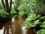
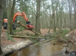
The upstream part of the Hierdensebeek is called the Leuveumse Beek, which is where Building with Nature measures were implemented. The main stream (upstream and downstream part) has a total length of approximately 17 km. Since 1993, efforts have been made to improve spatial planning, water quality and ecology by reconnecting an old meander. In 1996/1997 there has been large-scale maintenance to the stream. The first Building with Nature activities involving dead wood started in 2011 and ended in 2013. The wood that was used came from the woods directly adjacent tot he stream and was introduced in a braided pattern to allow for optimal throughflow. In addition to the usage of dead wood, the Syngery project started in 2014, in which various BwN measures are combined, like shading, altered mowing regimes and sand suppletion. The University of Amsterdam researched the effect of the wood that was introduced on the flora and fauna.

This experiment is being performed within the WFD innovation programme ‘Beekdalbreed hermeanderen’ (En: Re-meandering accross the stream valley’). As part of this directive, water and nature managers work together to make stream restoration measures as effective as possible. Other partners involved in the project are Natuurmonumenten, Landschap Overijssel, Wageningen University, Wageningen Environmental Research and Utrecht University. The programme was originally initiated by STOWA (Stichting Toegepast Onderzoek Waterbeheer). The Dutch ministry of Infrastructure and environment (Infrastructuur en Milieu) subsidises 70% of this project.

Source: https://www.sprengenbeken.nl/hierdense-beken/#Leuvenumse%20Beek

Monitoring surveys and results

This case study hasn’t got any Monitoring survey and results, you can add some by editing the project overview.

Lessons learnt

This case study hasn’t got any lessons learnt, you can add some by editing the project overview.


Image gallery


De beek bij Staverden
De monding van de Hierdense Beek ter plaatse van het randmeer
Hierdense Beek vanaf de brug bij de monding
Succesvol natuurherstel Leuvenumse beek
ShowHideAdditionalImage.png


Catchment and subcatchment


Site

Name Leuvenumse bos
WFD water body codes
WFD (national) typology R5
WFD water body name
Pre-project morphology Single channel, Low gradient passively meandering
Reference morphology
Desired post project morphology
Heavily modified water body Yes
National/international site designation
Local/regional site designations
Protected species present No
Invasive species present No
Species of interest
Dominant hydrology Naturally draining
Dominant substrate Sand
River corridor land use Woodland
Average bankfull channel width category 5 - 10 m
Average bankfull channel width (m) 99 m <br />0.009 km <br />900 cm <br />
Average bankfull channel depth category 0.5 - 2 m
Average bankfull channel depth (m) 1.81.8 m <br />0.0018 km <br />180 cm <br />
Mean discharge category Less than 0.1 m³/s
Mean annual discharge (m3/s) 0.080.08 m³/s <br />80 l/s <br />
Average channel gradient category Less than 0.001
Average channel gradient 0.001
Average unit stream power (W/m2) 0.0871733333333330.0872 W/m² <br />


Project background

Reach length directly affected (m)
Project started 2013
Works started 2014/10/01
Works completed 2020/05/01
Project completed
Total cost category 100 - 500 k€
Total cost (k€) 308308 k€ <br />308,000 € <br />
Benefit to cost ratio
Funding sources

Cost for project phases

Phase cost category cost exact (k€) Lead organisation Contact forename Contact surname
Investigation and design
Stakeholder engagement and communication
Works and works supervision 100 - 500 k€ 196196 k€ <br />196,000 € <br />
Post-project management and maintenance 1 - 10 k€ 1500 euro/year"euro/year" is not declared as a valid unit of measurement for this property.
Monitoring 100 - 500 k€ 104104 k€ <br />104,000 € <br />


Reasons for river restoration

Mitigation of a pressure
Hydromorphology Continuity for organisms, water quality
Biology
Physico-chemical
Other reasons for the project


Measures

Structural measures
Bank/bed modifications Sand deposit, dead wood deposit
Floodplain / River corridor
Planform / Channel pattern
Other Shading
Non-structural measures
Management interventions Mowing management
Social measures (incl. engagement)
Other


Monitoring

Hydromorphological quality elements

Element When monitored Type of monitoring Control site used Result
Before measures After measures Qualitative Quantitative
Flow velocities Yes Yes No No No
Quantity & dynamics of flow Yes Yes No No No
Width & depth variation Yes Yes No No No

Biological quality elements

Element When monitored Type of monitoring Control site used Result
Before measures After measures Qualitative Quantitative
Fish Yes Yes No No No
Macrophytes Yes Yes No No No

Physico-chemical quality elements

Element When monitored Type of monitoring Control site used Result
Before measures After measures Qualitative Quantitative
Acid neutralising capacity Yes Yes No No No
PH Yes Yes No No No
Temperature Yes Yes No No No
Transparency Yes Yes No No No
Oxygen balance Yes Yes No No No

Any other monitoring, e.g. social, economic

Element When monitored Type of monitoring Control site used Result
Before measures After measures Qualitative Quantitative


Monitoring documents


Additional documents and videos


Additional links and references

Link Description

Supplementary Information

Edit Supplementary Information