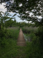
Case study:Restoration of the Pantanello wetland area (Fondazione Caetani)
This case study is pending approval by a RiverWiki administrator.
Project overview
| Status | Complete |
|---|---|
| Project web site | http://www.frcaetani.it/parco-pantanello/ |
| Themes | Economic aspects, Environmental flows and water resources, Habitat and biodiversity, Social benefits |
| Country | Italy |
| Main contact forename | Massimo |
| Main contact surname | Amodio |
| Main contact user ID | |
| Contact organisation | Fondazione R. Caetani |
| Contact organisation web site | http://www.frcaetani.it |
| Partner organisations | |
| Parent multi-site project | |
| This is a parent project encompassing the following projects |
No |
Project summary
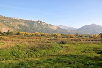
This is an intervention to restore a wetland on the agricultural land of the "Giardino di Ninfa" Regional Natural Monument. This project was managed by the Italian Center for River Restoration (CIRF) and funded by the Lazio Region and the Caetani Foundation.
It concerned in particular the Ninfa area and was designed to improve the aquatic ecosystem as a whole.
In particular, interventions carried out were:
(i) creation of new habitats conducive to the recovery and conservation of regressed plant and animal associations;
(ii) reconstruction of a small portion of the original landscape of the Pontine Marshes where the medieval city of Ninfa was located;
(iii) realization of a concrete reference experience in the field of environmental recovery of agricultural areas, artificial canals, riparian zones, as supporting elements for the creation of ecological networks of different scale.
The restoration plan was started in the mid-1990s of the last century. The realization of the wet areas took a long time in 2003. The project was completed in 2009, the year in which Pantanello became usable for a conscious and sustainable tourism. The intervention, although not expressly planned for this purpose, succeeded in expanding a core area of the ecological network (the site IT6040002 "Ninfa - aquatic environments") which was rapidly colonized by many species of interest, demonstrating the strong propensity in the Agro Pontino to re-naturalization.
In a nutshell, the project actions implemented were the following: - morphological remodeling - realization of the new hydraulic structure of the area - completion of the planting of plant plants - creation of structures to attract wildlife - creation of facilities for the visit and educational use of the area - restoration of Podere Pantanello - restoration of the Podere Ninfa II - complete conversion to a natural layout of the riparian strip of the Ninfa River.
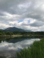
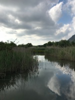
The basins: The shore line of the 5 basins was traced according to the original topography; in this way it was necessary to carry out content restorations of material only for the basins D and E, near the overflow threshold. The first 3 ponds (A, B, C) have a maximum depth of 0.5 meters, with an intermediate isobath of 0.2 m (B) and 0.3 m (A, C), while basins D and E reach and exceed 1 meter in depth. The morphometric trend of the laminar ponds and of the deepest one (sinuosity of the isobaths, relative distances and progressive depths) is such as to reproduce the natural wetlands; also the water lines connecting the basins are traced with the same naturalness criterion; especially for the section between the basins C and E, almost 200 meters long and with a 2-meter difference in height, partly through design indications and partly due to natural evolution, a lotic environment has emerged characterized by small pools and insights, useful for the ascent of the fish fauna. In basin E, intended mainly for the development of avifauna, a portion emerged (islet) of about 30 cm above the water level; the contour of the shoreline, very jagged and oriented against the prevailing winds coming from the southern quadrants, was designed to allow the poultry fauna, step or sedentary, to find the ideal conditions for nesting.
The marshes: Along the riparian strip of the Ninfa river, subjected to a landscape constraint for a width of 150 meters, no earth movements were carried out that could alter the morphology of the land. However along the most depressed sector of this area, contained in the 21.5 m islet in the areas not served by the surface drainage grid, in the seasons of greater rainfall, a natural tendency to swamping is observed, which has been further emphasized following the abandonment of the current network of school girls created for the previous agricultural management of the funds in question. This evolution has made it possible to recover, for naturalistic purposes, a not inconsiderable portion of the area, without interfering with the binding regime, thus recreating "swimming pools" and marshes, paranatural environments of extreme interest since substantially regulated by seasonal, evolved weather and climate conditions , over the years, towards conditions of self-reliance.
The perimeter embankment: Its function is to obtain the necessary quotas, where the topography is more depressed, to set the shore line of the basin E to the 22.5 meter height, thus avoiding a greater deepening of the excavation to reach the required liquid volumes. It develops for a length of about 1,200 meters, has a trapezoid section, with slope slope of less than 10%, width of the driveway of 4 meters and a maximum height of 3.5 meters from the ground level (average h of 1 , 5 meters). The choice of the soft profile satisfies two different needs: on the one hand it minimizes the impact created by an elongated relief on a flat morphology, on the other it allows the use of a significant amount of material coming from the excavations.
The observatory: It consists of an embankment built with the redundant earth movements not used for the perimeter embankment of basin E. It is located near the Arboretum and reaches a height of about 5 meters from the ground level (on the south side) of about 5 meters in order to offer a panoramic view over the whole area. The ascent to the observatory and the descent towards the Lestra, have the gradients contained within 8% in order to allow access also to the disabled. The south-facing slope is shaped with larger slopes to allow the nesting of some rupicolous species.
The recovery of the Casale Pantanello and the artifacts associated with it concerns the western summit of the property at a distance of about 1000 m from the SCI limits. The action also involved the reclamation and redevelopment of the area surrounding the Casale. In addition to the removal of crumbling materials and structures, the abatement of unstable and / or diseased plants, an adequate soil tillage was carried out with the addition of vegetable soil, the creation of natural lawn (according to the principles of "wildflowers"), the creation of shrub arboreal hedges along the street front and along the consortium canalization at the back of the house, in addition to the formation of small shrub tree shrubs at the planting of isolated plants.
The recovery of Podere Ninfa II, destined to host the operational-educational center on the ground floor and the accommodation for the caretaker on the first floor.
Monitoring surveys and results
Lessons learnt
Image gallery
|
Catchment and subcatchmentSelect a catchment/subcatchment
Catchment
Subcatchment
Site
Project background
Cost for project phases
Reasons for river restoration
Measures
MonitoringHydromorphological quality elements
Biological quality elements
Physico-chemical quality elements
Any other monitoring, e.g. social, economic
Monitoring documents
Additional documents and videos
Additional links and references
Supplementary InformationEdit Supplementary Information
| ||||||||||||||||||||||||||||||||||||||||||||||||||||||||||||||||||||||||||||||||||||||||||||||||||||||||||||||||||||||||||||||||||||||||||||||||||||||||||||||||||||||||||||||||||||||||||||||

