Case study:Welton Farm Landfill/Riverbank Works

From RESTORE
Revision as of 10:10, 21 March 2019 by Crchalmers (talk | contribs)
Jump to navigation Jump to search

This case study is pending approval by a RiverWiki administrator.

Approve case study


0.00
(0 votes)


To discuss or comment on this case study, please use the discussion page.


Location: 56° 35' 8.51" N, 3° 18' 24.57" W
Loading map...
Left click to look around in the map, and use the wheel of your mouse to zoom in and out.


Project overview

Edit project overview
Status Complete
Project web site
Themes Environmental flows and water resources, Flood risk management, Habitat and biodiversity
Country Scotland
Main contact forename Chris
Main contact surname Chalmers
Main contact user ID
Contact organisation PKC
Contact organisation web site
Partner organisations
Parent multi-site project
This is a parent project
encompassing the following
projects
No
This case study hasn’t got a picture, you can add one by editing the project overview.

Project summary

Edit project overview to modify the project summary.


The River Ericht is part of the wider Tay catchment and has a steep, flashy catchment with an area of 432km2 to its confluence with the River Isla which later joins the River Tay. The project was located 2km downstream of Blairgowrie, Scotland and located within a Special Area of Conservation (SAC), UK0030312. The project was undertaken on a historic landfill site on the south riverbank of the River Ericht. There is considerable ecological variety in the Tay catchment, resulting in the Tay supporting the full range of salmon life-history types found in Scotland, with adult salmon entering the River Tay throughout the year to spawn in different parts of the catchment. In addition, Otter, Beaver, Bird and three Lamprey species (Sea, Brook and River) were found within the SAC.

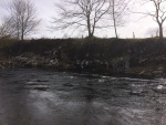
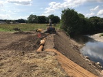
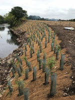
The project consisted of landfill and riverbank remediation work. Landfill material was polluting the River Ericht impacting the watercourse and subsequent SAC following numerous spate events in 2015/16. This had a direct impact upon the ecology and environment. The aim of the project was to prevent further landfill material entering the watercourse and to install protective measures to protect the riverbank and reduce further erosion.

Monitoring surveys and results

Edit project overview to modify the Monitoring survey and results.


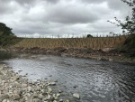
The project has only recently been completed and the full benefits have yet to be quantified. The willow and grass seed has started to grow following a mild autumn in 2018 and the integrity of the riverbank has been tested following a number of spate events in December 2018 and February/March 2019. A monitoring regime has been set up in order to assess the longer term performance of the scheme.

Lessons learnt

Edit project overview to modify the lessons learnt.


Firmly secure willow tubing; approx. 5% lost during spate event. Willow whips to be planted from Autumn - early spring. Willow pots installed thereafter. Waste to be protected by netting to prevent windblown pollution.


Image gallery


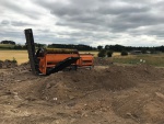
Historic Landfill
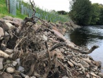
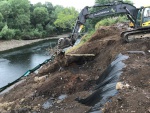
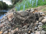
Root Wad Installation
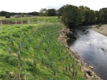
Project Completion
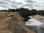
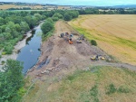
Drone Image Following Works
Repfrofiling
Separation of waste
Separation of waste
root wad placement
root wad placement
Drone during works
Drone during works
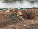
Coir matting with trench
willow installation
Root wad
Completion
ShowHideAdditionalImage.png


Catchment and subcatchment

Catchment

River basin district Tay
River basin River Ericht

Subcatchment

River name River Ericht
Area category 100 - 1000 km²
Area (km2) 432432 km² <br />43,200 ha <br />
Maximum altitude category 100 - 200 m
Maximum altitude (m)
Dominant geology Paleozoic - Devonian
Ecoregion Great Britain
Dominant land cover Intensive agriculture (arable)
Waterbody ID


Site

Name River Ericht
WFD water body codes 6535
WFD (national) typology
WFD water body name River Ericht
Pre-project morphology Sinuous
Reference morphology
Desired post project morphology Reinforced banks
Heavily modified water body No
National/international site designation EU - Special Area of Conservation
Local/regional site designations Special Area of Conservation
Protected species present Yes
Invasive species present No
Species of interest Otter (Lutra lutra), Atlantic salmon (Salmo salar), Sea lamprey, Brook lamprey, river lamprey, Beaver, badger, sand martin (Riparia riparia), yellow hammer
Dominant hydrology
Dominant substrate Glacial Till, Boulders, Glaciofluvial, Alluvium, Gravel
River corridor land use Intensive agriculture (arable)
Average bankfull channel width category 5 - 10 m
Average bankfull channel width (m)
Average bankfull channel depth category 0.5 - 2 m
Average bankfull channel depth (m)
Mean discharge category 100 - 1000 m³/s
Mean annual discharge (m3/s) 187m³"m³" is not declared as a valid unit of measurement for this property.
Average channel gradient category Less than 0.001
Average channel gradient 0.0083
Average unit stream power (W/m2)


Project background

Reach length directly affected (m) 50m0.05 km <br />5,000 cm <br />
Project started 01/04/2017
Works started 2018/07/02
Works completed 2018/08/08
Project completed 2019/08/09
Total cost category 50 - 100 k€
Total cost (k€) 8000080,000 k€ <br />80,000,000 € <br />
Benefit to cost ratio
Funding sources Local Authorities, Scottish Government

Cost for project phases

Phase cost category cost exact (k€) Lead organisation Contact forename Contact surname
Investigation and design Perth and Kinross Council
Stakeholder engagement and communication Perth and Kinross Council
Works and works supervision Perth and Kinross Council
Post-project management and maintenance Perth and Kinross Council
Monitoring Perth and Kinross Council


Reasons for river restoration

Mitigation of a pressure
Hydromorphology
Biology
Physico-chemical
Other reasons for the project


Measures

Structural measures
Bank/bed modifications
Floodplain / River corridor
Planform / Channel pattern
Other
Non-structural measures
Management interventions
Social measures (incl. engagement)
Other


Monitoring

Hydromorphological quality elements

Element When monitored Type of monitoring Control site used Result
Before measures After measures Qualitative Quantitative

Biological quality elements

Element When monitored Type of monitoring Control site used Result
Before measures After measures Qualitative Quantitative

Physico-chemical quality elements

Element When monitored Type of monitoring Control site used Result
Before measures After measures Qualitative Quantitative

Any other monitoring, e.g. social, economic

Element When monitored Type of monitoring Control site used Result
Before measures After measures Qualitative Quantitative


Monitoring documents


Additional documents and videos


Additional links and references

Link Description

Supplementary Information

Edit Supplementary Information