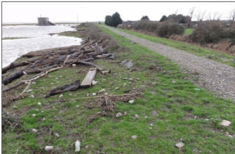
Case study:Rhymney Great Wharf
This case study is pending approval by a RiverWiki administrator.
Project overview
| Status | Complete |
|---|---|
| Project web site | http://www.therrc.co.uk/sites/default/files/projects/57_rhymney.pdf |
| Themes | Flood risk management, Habitat and biodiversity |
| Country | Wales |
| Main contact forename | Huw |
| Main contact surname | Alford |
| Main contact user ID | |
| Contact organisation | Natural Resources Wales |
| Contact organisation web site | http://naturalresources.wales/?lang=en |
| Partner organisations | Atkins |
| Parent multi-site project | |
| This is a parent project encompassing the following projects |
No |
Project summary
The Severn Estuary foreshore has international importance, reflected by the following designations: Site of Special Scientific Interest (SSSI), Special Protection Area (SPA), possible Special Area of Conservation (pSAC) and Ramsar. The site itself is located seaward of the Wentlooge Sea Defences, where the upper, vegetated saltmarsh is referred to as the 'wharf' and the lower unvegetated foreshore as the 'mudflats'.
The Wentlooge Sea Defences (Map 1) protect an area of low-lying land, of which approximately 32km2 lies below mean high water springs (MHWS). The wharf acts as part of the sea defence by reducing the incident wave energy on the embankments themselves.
Study of the foreshore highlighted that the wharf had been eroding locally at a fairly constant rate over a long period. In 2003, pockets of erosion were in close proximity to the flood defence embankment and as such continued erosion was predicted to undermine the embankment by the year 2008. As an immediate mitigation against further erosion of the wharf, thus protecting the defences, it was decided to use harder, more traditional engineering in the form of blockstone and rip-rap. As a longer term strategy, polder were used in an effort to regenerate the mudflats and increase protection to the wharf scarp.
The works that were carried out have effectively stopped/slowed the erosion of the wharf, thus:
• maintaining the ecologically important land
• preventing the undermining of the defences and maintaining their function
• protecting ~30km2 of agricultural land, business and numerous communities within the Wentlooge Levels
Monitoring surveys and results
Lessons learnt
Image gallery
|
Catchment and subcatchment
Site
Project background
Cost for project phases
Reasons for river restoration
Measures
MonitoringHydromorphological quality elements
Biological quality elements
Physico-chemical quality elements
Any other monitoring, e.g. social, economic
Monitoring documents
Additional documents and videos
Additional links and references
Supplementary InformationEdit Supplementary Information
| ||||||||||||||||||||||||||||||||||||||||||||||||||||||||||||||||||||||||||||||||||||||||||||||||||||||||||||||||||||||||||||||||||||||||||||||||||||||||||||||||||||||||||||||||||

