Case study:Bio-engineering and creation of side channels along the rectified section of the Scarpe River in Arras
This case study is pending approval by a RiverWiki administrator.
Project overview
| Status | Complete |
|---|---|
| Project web site | |
| Themes | Habitat and biodiversity, Water quality |
| Country | France |
| Main contact forename | Nathalie |
| Main contact surname | Bret |
| Main contact user ID | |
| Contact organisation | |
| Contact organisation web site | http://www.cu-arras.fr/ |
| Partner organisations | Artois-Picardie water agency; Pas-de-Artois-Picardie water agency; Pas-de-Calais departmental federation of certified associations for fishing and protection of aquatic environments (FDAAPPMA 62)departmental federation of certified associations for fishing and protection of aquatic environments (FDAAPPMA 62) |
| Parent multi-site project | |
| This is a parent project encompassing the following projects |
No |
Project summary
In a partnership with the Artois-Picardie water agency,
CUA launched ecological-restoration works on a
section of the Scarpe. The reaches most affected by
anthropogenic pressures were seen as the priority,
namely the entire section between Arras and SaintLaurent-Blangy.
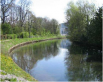
A study by a specialised consulting firm recommended restoring natural banks with a slight slope and improving the riparian vegetation.
The metal sheet piles, initially installed for bank protection, were deemed unsuitable and removed.
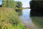
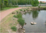
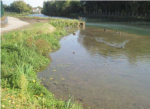
The banks were graded to a slight slope and stabilised using techniques suited to the hydraulic constraints weighing on each sector:
- helophyte rolls or calcareous landfill with geotextile fabric in areas where the constraints are not severe;
- mixed techniques (gabion bed and vegetated geomats) in areas subjected to greater constraints.
A total of 1 750 metres of bio-engineering bank-protection techniques were installed.
A number of measures were taken for the riparian vegetation, including planting of helophytes at the foot of banks, seeding of work areas with a mix of herbaceous plants, restoration of wooded areas by planting white willows and elimination of the invasive species found on site.
The top of the white willows was cut to encourage the growth of buds and of the tree trunks. This pruning technique will produce cavities that birds, small mammals and insects can use.
A lagoon was also created as an alluvial “annex” with two reed beds measuring 1 000 and 1 450 m² on the site of the former turn-around point for péniche barges in an effort to restore habitats for different species, notably pike.
Monitoring surveys and results
An pre work survey was carried out in 2010,on
the plant and animal compartments. Currently, no
particular ecological monitoring has been set up.
However, a check on the renewed growth of the
vegetation was run in September 2012, during the
works.
An assessment on the changes in the environment is also planned at some point at least five years after the works.
Unfortunately, the works had to be done from the water, which made it difficult. In addition, a large geese population, present on the river since before the works, has damaged and slowed the regrowth of the helophyte vegetation, particularly in the reed beds.
In 2010, the pre works assessment revealed a relictual population of woolly burdock that still existed on the site, but was threatened. The assessment was also an occasion to run surveys on two fish species, two emblematic bird species and one emblematic insect species. No amphibian species were noted.
An assessment of the impact of the works on the restored habitats and on biodiversity is planned at some point at least five years after the works in order to give enough time to the environment to adapt and to the various species to go through their life cycle. The assessment, carried out by a specialised consulting firm, will be based on the changes in the population numbers of the species listed in the initiallyt in order to determine the degree to which the objectives set by the project owner were met, namely:
- maintain the woolly burdock, pike and eel populations;
- install at least one amphibian species;
- double the number of bird and insect species (two and one respectively) observed prior to the works.
This project strove to achieve a balance between the ecological value of the site and its use as a waterway, i.e. a channel for commercial shipping, pleasure boating and the corresponding recreational activities. For example, the landscape of the site was improved with beneficial effects on tourism and pleasure boating, as well as on recreational activities (walking, etc.).
Lessons learnt
Image gallery
|
Catchment and subcatchment
Site
Project background
Cost for project phases
Reasons for river restoration
Measures
MonitoringHydromorphological quality elements
Biological quality elements
Physico-chemical quality elements
Any other monitoring, e.g. social, economic
Monitoring documents
Additional documents and videos
Additional links and references
Supplementary InformationEdit Supplementary Information
| ||||||||||||||||||||||||||||||||||||||||||||||||||||||||||||||||||||||||||||||||||||||||||||||||||||||||||||||||||||||||||||||||||||||||||||||||||||||||||||||||||||||||||


