Case study:Aesthetic vs. functional restoration of urban and peri-urban rivers: the Manzanares River in Madrid
This case study is pending approval by a RiverWiki administrator.
Project overview
| Status | In progress |
|---|---|
| Project web site | |
| Themes | Environmental flows and water resources, Habitat and biodiversity, Hydromorphology, Land use management - forestry, Social benefits, Urban |
| Country | Spain |
| Main contact forename | Fernando |
| Main contact surname | Magdaleno |
| Main contact user ID | |
| Contact organisation | Centre for Studies and Experimentation on Public Works (CEDEX) |
| Contact organisation web site | http://www.cedex.es/CEDEX/lang castellano/ |
| Partner organisations | |
| Parent multi-site project | |
| This is a parent project encompassing the following projects |
No |
Project summary
Peri-urban reach
• Improvement of environmental flow regime: the environmental flow regime should be optimized to allow for a better river dynamics. The discharge of episodic controlled floods could be capable of regenerating the riverbed and improving the solid transport (Magdaleno, 2017). The characteristics of these floods have been designed and proposed to the water authorities.
• Rescue and transfer of native ichthyofauna such as barbel (Luciobarbus bocagei), Iberian nase (Pseudochondrostoma polylepis) and Iberian gudgeon (Gobio lozanoi).
• Increased complexity and hydraulic diversity by using materials of coarse granulometry at certain sections, favoring the generation of optimal erosion and sedimentation patterns.
• Forestry works and removal of exotic vegetation: These works include the cutting of dry or dying vegetation, or the pruning of specimens that require an improvement in their structure or that have risks for the visitors. Also ailanthus –Ailanthus altissima-, box elder –Acer negundo- and false acacias –Robinia pseudoacacia- will be removed.
• Restoration of riparian vegetation on the river banks, the margins, the floodplain and the distal areas.
• Removal of excessive patches of helophytic species in the channel. Reed species -Phragmites australis- and narrowleaf cattail –Typha angustifolia- will be removed.
• Removal of obsolete transversal works and artificial barriers: the remains of an old gauging station, and some sedimentary heaps (with a total volume of 10,000 m3) accumulated in the channel which are creating large backwaters, and which have been colonized by pioneer vegetation will be removed.
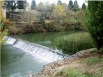
• Construction of fish ramp.
• Removal of landfills in the riparian areas to recover a certain degree of naturalness in the transversal profiles of the channel, which are now very much incised. the newly created surfaces will be re-vegetated, using plant propagules from the area.
• Improvement of trails. Also different signs and educational materials will also be installed for visitors.
Urban reach
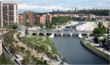
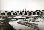
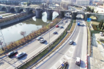
The progressive opening of the regulatory gates of the Manzanares River. The first effect of this opening was the reduction of the artificial depth of the dammed river (close to or greater than 2 m), the recovery, after decades of complete immobility, of sediment transport and the reappearance of a wide number of species of fauna and flora associated with the recently created fluvial forms. The creation of sandy islands and bars along the urban reach, and their rapid colonization by natural vegetation, has accelerated the change of the fluvial landscape. The City Council plans, at this moment, the creation of bioengineered slopes in the banks formerly covered by rip-raps, the planting of riparian species in the upper part of these slopes, and some other landscaping and environmental design project (such as the creation of a fish pass in one of the regulatory gates, the reintroduction of native ichthyofauna, or the creation of a fish breeding centre, among others).
Monitoring surveys and results
1. The restoration projects under execution or recently implemented
in the urban and peri-urban reaches of the
Manzanares River in Madrid have shown the high capacity
of historically degraded rivers to enjoy a fast recovery of
many important functions and services, following a correctly
designed hydromorphological and ecological restoration
or rehabilitation.
2. Even the more constrained urban reaches may sustain interesting aquatic and riparian habitats, and attract many different floral and faunal species. This is the case of the urban downtown reach of the river, which has bloomed in terms of bird and fish communities immediately after the restoration of some basic hydrogeomorphic patterns. In this case, the maintenance of a managerial approach strictly based on certain aesthetic values would have involved keeping the river in a very poor condition, with no natural processes attached and a total lack of relevant biotic communities.
3. Restoration of a minimum functionality of urban reaches requires restoring, as far as possible, the dynamics of the peri-urban reaches both upstream and downstream. The urban reach must not be an isolated water shackle, unable to constitute part of a river corridor which offers a large diversity of functions and services to the city and to its citizens.
4. The legal, scientific, technical and social advances recently developed in the approach to rivers must be reflected in their management. Strictly engineered solutions are frequently not cost-efficient, since they use to leave aside a wide number of the rivers´ functions and services. Selfmaintenance or self-restoration of rivers is also not an appropriate solution in most cases, since the pressures and constraints around rivers require active managerial approaches. Green infrastructures and natural water retention measures, as presently considered in the literature and in the legal context, may guide the efforts to restore urban and peri-urban rivers, because they involve multi-functional solutions, and can create the necessary links between the many different laws and policies which nowadays rule urban and peri-urban rivers.
Lessons learnt
Image gallery
|
Catchment and subcatchment
Site
Project background
Cost for project phases
Reasons for river restoration
Measures
MonitoringHydromorphological quality elements
Biological quality elements
Physico-chemical quality elements
Any other monitoring, e.g. social, economic
Monitoring documents
Additional documents and videos
Additional links and references
Supplementary InformationEdit Supplementary Information
| ||||||||||||||||||||||||||||||||||||||||||||||||||||||||||||||||||||||||||||||||||||||||||||||||||||||||||||||||||||||||||||||||||||||||||||||||||||||||||||||||||||||||||||||||||


