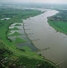
Case study:Opijnen- Side channel
Project overview
| Status | Complete |
|---|---|
| Project web site | |
| Themes | Habitat and biodiversity, Monitoring, Water quality |
| Country | Netherlands |
| Main contact forename | Rijkswaterstaat |
| Main contact surname | Rijkswaterstaat |
| Main contact user ID | |
| Contact organisation | Rijkswaterstaat |
| Contact organisation web site | http://wiki.reformrivers.eu/images/d/d9/RWS WD 2008.pdf |
| Partner organisations | |
| Parent multi-site project | |
| This is a parent project encompassing the following projects |
No |
Project summary
The artificial side channel of Opijnen was created by opening up groynes along a longitudinal dam. This has led to a flowing side channel which has been extensively monitored for ecological response. This manner of side channel can be used to improve navigation while at the same time restoring characteristic habitat for rheophilic fish and benthic invertebrates. Macrophytes have not shown a clear positive effect in this case.
The river Waal is a major tributary of the Rhine. Near the village of Opijnen a number of groyne fields were closed off in 1984 by the construction of a longitudinal dike. This construction improves navigation conditions for ship traffic on the Waal by directing the flow more towards the center of the channel. This prevents unwanted sedimentation of the deep middle parts of the channel which are used by ships. The site is situated in the outer bend of a meander. By closing off these groyne fields the hydromorphological conditions were altered. Water flow was stopped, leading to static water bodies in the groynes. Also the sedimentation and erosion of the banks was hampered.
National natural and ecology policy led to measures being taken to restore part of the natural flow and dynamics in the channel that the dike had severed. This was undertaken in 1994. To do this without influencing the main channel, openings were made at two points in the dike (entrance & outlet) and between the groynes. This allowed water from the main channel to flow through. In essence a side channel was created. The side channel has a flow during 99% of the year due to the bed level and the bottom sill at the entrance of the channel. The measure was taken in hopes of artificially creating biotopes that no longer exist along the heavilly modified river Rhine.
The project served as a pilot to monitor and analyse the effects. Scientific research was done on the channel to identify if the channel indeed served to (re)create habitat and biotopes that had disappeared due to channelization and artificial alterations of the Rhine and its tributaries in the Netherlands. The primary success criteria in this research were an increase in characteristic wading birds, fish and macro invertebrates.
Monitoring surveys and results
Macrophytes showed a change in assemblage structure after the measure was implemented. The overall abundance remained relatively low, specifically for the characteristic species who are only found at low densities. The general consensus for the WFD is that the BQE macrophytes is not positively or negatively affected by the measure.
Benthic invertebrates showed an increase in species diversity a few years after the opening of the channel. The species diversity was roughly equivalent to the diversity found prior to opening of the channel. This can be explained by the loss of stagnant water species when the channel was opened up. A significant increase in rheophilic taxa was visible; increasing from 4% of the total amount of found taxa prior to the opening of the channel to 14-21% after the opening. Subsequent years of monitoring have led to the conclusion that the benthic invertebrates have been positively affected by the measure. Rare rheophilic species have not been found at the site.
Eurytopic fish species were dominant in abundance throughout the side channel. This was the case for both the age-0 and the age-1+ fish. The site showed a significant increase in rheophilic fish species, including a number of rare fish that are uncommon in the Dutch rivers. Limnophilic species decreased and become (nearly) absent in the years after the measure was implemented. This was in line with the expectations however, as the measure led to the destruction of stagnant water habitats. It can be stated that fish were positively influenced by the measure.
Wading birds the habitat needed for seasonally migrating wading birds is available in the side channel; the very shallow waters and gradually increasing banks serve as ideal habitat. Despite this the number of wading bird species observed showed high fluctuations throughout the years. This may in part be related to the breeding success of wading bird colonies throughout the years. Different species made use of the area in different months of the year, conform their migratory behaviour.
Hydromorphology has not been monitored specifically. What can be noted is that the hydrology in terms of flow conditions (stagnant water - flowing side channel) has been altered by the measure.
Lessons learnt
The lateral dike which is part of the side channel system helps to guide water flow in the main channel in such a way that navigation is positively affected. Though this dike was build prior to the side channel project, it does serve as an example of a potential restoration technique which benefits both natural dynamics and ecology as well as navigation along the main channel.
Image gallery
|
Catchment and subcatchmentSelect a catchment/subcatchment
Catchment
Subcatchment
Other case studies in this subcatchment: Beneden-Leeuwen-Side channel, Buiten Ooij, Millingerwaard-Floodplain rehabilitation
Site
Project background
Cost for project phases
Reasons for river restoration
Measures
MonitoringHydromorphological quality elements
Biological quality elements
Physico-chemical quality elements
Any other monitoring, e.g. social, economic
Monitoring documents
Additional documents and videos
Additional links and references
Supplementary InformationEdit Supplementary Information
| ||||||||||||||||||||||||||||||||||||||||||||||||||||||||||||||||||||||||||||||||||||||||||||||||||||||||||||||||||||||||||||||||||||||||||||||||||||||||||||||||||||||||||||||||||||||||||||||||||||||||||||||||||||||||||||||||||||||||||||||||||||||

