Case study:The Irfon Special Area of Conservation Project
Project overview
| Status | Complete |
|---|---|
| Project web site | http://www.wyeuskfoundation.org/isac/ |
| Themes | Environmental flows and water resources, Habitat and biodiversity, Land use management - forestry, Monitoring, Water quality |
| Country | Wales |
| Main contact forename | Stephen |
| Main contact surname | Marsh-Smith |
| Main contact user ID | |
| Contact organisation | Wye & Usk Foundation |
| Contact organisation web site | http://www.wyeuskfoundation.org/ |
| Partner organisations | Environment Agency Wales, Rivers Trust, The National Museum of Wales |
| Parent multi-site project | |
| This is a parent project encompassing the following projects |
No |
Project summary
The ISAC Project
The EU Life+ fund supports bids in two categories - nature and biodiversity. The former enables actions to be taken to restore Special Areas of Conservation (SACs), such as the Wye and Usk. In 2008 the Wye & Usk Foundation submitted a bid and, after a rigorous justification phase, we were fortunate to be one of just four successful UK candidates. We chose the Irfon as it had all the SAC species present - though only just with some! Our partners include the Environment Agency Wales, The Rivers Trust and the National Museum of Wales. We are also assisted with matching funds by Countryside Council for Wales. In 2013 Environment Agency Wales and Countryside Council for Wales merged to form Natural Resources Wales.
Project Summary
Water Quality
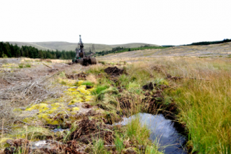
The plan included both specific actions for the listed SAC species and two main areas of work. In the upper Irfon above Llanwrtyd Wells practically all of the river and its tributaries drain uplands that are heavily afforested. In our pHish project, we set about correcting the low pH - and hence restoring invertebrate and fish life - of both the Irfon and upper Wye catchment. We achieved success in the upper Wye, Tarenig, Bidno and other streams in the area and salmon are now present in good quantities. We were, however, only partially successful on the Irfon. This was for two reasons. Firstly, a smaller proportion of the upper Wye catchment had been forested than the Irfon. Secondly, the Wye had many more hydrological sources where powdered limestone could be introduced. On the Irfon, however, these were largely obliterated by extensive forestry drains, which also compound the pH and hydrological problems by accelerating run off. Within ISAC we worked with both the private and public forestry interests to recover these crucial wetland areas and to correct the effects of the severe drainage system. Coniferous trees were removed and forest design plans altered to keep these restored wetland sections wet.
Habitat Restoration
The other essential part of the project was the restoration of the riparian habitat of the main tributaries of the Irfon. Double bank fencing, erosion repair, coppicing and introducing instream features and water gates comprised the bulk of the work. In all 32km of SAC designated sections of the Cledan, South Dulas, Cammdwr, Cammarch, Cynffiad, Garth Dulas and Chwefru were restored.
New techniques for pleaching riparian trees into the channel and soft revetments using hawthorn were developed during the project and proven be effective on a catchment scale.
Protecting Annex II Species
Amongst the species that benefited, Atlantic salmon (Salmon salar) are perhaps be the most obvious as both the acid waters work and habitat restoration increased the survival rates of juveniles. These works also benefited the other SAC species, including white clawed crayfish(Austropotamobius pallipes), freshwater pearl mussel (Margaritifera margaritifera), the lampreys (Petromyzon marinus, Lampetra fluviatilis, Lampetra planeri) shad(Alosa fallax, Alosa alosa) bullhead (Cottus gobio), otter (Lutra lutra) and rannunculus sp.
Captive breeding programmes were also established within the project by Natural Resources Wales at Abercynrig hatchery for white clawed crayfish and freshwater pearl mussel.
Monitoring
Whilst ISAC was primarily a 'doing' project, some monitoring was required to guide actions and quantify results. Fish populations were studied by annual electrofishing surveys, a baseline having been established by Natural Resources Wales in 2010.
Acid waters monitoring by the National Museum of Wales comprises a network of 22 sites recording pH, diatoms, water chemistry and invertebrate analysis. Further to this, otter and rannunculus distribution was assessed during the project.
The Rivers Trusts were responsible for disseminating the findings and results of ISAC using their links with other EU projects and rivers' trusts. This project allowed us to protect what we had and to restore what we might lose in this important sub-catchmnet of the Wye SAC, so by enhancing some of the most important species and habitats in the UK.
Monitoring surveys and results
Lessons learnt
Image gallery
|
Catchment and subcatchment
Site
Project background
Cost for project phases
Reasons for river restoration
Measures
MonitoringHydromorphological quality elements
Biological quality elements
Physico-chemical quality elements
Any other monitoring, e.g. social, economic
Monitoring documents
Additional documents and videos
Additional links and references
Supplementary InformationEdit Supplementary Information
| ||||||||||||||||||||||||||||||||||||||||||||||||||||||||||||||||||||||||||||||||||||||||||||||||||||||||||||||||||||||||||||||||||||||||||||||||||||||||||||||||||||||||||||||||||

