Case study:Upper Emscher
This case study is pending approval by a RiverWiki administrator.
Project overview
| Status | Complete |
|---|---|
| Project web site | |
| Themes | Habitat and biodiversity, Hydromorphology |
| Country | Germany |
| Main contact forename | Mechthild |
| Main contact surname | Semrau |
| Main contact user ID | User:EGLV |
| Contact organisation | Emschergenossenschaft |
| Contact organisation web site | http://eglv.de |
| Partner organisations | |
| Parent multi-site project | |
| This is a parent project encompassing the following projects |
No |
Project summary
Part of the integrated river basin management for the Emscher Region (865 km2, 2.700 inhabitants/ km2) is the revitalization of the river Emscher and its tributaries. Due to industrialization the waterbodies were systematically developed as open wastewater sewers in the beginning of the 20th century. Economic and technical alternatives such as closed sewer systems could not be implemented due to constant subsidence caused by coal mining.
Momentarily, the river system is being restructured in order to enable the Emscher to once again be a fully functioning, continuous water-based ecosystem with typical topology and vegetation.
An ecological concept based on the assumption of a non-interrupted river as a connection from the source to the mouth has been developed.
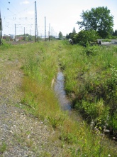
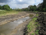
Studies on the feasibility of restructuring the Emscher show, that due to coal mining, industrial impacts and population changes the “original” conditions can never be reached again. It will not be possible to return the Emscher to its original, meandering state. Therefore, the reference conditions are no direct goals for the river restoration, but they give orientation in the planning procedure. The upper Emscher is a small river, in parts still a creek of a little more than 12 km in length. Its source is located in a small forest south of Dortmund. Flowing northwards the restored waterbody passes fields, shrubs and several towns/quarters of Dortmund as well as smaller industrial parks. Due to the many restrictions by buildings or infrastructure several box-culverts with natural substrates had to be built. The longest in Dortmund-Aplerbeck has a length of 120 m. Since there was hardly any space at all, the culvert and the sewage pipes were constructed more or less simultaneously, placing the culvert on top of the pipes. Several flood water detention basins have been custructed along the watercourse. The biggest of which, the " Phoenix-See " (Phoenix-Lake), is mostly used as recreation area. Bicycle and pedestrian paths as well as a harbour for sailing boats have been placed in and around the Lake. Because of the restrictions the Emscher is usually not meandering, but mostly in a more or less woven bed which has been sharply incised during the beginning of the 20th century. Except for the part parallel to the Phoenix-Lake and the many urban areas restricting the width and natural dynamics, natural succession can be allowed (sometimes only in the meadow, not on the slopes), thus creating different habitats of alder forest, Typha and Carex reeds, sedge, floodgrass and Potamogeton in the compensatory floodplain.
Monitoring surveys and results
Lessons learnt
Image gallery
|
Catchment and subcatchmentSelect a catchment/subcatchment
Catchment
Subcatchment
Other case studies in this subcatchment: Flood detention basin (HRB) Ickern-Mengede
Site
Project background
Cost for project phases
Reasons for river restoration
Measures
MonitoringHydromorphological quality elements
Biological quality elements
Physico-chemical quality elements
Any other monitoring, e.g. social, economic
Monitoring documents
Additional documents and videos
Additional links and references
Supplementary InformationEdit Supplementary Information
| ||||||||||||||||||||||||||||||||||||||||||||||||||||||||||||||||||||||||||||||||||||||||||||||||||||||||||||||||||||||||||||||||||||||||||||||||||||||||||||||||||||||||||||||||||||||||||||||||||||||||||||||||||||||||||||||||||||||||||||||||||||||||||||||||||||||||||||||||||||||||||||||||


