Case study:Agreed definition of mobility area for the Adour

From RESTORE
Revision as of 06:28, 6 September 2013 by Admin (talk | contribs)
Jump to navigation Jump to search
0.00
(0 votes)


To discuss or comment on this case study, please use the discussion page.


Location: 43° 39' 8.51" N, 0° 0' 51.13" W
Loading map...
Left click to look around in the map, and use the wheel of your mouse to zoom in and out.


Project overview

Edit project overview
Status In progress
Project web site
Themes
Country France
Main contact forename Fréderic
Main contact surname
Main contact user ID
Contact organisation Institution Adour
Contact organisation web site
Partner organisations
Parent multi-site project
This is a parent project
encompassing the following
projects
No
This case study hasn’t got a picture, you can add one by editing the project overview.

Project summary

Edit project overview to modify the project summary.


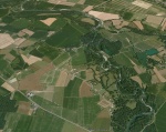
The Adour is an highly mobile, braided piedmont watercourse and constitutes one of the primary resources for alluvial materials in the Adour-Garonne basin. From the 1960s, large amounts of aggregates were extracted from both its main channel and associated floodplain. These activities caused a significant incision of the main channel, reducing the frequency of flooding into the floodplain, lowering the ground water table and cutting off ancient meanders, etc. Thus erosion of the banks occurred, which prompted the managing authorities to stabilise its cross-sectional and longitudinal profile: major embankments, weirs and protective structures for banks (covering 26% of banks) were subsequently constructed on the Adour. In order to put a stop to isolated responses to demands for riverbank consolidation without the implementation of a global approach, the Institution Adour and the two local associations conducted a joint study of how to design an integrated, acceptable and sustainable management programme for the Adour’s mobility area. The consultation with stakeholders in the area led to the definition of a permissible mobility area covering 1,744 hectares.

Monitoring surveys and results

This case study hasn’t got any Monitoring survey and results, you can add some by editing the project overview.

Lessons learnt

This case study hasn’t got any lessons learnt, you can add some by editing the project overview.


Image gallery


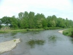
The Adour at Izotges (Gers).
Restoration of the three hectares of floodplain by moving back embankments, representing an additional storage area for 50,000 m³ of floodwater.
The Adour at Jû-Belloc (Gers): watercourse with a mobile bed.
ShowHideAdditionalImage.png


Catchment and subcatchment

Catchment

River basin district Hautes-Pyrénées et Ger
River basin Adour - Garonne

Subcatchment

River name L'Adour
Area category more than 10000 km²
Area (km2) 17000 km²1,700,000 ha <br />
Maximum altitude category
Maximum altitude (m)
Dominant geology
Ecoregion Western Plains
Dominant land cover Intensive agriculture
Waterbody ID


Site

Name Hautes-Pyrénées et Ger
WFD water body codes FRFR327C
WFD (national) typology
WFD water body name
Pre-project morphology Braided, Entrenched, Embanked
Reference morphology Braided
Desired post project morphology
Heavily modified water body true
National/international site designation
Local/regional site designations
Protected species present
Invasive species present
Species of interest
Dominant hydrology
Dominant substrate Gravel
River corridor land use Intensive agriculture, Urban
Average bankfull channel width category 10 - 50 m
Average bankfull channel width (m) 2020 m <br />0.02 km <br />2,000 cm <br />
Average bankfull channel depth category
Average bankfull channel depth (m)
Mean discharge category
Mean annual discharge (m3/s) 3535 m³/s <br />35,000 l/s <br />
Average channel gradient category
Average channel gradient 0.002
Average unit stream power (W/m2) 34.324534.325 W/m² <br />


Project background

Reach length directly affected (m) 44000 m44 km <br />4,400,000 cm <br />
Project started 2005/01/01
Works started 2008/01/01
Works completed 2018/01/01
Project completed
Total cost category 1000 - 5000 k€
Total cost (k€) 3733 k€3,733,000 € <br />
Benefit to cost ratio
Funding sources Water Agency, Institution Adour, Regional Council, French State

Cost for project phases

Phase cost category cost exact (k€) Lead organisation Contact forename Contact surname
Investigation and design 100 - 500 k€ 130 k€130,000 € <br />
Stakeholder engagement and communication 50 - 100 k€ 55 k€55,000 € <br />
Works and works supervision 1000 - 5000 k€ 2580 k€2,580,000 € <br /> Water Agency
Post-project management and maintenance
Monitoring 100 - 500 k€ 130 k€130,000 € <br />


Reasons for river restoration

Mitigation of a pressure Flood defence, Abstraction, Aggregate/mineral extraction
Hydromorphology Width & depth variation, Flow velocities, Structure & condition of riparian zones
Biology
Physico-chemical
Other reasons for the project Flood risk management, Stop riverbed incision and groundwater table lowering


Measures

Structural measures
Bank/bed modifications Removal/retreat of bank protection
Floodplain / River corridor Restoration of riparian forest
Planform / Channel pattern
Other
Non-structural measures
Management interventions Definition of erodble corridor
Social measures (incl. engagement)
Other Consultation


Monitoring

Hydromorphological quality elements

Element When monitored Type of monitoring Control site used Result
Before measures After measures Qualitative Quantitative
Channel pattern/planform Yes

Biological quality elements

Element When monitored Type of monitoring Control site used Result
Before measures After measures Qualitative Quantitative

Physico-chemical quality elements

Element When monitored Type of monitoring Control site used Result
Before measures After measures Qualitative Quantitative

Any other monitoring, e.g. social, economic

Element When monitored Type of monitoring Control site used Result
Before measures After measures Qualitative Quantitative


Monitoring documents


Additional documents and videos


Additional links and references

Link Description

Supplementary Information

Edit Supplementary Information