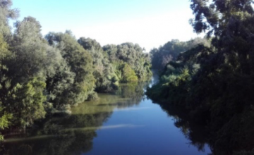
Case study:Environmental Restoration of the Lower Section of the Bembézar River and its River Environment (Phase 1)

From RESTORE
Revision as of 13:05, 23 October 2019 by Wetnet (talk | contribs)
Jump to navigation Jump to search

This case study is pending approval by a RiverWiki administrator.

Approve case study


0.00
(0 votes)


To discuss or comment on this case study, please use the discussion page.


Location: 37° 47' 26.31" N, 5° 13' 15.98" W
Loading map...
Left click to look around in the map, and use the wheel of your mouse to zoom in and out.


Project overview

Edit project overview
Status In progress
Project web site http://www.chguadalquivir.es/inicio
Themes Habitat and biodiversity, Land use management - forestry, Monitoring, Social benefits
Country Spain
Main contact forename Maria Jesus
Main contact surname Castañeda
Main contact user ID
Contact organisation Guadalquivir Hydrographic Confederation. Ministry for Ecological Transition.
Contact organisation web site http://www.chguadalquivir.es/inicio
Partner organisations
Parent multi-site project
This is a parent project
encompassing the following
projects
No
Project picture

Project summary

Edit project overview to modify the project summary.


With the aim of reorienting development towards sustainability, the Ministry of Agriculture and Fisheries, Food and the Environment has become aware of the importance of recovering the beds and banks of our rivers, and as a result has designed the National Strategy for Restoration of Rivers, a project that aims to recover river masses. It is a question of giving back to the river what was its own, its space, its vegetation, its water..., so that by itself it is capable of recovering its associated ecosystem. And following the requirements of the Water Framework Directive, approved in December 2000 and obligatory for the Spanish State, the objective is to ensure that rivers and streams recover their "good ecological status", and to make all administrative uses and actions compatible with the conservation of their natural values. The implementation of the National Strategy for the Restoration of Rivers is based on debate and consensus. We have sought the maximum participation of representatives of all entities of society to have the approval of all. The objective of this project is the environmental restoration of the lower stretch of the Bembézar River and its surroundings, which also includes the final stretch of its tributary, the Guadalora stream and the Madre Vieja river corridor (the former arm of the Guadalquivir that joins the Bembézar). The lower section of the Bembézar River is surrounded by extensive irrigated land that uses its waters through the hydraulic infrastructures created in its basin (reservoirs, canals and irrigation systems). It is thus a heavily regulated river, with three reservoirs upstream of this stretch, so that the recovery of it to its natural state is unfeasible. On the other hand, it is affected by important infrastructures that cross its course. The AVE trains tracks limit the lower section to the north and half of the section is crossed by the Seville-Cordoba railway and the Seville-Cordoba road (A-431). The project carries out actions to improve the natural environment through the cleaning of the riverbed and the restoration of autochthonous riverside vegetation; integration actions in a fluvial space, such as the construction of a pedestrian path and a footbridge over the river; and the conditioning of infrastructures for public use through the cleaning of vegetation from the existing Medieval Bridge in the Bembézar riverbed.

Monitoring surveys and results

This case study hasn’t got any Monitoring survey and results, you can add some by editing the project overview.

Lessons learnt

This case study hasn’t got any lessons learnt, you can add some by editing the project overview.


Image gallery


ShowHideAdditionalImage.png


Catchment and subcatchment

Catchment

River basin district C.H.Guadalquivir
River basin Guadalquivir River

Subcatchment

River name Bembézar River
Area category
Area (km2) 1.381.38 km² <br />138 ha <br />
Maximum altitude category
Maximum altitude (m)
Dominant geology
Ecoregion Vega del Guadalquivir"Vega del Guadalquivir" is not in the list (Iceland, Tundra, Borealic uplands, Fenno-Scandian Shield, Great Britain, Ireland and Northern Ireland, Ibero-Macaronesian, Taiga, Central Plains, Baltic Province, ...) of allowed values for the "Ecoregion" property.
Dominant land cover tree form, agricultural (irrigated)
Waterbody ID


Site

Name Lower Section of Bembézar River and its Surroundings
WFD water body codes
WFD (national) typology
WFD water body name
Pre-project morphology
Reference morphology
Desired post project morphology
Heavily modified water body No
National/international site designation
Local/regional site designations
Protected species present Yes
Invasive species present No
Species of interest According to the Book of the Threatened Wild Flora of Andalusia, published by the Department of the Environment of the Regional Government of Andalusia (2000), reference is made to the hackberry tree (Celtis australis), catalogued as Vulnerable (Regional Government of Andalusia). According to this same source, the hackberry tree does not meet any of the criteria for which it can be considered an endangered species, but it has ethnobotanical and timber importance. Specially since it is a marginal crop from historical agricultures, having archaeological importance as a bio-indicator of the presence of ancient or current roads, mills or irrigation ditches. Therefore, its wild populations in the region must be conserved, its presence valued in environmental impact projects, and the identification of forest formations and isolated individuals, valuing their function and meaning.
Dominant hydrology
Dominant substrate
River corridor land use
Average bankfull channel width category
Average bankfull channel width (m)
Average bankfull channel depth category
Average bankfull channel depth (m)
Mean discharge category
Mean annual discharge (m3/s)
Average channel gradient category
Average channel gradient
Average unit stream power (W/m2)


Project background

Reach length directly affected (m)
Project started 2019/01/08
Works started 2019/12/16
Works completed
Project completed
Total cost category
Total cost (k€) 960.873,02",02" is not declared as a valid unit of measurement for this property.
Benefit to cost ratio
Funding sources Guadalquivir Hydrographic Confederation

Cost for project phases

Phase cost category cost exact (k€) Lead organisation Contact forename Contact surname
Investigation and design
Stakeholder engagement and communication
Works and works supervision
Post-project management and maintenance
Monitoring


Reasons for river restoration

Mitigation of a pressure
Hydromorphology The hilly countryside seams very close to the riverbed, causing an increase of river sinuosity as it passes by.
Biology
Physico-chemical
Other reasons for the project social


Measures

Structural measures
Bank/bed modifications Actions to improve the natural environment: Cleaning of the riverbed and the riverbank; Removal of dead vegetation and cleaning of rubbish.
Floodplain / River corridor Actions to improve the natural environment: Restoration of the autochthonous riverside vegetation in the sections in which the reedbed is present. It is responsible for the degradation of the autochthonous vegetation, in an area which should be a riverside forest with species closer to the ecological climax; Removal of ailanthus and other invasive exotic species.
Planform / Channel pattern
Other
Non-structural measures
Management interventions
Social measures (incl. engagement) Actions of integration in a river area: Construction of a pedestrian path 2 meters wide and 3, 080 meters long along the riverside forest of the Bembézar River; Construction of a footbridge over the river and improvement of difficult passageways along the path. Improvement of infrastructures for public use: Cleaning of vegetation of the existing Medieval Bridge in the Bembézar riverbed.
Other


Monitoring

Hydromorphological quality elements

Element When monitored Type of monitoring Control site used Result
Before measures After measures Qualitative Quantitative

Biological quality elements

Element When monitored Type of monitoring Control site used Result
Before measures After measures Qualitative Quantitative

Physico-chemical quality elements

Element When monitored Type of monitoring Control site used Result
Before measures After measures Qualitative Quantitative

Any other monitoring, e.g. social, economic

Element When monitored Type of monitoring Control site used Result
Before measures After measures Qualitative Quantitative


Monitoring documents


Additional documents and videos


Additional links and references

Link Description

Supplementary Information

Edit Supplementary Information