Case study:Marsh restoration on the Merlue
Project overview
| Status | Complete |
|---|---|
| Project web site | |
| Themes | Habitat and biodiversity |
| Country | France |
| Main contact forename | Eric |
| Main contact surname | Chaput |
| Main contact user ID | |
| Contact organisation | Association pour le développement et l’animation de la Petite Montagne |
| Contact organisation web site | |
| Partner organisations | |
| Parent multi-site project | |
| This is a parent project encompassing the following projects |
No |
Project summary
The Merlue is a 7,9 km long tributary of the Valouse, with a small watershed (less than 15 km2) half covered by managed forests, half by non (or little) fertilized grassland. The fish population is mainly composed of two species : brown trout and bullhead (Cottus gobio). The invasive signal crayfish (Pacifastacus leniusculus) is also present. In its middle stretch, the Merlue used to cross a marsh, however more than one century ago, the riverbed was moved to the edge of the marsh in order to drain the land and plant softwood (which has never been productive). The new configuration affected the summer connection with the groundwater table. This explains both the frequency of drying up and the overheating of a portion of the river, two phenomena that are not observed downstream from the marsh, where the Merlue is in its original bed.
In the lower stretch, the riverbed was enlarged by approximately five meters, resulting in shallow waters and reduced available habitat for aquatic wildlife.
The Merlue is part of the Natura 2000 site “Petite montagne du Jura”. Restoration actions were carried out within the LIFE project “Ruisseaux de têtes de bassins et faune patrimoniale associée” (LIFE 04NAT/FR/000082), focusing on restoring the population of native white-clawed crayfish (Austropotamobius pallipes.
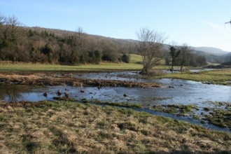
Before the works , 19,4 hectares were acquired in the marsh, thanks to the intervention of the “property development and rural settlement society” ( SAFER) . Four hectares of invasive willows and undesirable tree species were removed. The old riverbed was found by infrared photography , since the analysis of land registers did not allow to locate it. The stream was moved where the former bed was and the rectified channel was filled. The new riverbed was only slightly excavated and was intentionally undersized (30 x 30 cm), so that it would naturally recreate its shape. Some ramps were was positioned under the bed where specific anthropogenic constraints (bridge, crossing for agricultural machinery , etc. ) did not allow a free dynamics.
In the downstream portion, softwoods were removed . The riverbed of the Merlue was narrowed and raised by 50 cm adding sediments excavated in the nearby village (for the foundation of a house), and arranged in order to recreate a sinuous low-flow channel and a sequence of riffles and pools.
The stretch ends with a drowned rock ramp, positioned at the same height as the current bottom of the riverbed .
Monitoring surveys and results
The project allowed to increase by 300 m the stream length and to raise the water level along 1 500 m. Ten hectares of wetlands have been restored, which are also a relevant flood storage area. Habitats diversity and functionality were increased and initial monitoring results are encouraging, however it is too early to assess the biological gains of the operation.
Lessons learnt
Image gallery
|
Catchment and subcatchmentSelect a catchment/subcatchment
Catchment
Subcatchment
Site
Project background
Cost for project phases
Reasons for river restoration
Measures
MonitoringHydromorphological quality elements
Biological quality elements
Physico-chemical quality elements
Any other monitoring, e.g. social, economic
Monitoring documents
Additional documents and videos
Additional links and references
Supplementary InformationEdit Supplementary Information
| ||||||||||||||||||||||||||||||||||||||||||||||||||||||||||||||||||||||||||||||||||||||||||||||||||||||||||||||||||||||||||||||||||||||||||||||||||||||||||||||||||||||||||||||||||||||||||||||||||||||||

