Case study:River Dulais Restoration Project
Project overview
| Status | Complete |
|---|---|
| Project web site | |
| Themes | Fisheries, Habitat and biodiversity |
| Country | Wales |
| Main contact forename | Nick |
| Main contact surname | Elbourne |
| Main contact user ID | |
| Contact organisation | River Restoration Centre |
| Contact organisation web site | http://www.therrc.co.uk |
| Partner organisations | Environment Agency Wales, Salix River & Wetland Services Limited |
| Parent multi-site project | |
| This is a parent project encompassing the following projects |
No |
Project summary
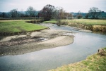
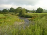
The River Dulais (Afon Dulais) is a tributary of the River Towy, and is an important spawning habitat for migratory fish. The river had a history of instability and planform adjustment. Unrestricted grazing, by sheep and cattle, had resulted in a loss of bankside vegetation. 4.9 km of the catchment had been fenced, however some areas needed more extensive bank protection.
Root wads were installed into the bank as an alternative to blockstone. In areas where the channel had additional capacity to scour or degrade brushwood protection was also used in between root wads. Careful thought was given to creating a smooth profile along the bank to reduce the risk of erosion. The riverbank above each root wad was protected by erosion control matting.
Forty root wads were installed over eighty metres of bank, with two to three metres of trunk left attached to the root wad. Crack willow (Salix fragilis), grey willow (Salix cinerea) and white willow (Salix alba) with an average trunk diameter of between 30cm and 60cm were used. Live willow was chosen as each tree should root and shoot to quickly bind the surrounding bank. All trees were sourced from within the Dulais catchment and two adjacent river valleys.
Since installation stabilisation of a complex outer meander bend has been achieved and each of the root wads installed has grown well.
Monitoring surveys and results
Lessons learnt
Catchment and subcatchment
Edit the catchment and subcatchment details
(affects all case studies in this subcatchment)
Site
| Name | River Dulais |
|---|---|
| WFD water body codes | GB110060036210 |
| WFD (national) typology | |
| WFD water body name | Dulais - conf with Ddu to confluence with Tywi |
| Pre-project morphology | |
| Reference morphology | |
| Desired post project morphology | |
| Heavily modified water body | No |
| National/international site designation | |
| Local/regional site designations | |
| Protected species present | No |
| Invasive species present | No |
| Species of interest | |
| Dominant hydrology | |
| Dominant substrate | |
| River corridor land use | |
| Average bankfull channel width category | |
| Average bankfull channel width (m) | |
| Average bankfull channel depth category | |
| Average bankfull channel depth (m) | |
| Mean discharge category | |
| Mean annual discharge (m3/s) | |
| Average channel gradient category | 0.01 - 0.1 |
| Average channel gradient | |
| Average unit stream power (W/m2) |
Project background
| Reach length directly affected (m) | 500 m0.5 km <br />50,000 cm <br /> |
|---|---|
| Project started | 2004/05/01 |
| Works started | |
| Works completed | |
| Project completed | 2004/05/31 |
| Total cost category | 10 - 50 k€ |
| Total cost (k€) | 33 k€33,000 € <br /> |
| Benefit to cost ratio | |
| Funding sources |
Cost for project phases
| Phase | cost category | cost exact (k€) | Lead organisation | Contact forename | Contact surname |
|---|---|---|---|---|---|
| Investigation and design | |||||
| Stakeholder engagement and communication | |||||
| Works and works supervision | 3333 k€ <br />33,000 € <br /> | Salix | |||
| Post-project management and maintenance | |||||
| Monitoring |
Supplementary funding information
Works split into €20k for revetment work and €13k for fencing
Reasons for river restoration
Measures
Structural measures
| |
|---|---|
| Bank/bed modifications | Bank stabilisation |
| Floodplain / River corridor | Control of riparian vegetation, Creation of wetlands |
| Planform / Channel pattern | Channel narrowing |
| Other | |
Non-structural measures
| |
| Management interventions | Fencing |
| Social measures (incl. engagement) | |
| Other | |
Monitoring
Hydromorphological quality elements
| Element | When monitored | Type of monitoring | Control site used | Result | ||
|---|---|---|---|---|---|---|
| Before measures | After measures | Qualitative | Quantitative | |||
Biological quality elements
| Element | When monitored | Type of monitoring | Control site used | Result | ||
|---|---|---|---|---|---|---|
| Before measures | After measures | Qualitative | Quantitative | |||
Physico-chemical quality elements
| Element | When monitored | Type of monitoring | Control site used | Result | ||
|---|---|---|---|---|---|---|
| Before measures | After measures | Qualitative | Quantitative | |||
Any other monitoring, e.g. social, economic
| Element | When monitored | Type of monitoring | Control site used | Result | ||
|---|---|---|---|---|---|---|
| Before measures | After measures | Qualitative | Quantitative | |||
Monitoring documents
Image gallery
Additional documents and videos
Additional links and references
| Link | Description |
|---|---|
| http://www.therrc.co.uk/case studies/rrn%20issue%2023.pdf | River Restoration Centre news article |
Supplementary Information
Edit Supplementary Information
Monitoring encompassed HABSCORE and electro fishing surveys, which were undertaken by the Environment Agency Wales just after construction in 2004 and again in 2006. Three sites were surveyed within the project reach, and a further three upstream to act as controls. At each site two semi-quantitative and one quantitative electro fishing surveys were carried out to determine population estimates for salmon and trout fry and parr. No marked differences were observed in fish densities between the two survey occasions, with some sites showing a reduction in fish numbers. However, it should be noted that the post-scheme surveys were undertaken just one year after the works, with the full benefits not likely to be realised until several years after implementation.
Where flow is focussed directly at the root wads, an area of localised scour has formed under the base of the exposed root ball. This provides an overhanging vegetated bank, which is a valuable new habitat feature. Diverse bankside cover has resulted and cleaner gravels are present, with visibly less fine sediment. Overall the channel geometry is now similar to more well-vegetated reaches of the river. Due to its rural and over-wide location maintenance of flow conveyance was not deemed to be an issue, even with the very fast growth rate of willow no post-project maintenance (coppicing) was required.


