Case study:Beekherstel Keersop: Difference between revisions
Bas Wullems (talk | contribs) No edit summary |
Bas Wullems (talk | contribs) No edit summary |
||
| Line 16: | Line 16: | ||
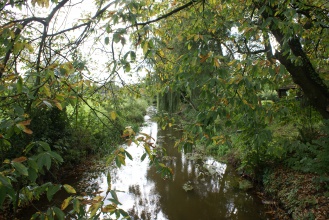
|Project picture=Afbeelding-keersop3.jpg | |Project picture=Afbeelding-keersop3.jpg | ||
|Picture description=Keersop, bron: https://www.dommel.nl/algemeen/actueel/werk-in-uitvoering/valkenswaard/beekherstel-keersop.html | |Picture description=Keersop, bron: https://www.dommel.nl/algemeen/actueel/werk-in-uitvoering/valkenswaard/beekherstel-keersop.html | ||
|Project summary= | |Project summary=The Keersop has its origin in the Elzenloop, then flows past Luyksgestel, Bergeijk, Westerhoven, Dommelen and finally discharges into the Dommel near Westerhoven. The main purposes of the planned measures is to make the straightened stream more natural again and increase the flow velocity in certain stretches. A secondary purpose is the restoration of the water depleted natural areas around the Keersop and Beekloop streams. Finally, the water authority will cooperate with farmers to improve water management in the area, as part of the integral desirable ground and surface water regime (NL: Gewenste Grond- en Oppervlaktewater Regime (GGOR)). | ||
Several restoration measures were carried out over the full length of the Keersop, varying from traditional stream restoration to Building with Nature. Building with Nature measures were implemented at trajectories 147, 148, 150, 151, 160, 161, 162, 163 (Factsheet NL27_BO_3_2). | |||
|Project title=Beekherstel Keersop | |Project title=Beekherstel Keersop | ||
}} | }} | ||
Latest revision as of 13:40, 1 April 2021
Project overview
| Status | In progress |
|---|---|
| Project web site | http://https://www.dommel.nl/algemeen/actueel/werk-in-uitvoering/valkenswaard/beekherstel-keersop.html |
| Themes | Environmental flows and water resources, Hydromorphology |
| Country | Netherlands |
| Main contact forename | Ineke |
| Main contact surname | Barten |
| Main contact user ID | |
| Contact organisation | |
| Contact organisation web site | |
| Partner organisations | |
| Parent multi-site project | |
| This is a parent project encompassing the following projects |
No |
Project summary
The Keersop has its origin in the Elzenloop, then flows past Luyksgestel, Bergeijk, Westerhoven, Dommelen and finally discharges into the Dommel near Westerhoven. The main purposes of the planned measures is to make the straightened stream more natural again and increase the flow velocity in certain stretches. A secondary purpose is the restoration of the water depleted natural areas around the Keersop and Beekloop streams. Finally, the water authority will cooperate with farmers to improve water management in the area, as part of the integral desirable ground and surface water regime (NL: Gewenste Grond- en Oppervlaktewater Regime (GGOR)).
Several restoration measures were carried out over the full length of the Keersop, varying from traditional stream restoration to Building with Nature. Building with Nature measures were implemented at trajectories 147, 148, 150, 151, 160, 161, 162, 163 (Factsheet NL27_BO_3_2).
Monitoring surveys and results
Lessons learnt
Image gallery
|
Catchment and subcatchmentSelect a catchment/subcatchment
Catchment
Subcatchment
Other case studies in this subcatchment: Beekherstel Beekloop BmN, Beekherstel Reusel Baarschot-Diessen, Boven-Dommel, Buulder Aa, Grote Aa, Herinrichting beekdal Tongelreep, Kleine Aa, traject Smalwater Noord, Kleine Beerze
Site
Project background
Cost for project phases
Reasons for river restoration
Measures
MonitoringHydromorphological quality elements
Biological quality elements
Physico-chemical quality elements
Any other monitoring, e.g. social, economic
Monitoring documents
Additional documents and videos
Additional links and references
Supplementary InformationEdit Supplementary Information
| ||||||||||||||||||||||||||||||||||||||||||||||||||||||||||||||||||||||||||||||||||||||||||||||||||||||||||||||||||||||||||||||||||||||||||||||||||||||||||||||||||||||||||||||||||||||||||||||||||||||||||||||||||||||||||||||||||||||||||||||||||||||||||||||||||||||||||||||

