Case study:MediCyn: Difference between revisions
No edit summary |
No edit summary |
||
| Line 1: | Line 1: | ||
{{Case study status | {{Case study status | ||
|Approval status= | |Approval status=Approved | ||
}} | }} | ||
{{Location | {{Location | ||
Latest revision as of 12:30, 25 February 2020
Project overview
| Status | In progress |
|---|---|
| Project web site | http://www.marseille-port.fr/fr/Page/18451 |
| Themes | Habitat and biodiversity |
| Country | France |
| Main contact forename | Isabelle |
| Main contact surname | Quoniam |
| Main contact user ID | |
| Contact organisation | Grand Port Maritime de Marseille |
| Contact organisation web site | http://www.marseille-port.fr/fr/Page/18451 |
| Partner organisations | TOUR DU VALAT |
| Parent multi-site project | |
| This is a parent project encompassing the following projects |
No |
Project summary
Context
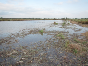
The Camargue wetlands are used in many ways which correspond to different types of water management. Such anthropic practices have transformed the natural habitats in many ways. Among these, traditional gaming water management, which targets the waterfowl, consists in the introduction of fresh water during summer, a period that is usually dry in the Mediterranean climate. This change in the natural cycle of water (i.e. a shorter dry period of temporary water bodies) leads to the loss of several Mediterranean species and to the eutrophication of the habitats as the organic matter has a shorter period to mineralize.
The management plan of the natural habitats of the Euromediterranean port of Marseille-Fos (GPMM) has the following objectives: (1) insure a favourable conservation status to the natural habitats and wild species, and (2) maintain traditional activities that are environmentally sustainable.
Objectives and implementation
Three types of water management, corresponding to 3 hydraulic calendars, will be tested: (1) the gaming calendar (July – January), (2) the Mediterranean calendar (November – April) and (3) the intermediate calendar (October – May).
To that end, we will create 9 ponds within the “Relai” (one of the GPMM natural estates), and implement the 3 calendars. At the “Grand Clos” (another GPMM’s natural estates), the traditional gaming water management will be maintained but we will test the intermediate calendar at 3 ponds which will be chosen by the local hunting society (SCPAM).
Monitoring surveys and results
Measure of the effects and future directions
We will monitor the respective effects of the 3 hydraulic calendars on the Mediterranean biodiversity, together with the hunting and pastoral values. The measures target the habitat (water levels, salinity), gaming and grazing activities (hunting bags, foraging value, users satisfaction…) and biodiversity (aquatic plants, dragonflies, ducks…).
Lessons learnt
The results of this monitoring will help the conservation managers to decide which hydraulic calendar(s) should be applied in the future to achieve the objectives of their management plan.
Image gallery
|
Catchment and subcatchmentSelect a catchment/subcatchment
Catchment
Subcatchment
Other case studies in this subcatchment: INTERREG MED WETNET - Membership card of the Verdier Marshes-Rhone Delta Wetland Contract, Restoration of the Cassaire wetland (Rhôle delta), The Verdier marshes
Site
Project background
Cost for project phases
Reasons for river restoration
Measures
MonitoringHydromorphological quality elements
Biological quality elements
Physico-chemical quality elements
Any other monitoring, e.g. social, economic
Monitoring documents
Additional documents and videos
Additional links and references
Supplementary InformationEdit Supplementary Information
| |||||||||||||||||||||||||||||||||||||||||||||||||||||||||||||||||||||||||||||||||||||||||||||||||||||||||||||||||||||||||||||||||||||||||||||||||||||||||||||||||||||||||||||||||||||||||||||||||||||||||||||||||||||||||||||||||


