Case study:TerraSeixe: Difference between revisions
No edit summary |
No edit summary |
||
| Line 60: | Line 60: | ||
}} | }} | ||
{{Motivations}} | {{Motivations}} | ||
{{Measures}} | {{Measures | ||
|Management interventions=definition and implementation of good management practices that ensure the conservation of biodiversity and the restoration of ecosystems in the context of emerging global change | |||
|Social measures=et up a support center for environmental education, ecotourism, research and scientific tourism at international level, contributing to rural development and the promotion of the local economy | |||
|Wider stakeholder / citizen engagement=create a climate refuge as an experimental and demonstrative area of climate change adaptation and mitigation measures | |||
}} | |||
{{Hydromorphological quality elements header}} | {{Hydromorphological quality elements header}} | ||
{{End table}} | {{End table}} | ||
Revision as of 10:57, 25 October 2019
This case study is pending approval by a RiverWiki administrator.
Project overview
| Status | Complete |
|---|---|
| Project web site | http://www.terraseixe.org/localizacao/#/en/introduction/ |
| Themes | Economic aspects, Habitat and biodiversity, Land use management - forestry |
| Country | Portugal |
| Main contact forename | Miguel |
| Main contact surname | Jeronimo |
| Main contact user ID | User:GEOTA |
| Contact organisation | GEOTA |
| Contact organisation web site | http://www.geota.pt/scid/geotawebpage/ |
| Partner organisations | 11 partners: Câmara Municipal de Aljezur, Câmara Municipal de Monchique, Câmara Municipal de Odemira, Junta de Freguesia de Odeceixe, Associação Vicentina, ICNF-DCN Algarve, APA-ARH Algarve, Universidade do Algarve – Centro de Estudos em Património, Paisagem e Construção, Universidade de Évora - Polo de Évora do Centro de Investigação em Biodiversidade e Recursos Genéticos (CIBIO), Instituto de Ciências Sociais (ICS) - Instituto de Ciências Sociais da Universidade de Lisboa - Grupo de Investigação Ambiente, Território e Sociedade e Universidade Nova de Lisboa - Faculdade de Ciências e Tecnologia |
| Parent multi-site project | |
| This is a parent project encompassing the following projects |
No |
Project summary
Green infrastructures (GI) are fundamental for territorial development. The Seixe river catchment basin (BHRS) is a microclimatic refuge with biogeographic characteristics , in particular fauna and flora with protection status. The aim of the project is to define GI and good management practices that are fundamental for ecological restoration and connectivity, biodiversity conservation and the promotion of nature tourism, based on climate change adaptation.
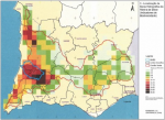
In 2004, the Cordão Verde project in the south of Portugal defined the main ecological corridors that would ensure the ecological connectivity between the Alentejo coast and the Guadiana river valley, identifying the Monchique mountain and BHRS as the main hotspot in southern Portugal for biodiversity conservation.
The combination of geographical and orographic characteristics created conditions for the existence of a microclimate refuge where some species typical of landscapes common at the end of the Tertiary period still persist, although today they are almost nonexistent in mainland Portugal. One of the representative species of these landscapes is the Quercus canariensis (Monchique oak). This species, together with other endemic flora and fauna of the region, gives a unique value to the native forests of this basin. This is formally recognized by the integration of almost 90% of this territory into the Natura 2000 Network, Important Bird Area (IBA) and the National Network of Protected Areas.
The project is being developed as a transdisciplinary pilot project in the area of biodiversity conservation, land use and climate change. In particular, it focueses the protection and conservation of species of restricted distribution, such as endemic species, and the need to organize and manage this territory to make it more resilient to climate change, in which southern Portugal is particularly vulnerable.
The overall objectives are: (i) definition and implementation of good management practices that ensure the conservation of biodiversity and the restoration of ecosystems in the context of emerging global change; (ii) create a climate refuge as an experimental and demonstrative area of climate change adaptation and mitigation measures; (iii) set up a support center for environmental education, ecotourism, research and scientific tourism at international level, contributing to rural development and the promotion of the local economy.
Monitoring surveys and results
Lessons learnt
Image gallery
|
Catchment and subcatchmentSelect a catchment/subcatchment
Catchment
Subcatchment
Site
Project background
Cost for project phases
Reasons for river restoration
Measures
MonitoringHydromorphological quality elements
Biological quality elements
Physico-chemical quality elements
Any other monitoring, e.g. social, economic
Monitoring documents
Additional documents and videos
Additional links and references
Supplementary InformationEdit Supplementary Information
| ||||||||||||||||||||||||||||||||||||||||||||||||||||||||||||||||||||||||||||||||||||||||||||||||||||||||||||||||||||||||||||||||||||||||||||||||||||||||||||||||||||||||||||||||||||||||||||||||||||||||


