Case study:Bringing Back the Bulbourne: Difference between revisions
No edit summary |
No edit summary |
||
| Line 43: | Line 43: | ||
{{Motivations | {{Motivations | ||
|Specific mitigation=Abstraction, | |Specific mitigation=Abstraction, | ||
|Hydromorphological quality elements=Channel pattern/planform, | |||
}} | }} | ||
{{Measures}} | {{Measures}} | ||
Revision as of 10:15, 25 March 2019
This case study is pending approval by a RiverWiki administrator.
Project overview
| Status | Complete |
|---|---|
| Project web site | http://http://www.boxmoortrust.org.uk/river-bulbourne/ |
| Themes | Fisheries, Habitat and biodiversity, Land use management - agriculture, Monitoring, Social benefits, Water quality |
| Country | Finland |
| Main contact forename | Liam |
| Main contact surname | Dennis |
| Main contact user ID | User:Liamd |
| Contact organisation | Environment Agency |
| Contact organisation web site | http://http://www.boxmoortrust.org.uk/river-bulbourne/ |
| Partner organisations | The Box Moor Trust |
| Parent multi-site project | |
| This is a parent project encompassing the following projects |
No |
Project summary
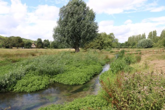
The River Bulbourne is a chalk stream that has been severely impacted by historic alterations, over-abstraction and its interaction with the Grand Union Canal. The one kilometre section is owned by the Box Moor Trust and is common land open to the public.
Prior to this project, the River Bulbourne was straight, over-wide and silty. Due to high banks and old dredging bunds, the river was disconnected from its floodplain and had little marginal habitat. Excessive grazing pressure resulted in bank erosion and little riparian vegetation. A large weir prevented fish passage and also caused an impoundment upstream further degrading the habitat.
The chalk stream characteristics had been almost completely lost. What should have been a beautiful gravelly stream meandering through rich, biodiverse floodplain, was actually a silty homogeneous channel with little habitat to provide home to wildlife.
Monitoring surveys and results
We have undertaken an integrated approach to monitoring and evaluation using complementary surveys incorporating professionals, academics and citizen scientists.
Electrofishing surveys have been conducted prior to delivery phase and post project. Further surveys will be carried out in future years to track population changes.
A group of volunteers regularly undertake Riverfly monitoring to help us understand the changes to the health of the river’s invertebrate populations. We worked with academics from Queen Mary University of London to apply the new Modular River Survey to assess changes in habitat composition as a result of the restoration work. This was complemented by localised detailed habitat assessments, physical biotope mapping and a river corridor survey undertaken by the Environment Agency. Sediment sampling was carried out and methods employed to minimize the introduction of pollutants present in the bank material into the river. We also used real-time monitoring sondes to demonstrate that the water quality of the river remained acceptable throughout the main phase of works. The results will provide a case study to help better inform similar schemes in future.
Lessons learnt
Image gallery
|
Catchment and subcatchment
Site
Project background
Cost for project phases
Reasons for river restoration
Measures
MonitoringHydromorphological quality elements
Biological quality elements
Physico-chemical quality elements
Any other monitoring, e.g. social, economic
Monitoring documents
Additional documents and videos
Additional links and references
Supplementary InformationEdit Supplementary Information
| ||||||||||||||||||||||||||||||||||||||||||||||||||||||||||||||||||||||||||||||||||||||||||||||||||||||||||||||||||||||||||||||||||||||||||||||||||||||||||||||||||||||||||||||||||

