Case study:Upper River Nairn restoration project: Difference between revisions
No edit summary |
No edit summary |
||
| Line 88: | Line 88: | ||
|Other motivation=To restore a heavily modified section of the Upper River Nairn back to a more natural state whilst also reducing the risk of flooding to protect agricultural interests | |Other motivation=To restore a heavily modified section of the Upper River Nairn back to a more natural state whilst also reducing the risk of flooding to protect agricultural interests | ||
}} | }} | ||
{{Measures}} | {{Measures | ||
|Bank and bed modifications measure=Channel realignment, embankment removal, channel reprofiling, installation of large wood structures | |||
|Floodplain / River corridor=Channel realignment, channel reprofiling, reinstatement of three wetlands | |||
|Planform / Channel pattern=Changing from a canalised straightened channel to a meandering/ wondering channel | |||
|Management interventions=Riperian tree planting, fencing | |||
|Social measures=Regulatory bodies incl with SEPA and SNH | |||
}} | |||
{{Hydromorphological quality elements header}} | {{Hydromorphological quality elements header}} | ||
{{End table}} | {{End table}} | ||
Revision as of 16:53, 21 February 2019
This case study is pending approval by a RiverWiki administrator.
Project overview
| Status | Complete |
|---|---|
| Project web site | |
| Themes | Environmental flows and water resources, Fisheries, Flood risk management, Habitat and biodiversity, Hydromorphology, Land use management - agriculture, Land use management - forestry, Monitoring |
| Country | Scotland |
| Main contact forename | Euan |
| Main contact surname | Anderson |
| Main contact user ID | User:Aberarder |
| Contact organisation | Aberarder Estate |
| Contact organisation web site | |
| Partner organisations | |
| Parent multi-site project | |
| This is a parent project encompassing the following projects |
No |
Project summary
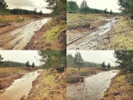
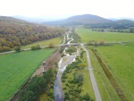
The site is located on the upper River Nairn, just west of the settlement of Croachy. The study section is 4 km long, extending upstream to where the channel exits from its steep headwater zone. The gradient of the channel generally decreases as it transitions into a floodplain zone, currently managed for agriculture. Under natural conditions, the study site was a highly dynamic alluvial fan with multiple channels. However, because of historical engineering for land management, natural physical processes in this part of the upper Nairn were significantly altered. The channel had been straightened and constrained between embankments, becoming ‘perched’ above its floodplain due to aggradation of its bed. The river corridor lacked the physical features and associated habitats that would naturally occur, mainly through the lack of morphological variability but also limited tree cover and large wood material in the active channel. As a result, the water body was classified at poor ecological status under EU Water Framework Directive (WFD) classifications.
Following a ‘process-based’ approach, an ‘assisted recovery’ design strategy was adopted, permitting the river to self-adjust towards a quasi-stable ‘dynamic equilibrium’ morphological condition. The aim was to reinstate a greater potential for the development of lateral channel variability (through the evolution of alluvial bar forms and associated bank erosion processes) and connectivity with wetland/ floodplain environments. Initially a series of conceptual design were developed from which, after stakeholder engagement, a preferred option was identified. A detailed design phase then followed, supported by high-resolution 2D hydrodynamic and morphodynamic (i.e. sediment transport) modelling. An iterative modelling-design process determined the optimal restoration approach for the different river sections.
Three different design strategies were proposed in discrete sections of the site. Due to practical site constraints, the design in the upstream sections of the site could only involve the localised reprofiling of the river corridor (mainly the removal/ re-grading of existing embankments) while, in the downstream section, channel realignment and the reinstatement of ‘online’ wetlands were implemented. Almost 1 km of channel length was realigned into a more sinuous course through a lower elevation area. Importantly, this connected a series of three online wetland areas before tying back into the existing channel course downstream. Furthermore, to mitigate the lack of large wood (LW) processes through the site, riparian planting was conducted in conjunction with the installation of ‘bar apex’ LW structures were installed at appropriate locations through the realigned channel.
Monitoring surveys and results
Post works monitoring is essential for evaluating the physical and ecological performance of the project. Given the near unique scale of application of the ‘process-based’ restoration approach, the project provided an invaluable opportunity to monitor how the river environment responds to the various components of the implemented works, providing valuable insight and guidance for the application of this type of approach in other areas.
Specific monitoring has included:
• Repeat topographic/ bathymetric surveys (immediately post-construction and subsequent to three high flow events flood events).
• Repeat sediment sampling (pre- and post- implementation)
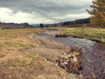
• Repeat fixed-point photographs
• Repeat spawning surveys/ redd counts (including pre-works and the two spawning seasons post-construction)
• Repeat electro-fishing surveys (in both channel and wetland locations, pre- and post-works)
Immediately after construction, a detailed topographic and sedimentary resurvey were carried out. Further resurveys have been undertaken after significant flow events, determining rapid evolution of the site and in the trajectory intended (and predicted by modelling).
Given fish populations are a good indicator of habitat condition, repeat red counts and electro-fishing surveys have also been undertaken. Latest survey results show significant increases in spawning and juvenile salmon and trout compared to pre-restoration conditions, providing an ‘ecological validation’ the works implemented.
Lessons learnt
Given the explicit development of an integrated steering group and the associated project management approach, challenges during the project were minimised. Also, experience from previous construction projects by the design/ build team meant that many potential issues were avoided. There was careful planning of the construction phase of the project such that the most intrusive works (i.e. construction of the realigned channel and large wood implementation) were conducted ‘offline’, minimising the risk of high flow events impacting the works and fine sediment pollution. Such ‘assisted recovery’ designs explicitly require a degree of ‘field fitting’, allowing for unexpected issues encountered to be managed through appropriate short notice design variations. This was the case in the furthest downstream section of the site where, due to wet ground, it was not safe for construction machinery to excavate the initially proposed realigned channel in this area. It was therefore decided that the proposed design be modified such that the third (furthest downstream) wetland feature would be instated through this ~200 m long section, subsequently proving to be an appropriate revision. Such a short notice adjustment was only possible due to the close and established working relationship between the designer, regulator (i.e. SEPA) and contractor.
Image gallery
|
Catchment and subcatchment
Site
Project background
Cost for project phases
Reasons for river restoration
Measures
MonitoringHydromorphological quality elements
Biological quality elements
Physico-chemical quality elements
Any other monitoring, e.g. social, economic
Monitoring documents
Additional documents and videos
Additional links and references
Supplementary InformationEdit Supplementary Information
| ||||||||||||||||||||||||||||||||||||||||||||||||||||||||||||||||||||||||||||||||||||||||||||||||||||||||||||||||||||||||||||||||||||||||||||||||||||||||||||||||||||||||


