Case study:Creation of flood channels and restoration of exchanges between the flood plain and the low-flow channel on the Vezouze: Difference between revisions
No edit summary |
No edit summary |
||
| Line 162: | Line 162: | ||
{{Additional links and references | {{Additional links and references | ||
|Link=www.onema.fr/sites/default/files/pdf/Vezouze_GB_BD2.pdf | |Link=www.onema.fr/sites/default/files/pdf/Vezouze_GB_BD2.pdf | ||
|Description=All information on this page is copied from | |Description=All information on this page is copied from the AFB, The French Agency for biodiversity. | ||
}} | }} | ||
{{Additional links and references footer}} | {{Additional links and references footer}} | ||
{{Supplementary Information}} | {{Supplementary Information}} | ||
{{Toggle content end}} | {{Toggle content end}} | ||
Revision as of 07:19, 30 July 2018
This case study is pending approval by a RiverWiki administrator.
Project overview
| Status | Complete |
|---|---|
| Project web site | http://www.onema.fr/IMG/EV/publication/rex_VezouzeGB.pdf |
| Themes | Flood risk management, Habitat and biodiversity, Hydromorphology, Monitoring, Social benefits, Urban |
| Country | France |
| Main contact forename | Josee |
| Main contact surname | Peress |
| Main contact user ID | User:Josee Peress |
| Contact organisation | AFB |
| Contact organisation web site | http://www.onema.fr/Hydromorphologie,510 |
| Partner organisations | |
| Parent multi-site project | |
| This is a parent project encompassing the following projects |
No |
Project summary
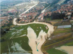
The work consisted of widening the river’s middle
water channel in some places. For this, a protective
levee has been levelled on the left bank. Two flood
channels, measuring one metre on average over
6 hectares, have been dug, involving the removal of
60,000 m3 of material. Within these flood channels,
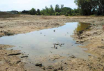
wetland environments such as ponds and side channels
have been created. Trees have been planted on
the banks as well as helophytes in flood channels. In
addition to these actions on the environment, work
on the rainwater system has also been undertaken:
check valves and pumping stations have been set up.
The Vezouze maintenance syndicate manages the removal of blockage and debris as required.
Monitoring surveys and results
A pre-restoration monitoring was carried out by a
consultancy in 2000 and again in 2003, 2004 and
2005 on the hydraulic component. Investigations
were required to study the hydrography,
hydrology, topography and geology of the land.
A bibliographic study was used to describe the
biological component of the aquatic environment.
Post-restoration ecological monitoring (habitats,
species) began in 2010 and will continue until 2014.
This monitoring consists of describing the natural
environment and assessing the impacts (positive
and / or negative) of operations on animal and plant
life, specifically targeting the restored flood plain
and side channels created. The hydromorphology
and biological communities living in the lowflow
channel (fish, aquatic invertebrates, etc.) are
however not investigated in this work.
The first results of 2010 and 2011 highlight several outstanding species for Lorraine, including insect and plant species. It will therefore be very interesting to monitor the evolution of these species on the site. Particular attention will be paid to plants receiving protected status, as these species were most likely to have been introduced during the restoration work.
The ecological evolution of the site is very satisfactory. The results of monitoring attest to the positive effects of the work on biodiversity with the presence of wildlife characteristic of wetlands and the presence of outstanding species in terms of flora and insect life. The evolution and diversification of the side channels, which have a dense vegetation of helophyte-type plants, are also very conducive to pike reproduction (even though there is no monitoring of this aspect, side channels here show strong potential).
Hydraulically, the results are equally satisfactory. Upstream to the restored area, height and surfaces of areas flooded in Lunéville have significantly diminished.
As the primary objective of this restoration is flood defence, the explanation to elected representatives of the benefits of preserving the flood storage area and diversifying habitats in the flood plain has led to the setting up of a project that reconciles hydraulic and ecological objectives. Cross-cutting objectives particularly motivated elected representatives who were thus able to meet the expectations of the local population in terms of safety and landscaping issues. These developments make it possible to combine flood management and improvement of the ecological status of the river.
In addition, a pedestrian path has been created in the area and its regular use reflects the renewed interest of local people for the site. Previously, they tended to avoid this unattractive, unsightly sector. The work thus helped to enhance “nature” in a peri-urban area.
Lessons learnt
Image gallery
|
Catchment and subcatchment
Site
Project background
Cost for project phases
Reasons for river restoration
Measures
MonitoringHydromorphological quality elements
Biological quality elements
Physico-chemical quality elements
Any other monitoring, e.g. social, economic
Monitoring documents
Additional documents and videos
Additional links and references
Supplementary InformationEdit Supplementary Information
| ||||||||||||||||||||||||||||||||||||||||||||||||||||||||||||||||||||||||||||||||||||||||||||||||||||||||||||||||||||||||||||||||||||||||||||||||||||||||||||||||||||||||||||||||||||


