Case study:Austria River Mur - Strategic river management for considerations in the power and water management sector in Styria/Austria: Difference between revisions
No edit summary |
No edit summary |
||
| Line 52: | Line 52: | ||
|Hydromorphological quality elements=Continuity for organisms, Continuity of sediment transport, Quantity & dynamics of flow, | |Hydromorphological quality elements=Continuity for organisms, Continuity of sediment transport, Quantity & dynamics of flow, | ||
}} | }} | ||
{{Measures}} | {{Measures | ||
|Bank and bed modifications measure=Providing of continuity, | |||
|Floodplain / River corridor=Protection of alluvial forests by connecting existing stocks to the fluvial dynamics | |||
|Planform / Channel pattern=Reconnection of cutoff meander, | |||
|Social measures=Population’s awareness raising for the river habitat. | |||
}} | |||
{{Hydromorphological quality elements header}} | {{Hydromorphological quality elements header}} | ||
{{End table}} | {{End table}} | ||
Revision as of 07:42, 24 July 2018
This case study is pending approval by a RiverWiki administrator.
Project overview
| Status | Complete |
|---|---|
| Project web site | |
| Themes | Economic aspects, Environmental flows and water resources, Flood risk management, Habitat and biodiversity, Hydropower, Hydromorphology, Land use management - agriculture, Land use management - forestry, Monitoring, Social benefits, Spatial planning, Water quality |
| Country | Austria |
| Main contact forename | Jörg |
| Main contact surname | Raderbauer |
| Main contact user ID | User:9984 |
| Contact organisation | freiland Environmental Consulting Civil Engineers Ltd. |
| Contact organisation web site | http://www.freiland.at |
| Partner organisations | Office of the Styrian Government - Department 14 Watermanagement, resources and sustainability |
| Parent multi-site project | |
| This is a parent project encompassing the following projects |
No |
Project summary
The objectives of the previously mentioned projects at the Mur is the recovery of natural rich structured river habitats , the reconnection of cutoff meander, the restoration of the river continuum, the protection of existing and the development of new alluvial forests by connecting existing stocks to the fluvial dynamics and the population’s awareness raising for the river habitat.
The restoration, improvement and long-term protection of natural wetlands and rivers, is a prerequisite for establishing rare and endangered water dependent animal and plant species. In addition, these measures serve the requirements of the water protection management to increase the retention capacity at flood discharges.
To reinforce the already implemented stepping stones and their effects from the previous projects and for the creation of a continuous restructured section, the new LIFE+ areas of follow-up projects were deliberately selected in the vicinity of previous projects. For the purpose of documenting and ensuring the success of the projects, the measures and their synergy effects are scientifically studied in monitoring programs, which will continue until 2015.
Up to now major success could be achieved by the measures implemented for improving the structural diversity of the Mur and the Enns. Acquisition and reactivation of flooded areas contributed to the passive flood protection, this has been proven already at the flood event in June 2013 - in spite of higher water flows than in 2002, reduced flooding and less damage were reported in 2013. Due to intense public relations the population deeply appreciated the projects and the habitats.
Through spatial integration of the measures, the cumulative effect for the river habitat goes far beyond its sum of the individual measures. The projects are an important step onto a nature-oriented liveable future on the Upper Mur and the Mur, and many more should follow.
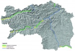
To overcome the conflict between hydropower expansion and nature protection or recreation/tourism, management plans have been established for the rivers Enns, Mur and Mürz. These plans have been aligned between energy providers and river experts. The core objective of these plans is to balance the interests of the energy sector and those of river protection and restoration, focussing on river-ecological aspects.
When setting up these plans, hydropower potentials have been juxtaposed with ecological goals that considered potentially affected protected species and areas, their ecological state as well as water management aspects. Where ecological measures for conservation and/or improvement of river-bound habitats have already been implemented, river stretches are excluded from any future hydropower use. Hence, already restored areas along the rivers Enns and Mur that have been supported via EU-programs are disclosed as ecological priority zones. Apart from the aforementioned designations, measures for poor ecological stretches have been defined. Special focus is given to the concept of “stepping stones” with its up- and downstream effects. Stepping stones bridge hardly restorable stretches and therewith provide an efficient and cost-saving concept for mitigation measures. The measures focus mainly on biological qualities, the primary criteria of the ecological status assessment.
The management plans provide a binding planning framework until 2022 and a regulation framework for hydropower projects at the mentioned rivers. Likewise, ecological interests are safeguarded for the long-term. Precious and pristine stretches of rivers are protected from encroachments and the perspective of further river restorations is enabled. The management plan for the river Mur is the basis for the enactment of a so called “regional program” of the Austrian Water Management Authority.
Water management plans (German: Gewässerbewirtschaftungspläne, BWP) represent the first planning instrument of this kind at province level in Austria and demonstrate that the involvement of the key stakeholders in the planning process succeeds in a mutually acceptable result, which enables to match the requirements of different policies and different interests.
Monitoring surveys and results
Lessons learnt
Image gallery
|
Catchment and subcatchment
Site
Project background
Cost for project phases
Reasons for river restoration
Measures
MonitoringHydromorphological quality elements
Biological quality elements
Physico-chemical quality elements
Any other monitoring, e.g. social, economic
Monitoring documents
Additional documents and videos
Additional links and references
Supplementary InformationEdit Supplementary Information
| ||||||||||||||||||||||||||||||||||||||||||||||||||||||||||||||||||||||||||||||||||||||||||||||||||||||||||||||||||||||||||||||||||||||||||||||||||||||||||||||||||||||||

