Case study:Enler River enhancement project: Difference between revisions
No edit summary |
No edit summary |
||
| Line 12: | Line 12: | ||
|Main contact surname=Bankhead | |Main contact surname=Bankhead | ||
|Main contact id=Judithbankhead | |Main contact id=Judithbankhead | ||
|Contact organisation=Rivers Agency | |Contact organisation=Rivers Agency Northern Ireland (DARDNI) | ||
|Contact organisation url=www.dardni.gov.uk/rivers | |Contact organisation url=www.dardni.gov.uk/rivers | ||
|Partner organisations=Rivers Agency | |Partner organisations=Rivers Agency Northern Ireland (DARDNI), DCAL Inland Fisheries, Castlereagh Borough Council | ||
|Multi-site=No | |Multi-site=No | ||
|Project picture=P4180319.JPG | |Project picture=P4180319.JPG | ||
Latest revision as of 12:12, 6 June 2017
Project overview
| Status | Complete |
|---|---|
| Project web site | |
| Themes | Fisheries, Habitat and biodiversity, Hydromorphology |
| Country | Northern Ireland |
| Main contact forename | Judith |
| Main contact surname | Bankhead |
| Main contact user ID | User:Judithbankhead |
| Contact organisation | Rivers Agency Northern Ireland (DARDNI) |
| Contact organisation web site | http://www.dardni.gov.uk/rivers |
| Partner organisations | Rivers Agency Northern Ireland (DARDNI), DCAL Inland Fisheries, Castlereagh Borough Council |
| Parent multi-site project | |
| This is a parent project encompassing the following projects |
No |
Project summary
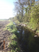
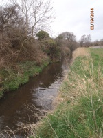
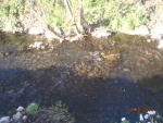
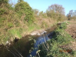
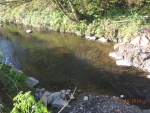
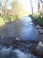
The Enler River is a typical arterially drained channel with laminar flow, regular depth and silt deposition. Compensation money from a fish kill prosecution allowed fishery enhancement measures to be planned and implemented. These included deflector groynes to narrow the channel and creat a thalweg, addition of spawning gravels and plums, and the creation of deeper water via a small cross river groyne
Monitoring surveys and results
Pre works fishery assessment and river habitat assessment were carried out, along with photographs. Post works photographs have been taken and this will continue. One year plus fishery assessment and habitat assessment planned for 2015.
Lessons learnt
Opportunisitc work due to compensation monies and public land ownership. The proximity of the Greenway cycle way, and high value market gardening land meant that the reach length had to be limited, and work constrained within the current channel dimensions. Lunkers that had been obtained for inlcusion in the scheme could not be used due to size issues - used elsewhere.
Image gallery
|
Catchment and subcatchmentSelect a catchment/subcatchment
Catchment
Subcatchment
Site
Project background
Cost for project phases
Reasons for river restoration
Measures
MonitoringHydromorphological quality elements
Biological quality elements
Physico-chemical quality elements
Any other monitoring, e.g. social, economic
Monitoring documents
Additional documents and videos
Additional links and references
Supplementary InformationEdit Supplementary Information
| |||||||||||||||||||||||||||||||||||||||||||||||||||||||||||||||||||||||||||||||||||||||||||||||||||||||||||||||||||||||||||||||||||||||||||||||||||||||||||||||||||||||||||||||||||||||||||||||||||||||||||||||||||||||||||||||||||||||||||

