Case study:Creamery Weir fish barrier easement: Difference between revisions
Robmitchell (talk | contribs) No edit summary |
No edit summary |
||
| Line 63: | Line 63: | ||
}} | }} | ||
{{Measures | {{Measures | ||
|Bank and bed modifications measure= | |Bank and bed modifications measure=Weir removal, | ||
}} | }} | ||
{{Hydromorphological quality elements header}} | {{Hydromorphological quality elements header}} | ||
Latest revision as of 09:49, 31 May 2017
Project overview
| Status | Complete |
|---|---|
| Project web site | |
| Themes | Fisheries, Habitat and biodiversity, Hydromorphology |
| Country | Scotland |
| Main contact forename | Rob |
| Main contact surname | Mitchell |
| Main contact user ID | User:Robmitchell |
| Contact organisation | RAFTS |
| Contact organisation web site | http://www.rafts.org.uk |
| Partner organisations | Galloway Fisheries Trust, SEPA |
| Parent multi-site project | |
| This is a parent project encompassing the following projects |
No |
Project summary
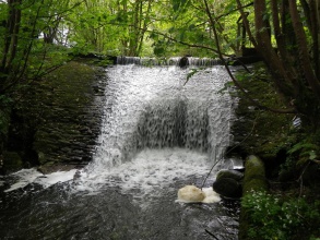
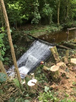
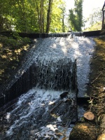
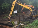
This project aimed to overcome a barrier to migratory fish to allow access to over 10km of habitat. A feasibility and options report led to the selection of removal as a preferred option. Design of the removal option took place in Winter 2015/2016, and the removal process began in August 2016 (completing within one month).
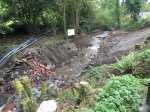
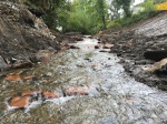
There were significant volumes of sediment that had accumulated behind the weir so the project had a strong element of hydromorphological restoration, as well as enabling fish passage. Any large stone located within the sediment was reused to create rock steps in the new channel, with the remainder being disposed of in line with waste regulations. These also acted as bed checks to guard against upstream incision, although in reality plentiful bedrock outcrops also served this purpose.
A disused sluice gate downstream of the weir site was also removed to ensure effective fish passage.
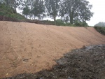
Finally, the left bank of the river channel is relatively steep and a public road is situated at the top of it. In order to stabilise this bank and guard against erosion, mixed seed-impregnated erosion protection matting has been installed.
Monitoring surveys and results
Removal took place relatively recently, and so monitoring has yet to be undertaken. Site visits are planned for early 2017, and in the longer term Galloway Fisheries Trust will carry out electrofishing surveys upstream of the site in order to compare the data with pre-works survey results.
Lessons learnt
It was difficult to identify a cost-effective and reliable method of determining the original bed level beneath significant amount of stored sediment upstream of the weir. The final decision was to remove the sediment in a careful and 'staged' manner, ensuring that hydromorphological expertise was on site to determine the point at which the original bed level was reached. This made it difficult to estimate clear costs of sediment disposal, but estimates proved relatively reliable.
Image gallery
|
Catchment and subcatchment
Site
Project background
Cost for project phases
Reasons for river restoration
Measures
MonitoringHydromorphological quality elements
Biological quality elements
Physico-chemical quality elements
Any other monitoring, e.g. social, economic
Monitoring documents
Additional documents and videos
Additional links and references
Supplementary InformationEdit Supplementary Information
| ||||||||||||||||||||||||||||||||||||||||||||||||||||||||||||||||||||||||||||||||||||||||||||||||||||||||||||||||||||||||||||||||||||||||||||||||||||||||||||||||||||||||||||||||||

