Case study:Burn of Mosset, Forres: Difference between revisions
No edit summary |
No edit summary |
||
| Line 9: | Line 9: | ||
|Themes=Fisheries, Flood risk management, Habitat and biodiversity, Hydromorphology | |Themes=Fisheries, Flood risk management, Habitat and biodiversity, Hydromorphology | ||
|Country=Scotland | |Country=Scotland | ||
|Main contact forename= | |Main contact forename=Barbara | ||
|Main contact surname= | |Main contact surname=Hellett | ||
|Contact organisation=Royal HaskoningDHV | |Contact organisation=Royal HaskoningDHV | ||
|Multi-site=No | |Multi-site=No | ||
Revision as of 14:13, 16 July 2015
Project overview
| Status | Complete |
|---|---|
| Project web site | |
| Themes | Fisheries, Flood risk management, Habitat and biodiversity, Hydromorphology |
| Country | Scotland |
| Main contact forename | Barbara |
| Main contact surname | Hellett |
| Main contact user ID | |
| Contact organisation | Royal HaskoningDHV |
| Contact organisation web site | |
| Partner organisations | |
| Parent multi-site project | |
| This is a parent project encompassing the following projects |
No |
Project summary
The Burn of Mosset is a small gravel bed stream draining an area of 49km2. A Tributary of the River Findhorn, it flows north through the town of Forres before entering Findhorn bay. The town of Forres has a long history of flooding from the burn, with six flood events causing serious damage to property or disruption in the last fifty years.
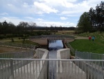
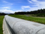
The new Flood Alleviation Scheme (FAS) took two years to complete. It included the construction of an earth-filled embankment dam designed to allow for discharges up to 8.5 m3/s to flow through Forres, with excess floodwater temporarily stored behind the dam.
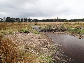
In addition to this, the upstream storage area has been designed to create an extensive natural sediment accretion zone (for sand, gravel and large wood). This will reduce the risk of sediment or other debris blocking the dam control structure. The scheme also aimed to create a mosaic of river and floodplain habitats, by working with natural processes to develop a multi-thread (anabranched) system. This was achieved by breaching the existing embanked channel which ran around a field boundary at two points, allowing flow to spill out across the open field, before re-joining the original channel just upstream of the dam. Tress were planted across the site to create a wet woodland habitat.
Since construction in 2008 the scheme is effectively storing large wood and sediment, with a large sediment outwash fan forming at the upstream breach. A small amount of adaptive management has been required at the upstream breach due to erosional events interacting with woody material in the channel. Measures were taken to ensure that a further breach of the old channel did not occur, as this could have led to flooding of a significant area of agricultural land.
In 2010 the scheme was awarded an "environmentally sustainable construction" commendation by the Institute of Civil Engineers. This project is part of the UK River Restoration Center's manual of river restoration techniques (update due to be published in late 2013).
Monitoring surveys and results
Lessons learnt
Image gallery
|
Catchment and subcatchmentSelect a catchment/subcatchment
Catchment
Subcatchment
Site
Project background
Cost for project phases
Reasons for river restoration
Measures
MonitoringHydromorphological quality elements
Biological quality elements
Physico-chemical quality elements
Any other monitoring, e.g. social, economic
Monitoring documents
Additional documents and videos
Additional links and references
Supplementary InformationEdit Supplementary Information
| ||||||||||||||||||||||||||||||||||||||||||||||||||||||||||||||||||||||||||||||||||||||||||||||||||||||||||||||||||||||||||||||||||||||||||||||||||||||||||||||||||||||||||||||||||||||||||||||||||||||||||||


