Case study:National Park Danube-Auen: Difference between revisions
No edit summary |
No edit summary |
||
| Line 17: | Line 17: | ||
|Partner organisations=via donau | |Partner organisations=via donau | ||
|Multi-site=Yes | |Multi-site=Yes | ||
|Project picture=331 natur lebwa lobau S.jpg | |||
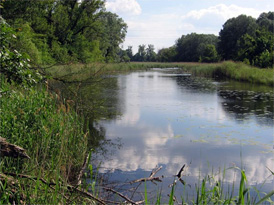
|Project summary=The Danube-Auen National Park lies between the European capitals Vienna and Bratislava. With over 9,300 hectares area, the park protects the last remaining major wetland environment in Central Europe. For a distance of just over 36 km, the Danube flows freely and is the lifeline of the national park. The dynamic rise and fall of water levels - sometimes up to 7 meters - mean that the wetlands landscape is constantly recreated and reformed. In this way, the flow of the Danube creates habitats for a large number of plants and animals. | |||
With the founding of the Donau-Auen National Park in 1996, this area was made an international refuge for posterity. Here, an ecosystem can blossom free of commercial constraints, thus guaranteeing that future generations may also experience first hand its power and beauty. | |||
The Donau-Auen National Park extends from Vienna all the way to the mouth of the March River (also called Morava) on the border to Slovakia. Thirty-eight kilometres long, at its widest point the Danube measures only around 4 km; the wetlands are only found directly on the Danube. To the north of the national park are the broad plains of the Marchfeld. To the south, the boundary is formed by the breakline of the Vienna Basin. The Lobau area has always been a popular recreational area, especially for the Viennese. Running through the national park are both the long-distance rambling trail 07 and the Danube Cycling Path, which comes from Passau and continues to Hungary via Hainburg. | |||
}} | }} | ||
{{Image gallery}} | {{Image gallery}} | ||
Revision as of 12:34, 17 September 2013
This case study is pending approval by a RiverWiki administrator.
Project overview
| Status | Complete |
|---|---|
| Project web site | http://www.donauauen.at/?area=nationalpark&language=english |
| Themes | Habitat and biodiversity, Hydromorphology, Monitoring |
| Country | Austria |
| Main contact forename | Stefan |
| Main contact surname | Schneeweihs |
| Main contact user ID | User:Nationalpark Donau-Auen |
| Contact organisation | Nationalpark Donau-Auen |
| Contact organisation web site | http://http://www.donauauen.at/?area=nationalpark&language=english |
| Partner organisations | via donau |
| This is a parent project encompassing the following projects |
Hainburg River Restoration, Witzelsdorf Pilot Project |
Project summary
The Danube-Auen National Park lies between the European capitals Vienna and Bratislava. With over 9,300 hectares area, the park protects the last remaining major wetland environment in Central Europe. For a distance of just over 36 km, the Danube flows freely and is the lifeline of the national park. The dynamic rise and fall of water levels - sometimes up to 7 meters - mean that the wetlands landscape is constantly recreated and reformed. In this way, the flow of the Danube creates habitats for a large number of plants and animals.
With the founding of the Donau-Auen National Park in 1996, this area was made an international refuge for posterity. Here, an ecosystem can blossom free of commercial constraints, thus guaranteeing that future generations may also experience first hand its power and beauty.
The Donau-Auen National Park extends from Vienna all the way to the mouth of the March River (also called Morava) on the border to Slovakia. Thirty-eight kilometres long, at its widest point the Danube measures only around 4 km; the wetlands are only found directly on the Danube. To the north of the national park are the broad plains of the Marchfeld. To the south, the boundary is formed by the breakline of the Vienna Basin. The Lobau area has always been a popular recreational area, especially for the Viennese. Running through the national park are both the long-distance rambling trail 07 and the Danube Cycling Path, which comes from Passau and continues to Hungary via Hainburg.
Monitoring surveys and results
Lessons learnt
Image gallery
|
Catchment and subcatchmentSelect a catchment/subcatchment
Catchment
Subcatchment
Other case studies in this subcatchment: Conservation of alluvial, Hainburg River Restoration, INTERREG MED WETNET - Memoradum on Participation in Wetland Conservation in Ljubljansko Barje Nature Park, Marsh protection in Egyek–Pusztakócs, Regelsbrunner Aue, Renaturation of Stržen's riverbed on intermittent Cerknica Lake, The Bulgarian Wetlands Restoration and Pollution Reduction Project, Witzelsdorf Pilot Project
Site
Project background
Cost for project phases
Reasons for river restoration
Measures
MonitoringHydromorphological quality elements
Biological quality elements
Physico-chemical quality elements
Any other monitoring, e.g. social, economic
Monitoring documents
Additional documents and videos
Additional links and references
Supplementary InformationEdit Supplementary Information
| ||||||||||||||||||||||||||||||||||||||||||||||||||||||||||||||||||||||||||||||||||||||||||||||||||||||||||||||||||||||||||||||||||||||||||||||||||||||||||||||||||||||||||||||||||||||||||||||||||||||||


