Case study:Inchewan Burn Bed restoration: Difference between revisions
Mattleeson (talk | contribs) No edit summary |
Mattleeson (talk | contribs) No edit summary |
||
| Line 165: | Line 165: | ||
{{Monitoring_documents}} | {{Monitoring_documents}} | ||
{{Monitoring_documents_end}} | {{Monitoring_documents_end}} | ||
{{ | {{Image gallery}} | ||
{{Case study image | |||
|File name=Inchewan Burn.jpg | |||
}} | |||
{{Image_gallery_end}} | {{Image_gallery_end}} | ||
{{Additional_Documents}} | {{Additional_Documents}} | ||
Revision as of 11:07, 9 August 2012
This case study is pending approval by a RiverWiki administrator.
Project overview
| Status | Complete |
|---|---|
| Project web site | http://therrc.co.uk/rrc_case_studies1.php?csid=52 |
| Themes | Hydromorphology |
| Country | Scotland |
| Main contact forename | John |
| Main contact surname | Monteith |
| Main contact user ID | |
| Contact organisation | |
| Contact organisation web site | |
| Partner organisations | |
| Parent multi-site project | |
| This is a parent project encompassing the following projects |
No |
Project summary
Monitoring surveys and results
Lessons learnt
Catchment and subcatchment
Edit the catchment and subcatchment details
(affects all case studies in this subcatchment)
Catchment
| River basin district | Tay |
|---|---|
| River basin | Inchewan |
Subcatchment
| River name | Inchewan Burn |
|---|---|
| Area category | |
| Area (km2) | |
| Maximum altitude category | |
| Maximum altitude (m) | |
| Dominant geology | Siliceous |
| Ecoregion | Great Britain |
| Dominant land cover | Urban, Woodland |
| Waterbody ID |
Site
| Name | Birnam |
|---|---|
| WFD water body codes | |
| WFD (national) typology | |
| WFD water body name | |
| Pre-project morphology | Single channel, Straight, Embanked, Revetments |
| Reference morphology | Step-pool, Pool-riffle, Single channel |
| Desired post project morphology | |
| Heavily modified water body | true |
| National/international site designation | |
| Local/regional site designations | |
| Protected species present | |
| Invasive species present | |
| Species of interest | |
| Dominant hydrology | Quick run-off |
| Dominant substrate | Bedrock |
| River corridor land use | Urban, Woodland |
| Average bankfull channel width category | 2 - 5 m |
| Average bankfull channel width (m) | |
| Average bankfull channel depth category | Less than 0.5 m |
| Average bankfull channel depth (m) | |
| Mean discharge category | |
| Mean annual discharge (m3/s) | |
| Average channel gradient category | |
| Average channel gradient | |
| Average unit stream power (W/m2) |
Project background
| Reach length directly affected (m) | 100 m0.1 km <br />10,000 cm <br /> |
|---|---|
| Project started | 2007/09/01 |
| Works started | |
| Works completed | 2007/11/01 |
| Project completed | |
| Total cost category | 50 - 100 k€ |
| Total cost (k€) | 100 k€100,000 € <br /> |
| Benefit to cost ratio | |
| Funding sources | SEPA, Perth Council, SNH |
Cost for project phases
| Phase | cost category | cost exact (k€) | Lead organisation | Contact forename | Contact surname |
|---|---|---|---|---|---|
| Investigation and design | Perth Council | John | Monteith | ||
| Stakeholder engagement and communication | Perth Council | John | Monteith | ||
| Works and works supervision | Perth Council | ||||
| Post-project management and maintenance | Perth Council | ||||
| Monitoring | Perth Council | John | Monteith |
Reasons for river restoration
Measures
Structural measures
| |
|---|---|
| Bank/bed modifications | Native tree planting, placement of boulders - set in concrete. |
| Floodplain / River corridor | |
| Planform / Channel pattern | |
| Other | |
Non-structural measures
| |
| Management interventions | |
| Social measures (incl. engagement) | |
| Other | |
Monitoring
Hydromorphological quality elements
| Element | When monitored | Type of monitoring | Control site used | Result | ||
|---|---|---|---|---|---|---|
| Before measures | After measures | Qualitative | Quantitative | |||
Biological quality elements
| Element | When monitored | Type of monitoring | Control site used | Result | ||
|---|---|---|---|---|---|---|
| Before measures | After measures | Qualitative | Quantitative | |||
Physico-chemical quality elements
| Element | When monitored | Type of monitoring | Control site used | Result | ||
|---|---|---|---|---|---|---|
| Before measures | After measures | Qualitative | Quantitative | |||
Any other monitoring, e.g. social, economic
| Element | When monitored | Type of monitoring | Control site used | Result | ||
|---|---|---|---|---|---|---|
| Before measures | After measures | Qualitative | Quantitative | |||
Monitoring documents
Image gallery
Additional documents and videos
Additional links and references
| Link | Description |
|---|
Supplementary Information
Edit Supplementary Information
RRC visit notes (2008):
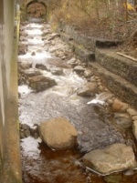
The new bed has enabled free passage to the upper burn and has had a dramatic impact on the visual ‘eyesore’ previously viewed by users of the popular pathway. The construction of a step-pool bedrock and boulder bed has added stability to the channel and now allows a much freer movement of bed sediment.
The concept of needing to anchor the ‘key’ boulders into the engineered bed but burying this structural element under 500mm+ of placed material allowed concerns over structural stability, morphology and aesthetics to be integrated into a common solution.

