Case study:Allt Lorgy River Restoration: Difference between revisions
No edit summary |
No edit summary |
||
| Line 52: | Line 52: | ||
{{Monitoring documents end}} | {{Monitoring documents end}} | ||
{{Image gallery}} | {{Image gallery}} | ||
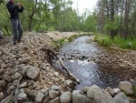
{{Case study image | |||
|File name=Embankment before.jpg | |||
|Caption=Before - artificial embankment | |||
}} | |||
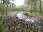
{{Case study image | |||
|File name=003 (800x600).jpg | |||
|Caption=After - lowered embankment | |||
}} | |||
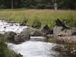
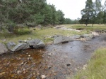
{{Case study image | |||
|File name=AL28 030912.JPG | |||
|Caption=Before - Cross channel boulders | |||
}} | |||
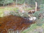
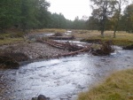
{{Case study image | |||
|File name=008 (800x600).jpg | |||
|Caption=After - Wood Structure | |||
}} | |||
{{Case study image | |||
|File name=AL50 030912.JPG | |||
|Caption=Before - Upstream Left bank bar | |||
}} | |||
{{Case study image | |||
|File name=015 (800x600).jpg | |||
|Caption=After - Upstream left bank bar | |||
}} | |||
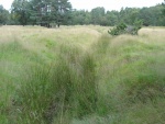
{{Case study image | |||
|File name=AL41 030912.JPG | |||
|Caption=Before - Large floodplain ditch | |||
}} | |||
{{Case study image | |||
|File name=DSC02378 (800x600).jpg | |||
|Caption=After - Floodplain ditch infilled | |||
}} | |||
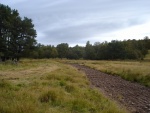
{{Case study image | |||
|File name=Lower embankmnet downstream view.png | |||
|Caption=Downstream view post works | |||
}} | |||
{{Case study image | |||
|File name=Flood lower embankment upstream (2).jpg | |||
|Caption=Downstream view during first flood event | |||
}} | |||
{{Image gallery end}} | {{Image gallery end}} | ||
{{Additional Documents}} | {{Additional Documents}} | ||
Revision as of 17:26, 15 January 2013
This case study is pending approval by a RiverWiki administrator.
Project overview
| Status | In progress |
|---|---|
| Project web site | |
| Themes | Flood risk management, Habitat and biodiversity, Hydromorphology, Monitoring |
| Country | Scotland |
| Main contact forename | Liz |
| Main contact surname | Henderson |
| Main contact user ID | |
| Contact organisation | Spey Catchment Initiative |
| Contact organisation web site | http://speyfisheryboard.com |
| Partner organisations | Spey Fishery Board, Cairngorm National Park Authority, Scottish Natural Heritage, SEPA |
| Parent multi-site project | |
| This is a parent project encompassing the following projects |
No |
Project summary
This project aims to restore the morphology and habitat of a 600m section of moderately high energy river and its floodplain by removing significant artificial constraints (man made embankments and boulders. Over the years these have canalised the water course from a multi braided to a single channel. By kick starting the process the intention is that over time the watercourse will do its own work to re-establish a natural equilibrium. In September 2012, five artificial embankments were lowered by the removal of over 900m3 of material. In stream boulders were removed and replaced with large wood structures. Additional wood structures were introduced in key locations and some of the extracted gravel was graded and stockpiled ready to be used for sediment reintoduction. Culvert pipes were removed from the floodplain and one large drainage ditch was in filled.
Monitoring surveys and results
Lessons learnt
Catchment and subcatchment
Edit the catchment and subcatchment details
(affects all case studies in this subcatchment)
Catchment
| River basin district | Scotland RBD |
|---|---|
| River basin | River Spey |
Subcatchment
| River name | River Avon |
|---|---|
| Area category | 100 - 1000 km² |
| Area (km2) | 545545 km² <br />54,500 ha <br /> |
| Maximum altitude category | 500 - 1000 m |
| Maximum altitude (m) | 700700 m <br />0.7 km <br />70,000 cm <br /> |
| Dominant geology | granite, sedimentary, metamorphosed sedimentary |
| Ecoregion | Great Britain |
| Dominant land cover | Moorland, agriculture, forestry |
| Waterbody ID | 23084 |
Other case studies in this subcatchment: River Avon Our Water Environment
Site
| Name | |
|---|---|
| WFD water body codes | |
| WFD (national) typology | |
| WFD water body name | |
| Pre-project morphology | |
| Reference morphology | |
| Desired post project morphology | |
| Heavily modified water body | |
| National/international site designation | |
| Local/regional site designations | |
| Protected species present | |
| Invasive species present | |
| Species of interest | |
| Dominant hydrology | |
| Dominant substrate | |
| River corridor land use | |
| Average bankfull channel width category | |
| Average bankfull channel width (m) | |
| Average bankfull channel depth category | |
| Average bankfull channel depth (m) | |
| Mean discharge category | |
| Mean annual discharge (m3/s) | |
| Average channel gradient category | |
| Average channel gradient | |
| Average unit stream power (W/m2) |
Project background
| Reach length directly affected (m) | 600600 m <br />0.6 km <br />60,000 cm <br /> |
|---|---|
| Project started | 2012/03/01 |
| Works started | 2012/09/17 |
| Works completed | 2012/09/24 |
| Project completed | |
| Total cost category | 10 - 50 k€ |
| Total cost (k€) | |
| Benefit to cost ratio | |
| Funding sources | SEPA Restoration fund, CNPA |
Cost for project phases
| Phase | cost category | cost exact (k€) | Lead organisation | Contact forename | Contact surname |
|---|---|---|---|---|---|
| Investigation and design | |||||
| Stakeholder engagement and communication | |||||
| Works and works supervision | |||||
| Post-project management and maintenance | |||||
| Monitoring |
Reasons for river restoration
Measures
Structural measures
| |
|---|---|
| Bank/bed modifications | Removal of 900m3 of embankment material. Removal of in stream boulders and replacement with wood structures. Additional strategic wood structures introduced. Graded extracted gravel to be used for sediment reintroduction |
| Floodplain / River corridor | Removal of 3 culvert pipes. Infilling of a large drainage ditch. |
| Planform / Channel pattern | |
| Other | Site fenced to enable natural regeneration to take place. Supplementary planting planned for Spring 2013. Long term site monitoring programmed planned. |
Non-structural measures
| |
| Management interventions | |
| Social measures (incl. engagement) | |
| Other | Demonstration site for natural flood management techniques |
Monitoring
Hydromorphological quality elements
| Element | When monitored | Type of monitoring | Control site used | Result | ||
|---|---|---|---|---|---|---|
| Before measures | After measures | Qualitative | Quantitative | |||
Biological quality elements
| Element | When monitored | Type of monitoring | Control site used | Result | ||
|---|---|---|---|---|---|---|
| Before measures | After measures | Qualitative | Quantitative | |||
Physico-chemical quality elements
| Element | When monitored | Type of monitoring | Control site used | Result | ||
|---|---|---|---|---|---|---|
| Before measures | After measures | Qualitative | Quantitative | |||
Any other monitoring, e.g. social, economic
| Element | When monitored | Type of monitoring | Control site used | Result | ||
|---|---|---|---|---|---|---|
| Before measures | After measures | Qualitative | Quantitative | |||
Monitoring documents
Image gallery
Additional documents and videos
Additional links and references
| Link | Description |
|---|
Supplementary Information
Edit Supplementary Information


