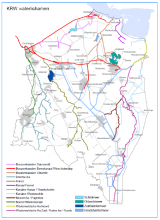
Case study:Gastersche Diep: Difference between revisions
Jump to navigation
Jump to search
Bas Wullems (talk | contribs) No edit summary |
Bas Wullems (talk | contribs) No edit summary |
||
| Line 6: | Line 6: | ||
}} | }} | ||
{{Project overview | {{Project overview | ||
|Status=Complete | |Status=Complete | ||
|Themes=Habitat and biodiversity, Hydromorphology, Monitoring | |Themes=Habitat and biodiversity, Hydromorphology, Monitoring | ||
| Line 14: | Line 13: | ||
|Contact organisation=Waterschap Hunze en Aa's | |Contact organisation=Waterschap Hunze en Aa's | ||
|Contact organisation url=www.hunzeenaas.nl | |Contact organisation url=www.hunzeenaas.nl | ||
|Name of parent multi-site project=Building with nature measures in streams | |||
|Multi-site=No | |Multi-site=No | ||
| | |Project picture=Waterlichamen Hunze en Aas.png | ||
|Project summary=The flow velocity in the stream had become too high, causing bed incision and lower water levels. To stop this effect, almost 100 dead trees and stubs were introduced in the Gastersche Diep, in three 400-metre-long stretches. | |||
|Monitoring surveys and results=Since the introduction of this large quantity of dead wood, water levels have risen between 0.27 and 0.65 m. The stream bed has risen by 0.17 m due to sediment deposition. | |||
|Project title=Gastersche Diep | |||
}} | }} | ||
{{Image gallery}} | {{Image gallery}} | ||
Revision as of 15:24, 18 January 2021
This case study is pending approval by a RiverWiki administrator.
Location: 53° 2' 26.11" N, 6° 38' 29.21" E
Left click to look around in the map, and use the wheel of your mouse to zoom in and out.
Project overview
| Status | Complete |
|---|---|
| Project web site | |
| Themes | Habitat and biodiversity, Hydromorphology, Monitoring |
| Country | Netherlands |
| Main contact forename | Emiel |
| Main contact surname | Galetzka |
| Main contact user ID | |
| Contact organisation | Waterschap Hunze en Aa's |
| Contact organisation web site | http://www.hunzeenaas.nl |
| Partner organisations | |
| Parent multi-site project | |
| This is a parent project encompassing the following projects |
No |
Project summary
Edit project overview to modify the project summary.
The flow velocity in the stream had become too high, causing bed incision and lower water levels. To stop this effect, almost 100 dead trees and stubs were introduced in the Gastersche Diep, in three 400-metre-long stretches.
Monitoring surveys and results
Edit project overview to modify the Monitoring survey and results.
Since the introduction of this large quantity of dead wood, water levels have risen between 0.27 and 0.65 m. The stream bed has risen by 0.17 m due to sediment deposition.
Lessons learnt
This case study hasn’t got any lessons learnt, you can add some by editing the project overview.
Image gallery
|
Catchment and subcatchment
Site
Project background
Cost for project phases
Reasons for river restoration
Measures
MonitoringHydromorphological quality elements
Biological quality elements
Physico-chemical quality elements
Any other monitoring, e.g. social, economic
Monitoring documents
Additional documents and videos
Additional links and references
Supplementary InformationEdit Supplementary Information
| ||||||||||||||||||||||||||||||||||||||||||||||||||||||||||||||||||||||||||||||||||||||||||||||||||||||||||||||||||||||||||||||||||||||||||||||||||||||||||||||||||||||||||||||||||

