Case study:VALAGUA (Valorização ambiental e gestão integrada da água e dos habitats no Baixo Guadiana transfronteiriço): Difference between revisions
No edit summary |
No edit summary |
||
| (7 intermediate revisions by the same user not shown) | |||
| Line 16: | Line 16: | ||
|Partner organisations=DPH - Diputación Provincial de Huelva ODIANA - Associação para o Desenvolvimento do Baixo Guadiana UHU - Universidad de Huelva UALG - Universidade do Algarve J A/CMAOT - Junta de Andalucía / Consejería de Medio Ambiente y Ordenación del Territorio ICNF - Instituto da Conservação da Natureza e das Florestas, I.P. APA - Agência Portuguesa do Ambiente, I.P. | |Partner organisations=DPH - Diputación Provincial de Huelva ODIANA - Associação para o Desenvolvimento do Baixo Guadiana UHU - Universidad de Huelva UALG - Universidade do Algarve J A/CMAOT - Junta de Andalucía / Consejería de Medio Ambiente y Ordenación del Territorio ICNF - Instituto da Conservação da Natureza e das Florestas, I.P. APA - Agência Portuguesa do Ambiente, I.P. | ||
|Multi-site=No | |Multi-site=No | ||
|Project picture= | |Project picture=Schermata 2019-10-28 alle 12.42.37.png | ||
|Picture description= | |Picture description=Valagua project | ||
|Project summary=The Guadiana basin is one of the three major river basins shared between Portugal and Spain and the one that currently has more problems both in quantity and water quality. This is partly justified by the marked seasonality of precipitation, a strong inter-annual irregularity, and the predominance of drier weather conditions. This scarcity justified a strong regularization and use of available resources, which, however, created more pressure on the river systems due to increasing demand. In the current context of climate change, this picture tends to worsen, with the main scenarios pointing to a significant reduction in water availability. | |Project summary=The Guadiana basin is one of the three major river basins shared between Portugal and Spain and the one that currently has more problems both in quantity and water quality. This is partly justified by the marked seasonality of precipitation, a strong inter-annual irregularity, and the predominance of drier weather conditions. This scarcity justified a strong regularization and use of available resources, which, however, created more pressure on the river systems due to increasing demand. In the current context of climate change, this picture tends to worsen, with the main scenarios pointing to a significant reduction in water availability. | ||
In the southernmost part of the basin, where the river is bordered by the two countries, high climate vulnerability ineracts with significant water uses (irrigation, coastal tourism, urban supply), degradation problems and poor water quality, as well as important ecological and natural values classified by the Natura 2000 Network and representing transboundary spaces of great environmental value in the Iberian Peninsula. | In the southernmost part of the basin, where the river is bordered by the two countries, high climate vulnerability ineracts with significant water uses (irrigation, coastal tourism, urban supply), degradation problems and poor water quality, as well as important ecological and natural values classified by the Natura 2000 Network and representing transboundary spaces of great environmental value in the Iberian Peninsula. | ||
| Line 28: | Line 28: | ||
}} | }} | ||
{{Image gallery}} | {{Image gallery}} | ||
{{Case study image | |||
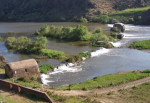
|File name=Gua1.png | |||
|Caption=Guadiana river | |||
}} | |||
{{Case study image | {{Case study image | ||
|File name=Gua4.png | |File name=Gua4.png | ||
| Line 47: | Line 51: | ||
}} | }} | ||
{{Site | {{Site | ||
|Name=Guadiana | |Name=Low Guadiana basin | ||
|Heavily modified water body=No | |Heavily modified water body=No | ||
|Protected species present= | |Protected species present=Yes | ||
|Invasive species present=No | |Invasive species present=No | ||
}} | }} | ||
| Line 55: | Line 59: | ||
|Project started=2015/01/01 | |Project started=2015/01/01 | ||
|Project completed=2019/09/30 | |Project completed=2019/09/30 | ||
|Total1 cost= | |Total cost category=1000 - 5000 k€ | ||
|Total1 cost=1,008.556 | |||
|Funding sources=INTERREG/POCTEP – ERDF: 756.417,09 € | |Funding sources=INTERREG/POCTEP – ERDF: 756.417,09 € | ||
}} | }} | ||
{{Motivations}} | {{Motivations | ||
|Specific mitigation=Riparian development, | |||
|Other motivation=raise awarenes | |||
}} | |||
{{Measures | {{Measures | ||
|Floodplain / River corridor=Implementation of functional and demonstrative actions for ecological restoration of riverine and riverine habitats | |Floodplain / River corridor=Implementation of functional and demonstrative actions for ecological restoration of riverine and riverine habitats | ||
Latest revision as of 15:37, 12 December 2019
This case study is pending approval by a RiverWiki administrator.
Project overview
| Status | In progress |
|---|---|
| Project web site | http://www.valagua.com/projeto |
| Themes | Economic aspects, Environmental flows and water resources, Habitat and biodiversity, Water quality |
| Country | Portugal |
| Main contact forename | Maria |
| Main contact surname | Bastidas |
| Main contact user ID | |
| Contact organisation | ADPM - Associação de Defesa do Património de Mértola |
| Contact organisation web site | http://www.adpm.pt/ |
| Partner organisations | DPH - Diputación Provincial de Huelva ODIANA - Associação para o Desenvolvimento do Baixo Guadiana UHU - Universidad de Huelva UALG - Universidade do Algarve J A/CMAOT - Junta de Andalucía / Consejería de Medio Ambiente y Ordenación del Territorio ICNF - Instituto da Conservação da Natureza e das Florestas, I.P. APA - Agência Portuguesa do Ambiente, I.P. |
| Parent multi-site project | |
| This is a parent project encompassing the following projects |
No |
Project summary
The Guadiana basin is one of the three major river basins shared between Portugal and Spain and the one that currently has more problems both in quantity and water quality. This is partly justified by the marked seasonality of precipitation, a strong inter-annual irregularity, and the predominance of drier weather conditions. This scarcity justified a strong regularization and use of available resources, which, however, created more pressure on the river systems due to increasing demand. In the current context of climate change, this picture tends to worsen, with the main scenarios pointing to a significant reduction in water availability.
In the southernmost part of the basin, where the river is bordered by the two countries, high climate vulnerability ineracts with significant water uses (irrigation, coastal tourism, urban supply), degradation problems and poor water quality, as well as important ecological and natural values classified by the Natura 2000 Network and representing transboundary spaces of great environmental value in the Iberian Peninsula.
The Valagua project addresses these issues, in a cooperation effort of Portugal and Spain, with the main goal of fostering research, knowledge, exchange and harmonization of information, as well as the implementation of good water and associated habitat management practices. The project main actions are:
• Production of knowledge on water quantity and quality, water use to safeguard habitats, and resolution of associated use conflicts.
• Implementation of functional and demonstrative actions for ecological restoration of riverine and riverine habitats, and awarenes raising in specific target groups to promote sustainable solutions.
• Creation of new ecotourism products, specific enhancement interventions, tour operators training and exchange of experiences.
• Development of integrated proposals for transboundary water and biodiversity management and their dissemination to policy makers, managers and other stakeholders.
Monitoring surveys and results
Lessons learnt
Image gallery
|
Catchment and subcatchmentSelect a catchment/subcatchment
Catchment
Subcatchment
Other case studies in this subcatchment: LIFE Saramugo, River restoration in the irrigation area Lobón (Badajoz)
Site
Project background
Cost for project phases
Reasons for river restoration
Measures
MonitoringHydromorphological quality elements
Biological quality elements
Physico-chemical quality elements
Any other monitoring, e.g. social, economic
Monitoring documents
Additional documents and videos
Additional links and references
Supplementary InformationEdit Supplementary Information
| ||||||||||||||||||||||||||||||||||||||||||||||||||||||||||||||||||||||||||||||||||||||||||||||||||||||||||||||||||||||||||||||||||||||||||||||||||||||||||||||||||||||||||||||||||||||||||||||||||||||||


