Case study:Nant Barrog: Difference between revisions
No edit summary |
No edit summary |
||
| (3 intermediate revisions by the same user not shown) | |||
| Line 1: | Line 1: | ||
{{Case study status | {{Case study status | ||
|Approval status= | |Approval status=Approved | ||
}} | }} | ||
{{Location | {{Location | ||
| Line 35: | Line 35: | ||
|Invasive species present=No | |Invasive species present=No | ||
}} | }} | ||
{{Project background}} | {{Project background | ||
{{Motivations}} | |Project started=2017 | ||
{{Measures}} | |Funding sources=Rural Development Plan Sustainable Management Scheme | ||
}} | |||
{{Motivations | |||
|Specific mitigation=Flood risk management, | |||
}} | |||
{{Measures | |||
|Other technical measure=Runoff pathway management, | |||
}} | |||
{{Hydromorphological quality elements header}} | {{Hydromorphological quality elements header}} | ||
{{End table}} | {{End table}} | ||
Latest revision as of 12:44, 8 November 2018
Project overview
| Status | In progress |
|---|---|
| Project web site | http://www.therrc.co.uk/sites/default/files/projects/41_nantbarrog.pdf |
| Themes | Flood risk management, Habitat and biodiversity, Land use management - agriculture, Land use management - forestry, Water quality |
| Country | Wales |
| Main contact forename | Jacques |
| Main contact surname | Sisson |
| Main contact user ID | |
| Contact organisation | Natural Resources Wales |
| Contact organisation web site | http://naturalresources.wales/?lang=en |
| Partner organisations | Coed Cymru, Bangor University, Woodland Trust |
| Parent multi-site project | |
| This is a parent project encompassing the following projects |
No |
Project summary
In 2012, the city of St Asaph – located on a downstream reach of the Afon Elwy (Map 1) – suffered severe flooding which resulted in a fatality. Natural Resources Wales began an investigation into how traditional hard engineered approaches, such as those proposed for the St Asaph flood alleviation scheme, could be supported by Working with Natural Processes (WWNP) measures. The investigation also looked at how these measures could have multiple ecosystem benefits.
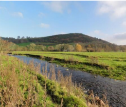
Llanfair Talhaiarn is a small village in the Elwy catchment, located at the confluence of Nant Barrog with the main river Elwy. The Nant Barrog is conveyed beneath the main street to the Elwy through the Water Street culvert. In periods of high rainfall the culvert is overwhelmed, resulting in flooding of properties in the village. Natural Resources Wales is reviewing the refurbishment of the culvert.
WWNP measures recommended for the Barrog in the Elwy Natural Flood Risk Management and Ecosystem Services Study (2015) were further reviewed at the subcatchment scale. WWNP measures for the Nant Barrog catchment were recommended in the Llanfair Talhaiarn Natural Flood Management Study (2015). A revision of the shortlisted options was further reviewed as part of the Llanfair Talhaiarn project appraisal report (2016) and the cost benefits of the different options were considered. The resulting recommended WWNP measures are listed in Table 1..
Coed Cymru, in partnership with Natural Resources Wales, the Woodland Trust and other organisations, will submit a bid in 2017 to the Welsh Government Rural Development Plan Sustainable Management Scheme for funding to implement the measures recommended in the Llanfair Talhaiarn report.
The Water Street culvert has an inlet capacity of 4.2m3s-1. Flooding will occur at a return period of a 1 in 50 year event with a peak flow of 4.8m3s-1. Modelling of 4 WWNP packages showed that, when considered separately, sufficient reductions would occur during the 1 in 50 year event for flow to remain within the channel at the culvert.
Monitoring surveys and results
Lessons learnt
Image gallery
|
Catchment and subcatchment
Site
Project background
Cost for project phases
Reasons for river restoration
Measures
MonitoringHydromorphological quality elements
Biological quality elements
Physico-chemical quality elements
Any other monitoring, e.g. social, economic
Monitoring documents
Additional documents and videos
Additional links and references
Supplementary InformationEdit Supplementary Information
| ||||||||||||||||||||||||||||||||||||||||||||||||||||||||||||||||||||||||||||||||||||||||||||||||||||||||||||||||||||||||||||||||||||||||||||||||||||||||||||||||||||||||||||||||||

