Case study:Reopening of the culverted Redon river: Difference between revisions
No edit summary |
No edit summary |
||
| (7 intermediate revisions by 2 users not shown) | |||
| Line 1: | Line 1: | ||
{{Case study status | {{Case study status | ||
|Approval status= | |Approval status=Approved | ||
}} | }} | ||
{{Location | {{Location | ||
| Line 123: | Line 123: | ||
|Funding sources=Agence de l’eau (Water Agency) (31%), General Council (28%), Regional Council (10%), Symasol (31%). | |Funding sources=Agence de l’eau (Water Agency) (31%), General Council (28%), Regional Council (10%), Symasol (31%). | ||
}} | }} | ||
{{Motivations}} | {{Motivations | ||
{{Measures}} | |Hydromorphological quality elements=Continuity for organisms, | ||
|Biological quality elements=Fish: Abundance, | |||
}} | |||
{{Measures | |||
|Bank and bed modifications measure=Reopening of culverted river, Bank stabilisation, Planting, | |||
|Planform / Channel pattern=Meandering channel, | |||
}} | |||
{{Hydromorphological quality elements header}} | {{Hydromorphological quality elements header}} | ||
{{End table}} | {{End table}} | ||
| Line 138: | Line 144: | ||
{{Additional Documents end}} | {{Additional Documents end}} | ||
{{Additional links and references header}} | {{Additional links and references header}} | ||
{{Additional links and references | |||
|Link=www.onema.fr/sites/default/files/EN/EV/publication/rex_RedonGB.pdf | |||
|Description=All information on this page is copied from the AFB, The French Agency for biodiversity | |||
}} | |||
{{Additional links and references footer}} | {{Additional links and references footer}} | ||
{{Supplementary Information}} | {{Supplementary Information}} | ||
{{Toggle content end}} | {{Toggle content end}} | ||
Latest revision as of 16:41, 2 January 2019
Project overview
| Status | Complete |
|---|---|
| Project web site | |
| Themes | Environmental flows and water resources, Habitat and biodiversity |
| Country | France |
| Main contact forename | Maxime |
| Main contact surname | Chateauvieux |
| Main contact user ID | |
| Contact organisation | Symasol |
| Contact organisation web site | http://www.symasol.fr/ |
| Partner organisations | Symasol, departmental environmental and agriculture division, the French National Agency for Water and Aquatic Environments (Office National de L’Eau et des Milieux Aquatiques), Fédération départementale de la pêche (departmental fishing federation), local fishing association, the commune. |
| Parent multi-site project | |
| This is a parent project encompassing the following projects |
No |
Project summary
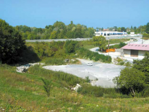
1.5 km from its outlet, the
Redon had been culverted for the purposes of a quarry.
The passage of the river through a concrete culvert
covering a 230 metre stretch prevents many of the fish
from the lake from swimming upstream, to an ideal
breeding ground. The quarry where the culvert is located is no
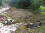
longer active, therefore 230 metres of the culverted river were reopened. In
order to diversify the environment, a meandering
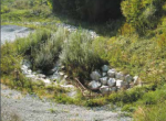
bed was created. Plantation was used to protect the
banks and the longitudinal section was stabilised
Monitoring surveys and results
Pre-restoration works monitoring have been carried
out. It includes a topographic survey for a hydraulic
analysis of the site. Furthermore, fish rescue by electric
fishing was performed at the opening of the culvert.
Fish stocks were monitored following the culvert removal on the Redon, six months after the restoration work. As part of the appraisal of the “Crossborder river contractforthe southwest part of Lake Geneva” (2006-2012), fish stocks were monitored in all the watercourses in the area covered by the SYMASOL. For this, the fish population was counted in the Redon at the location of the work site in the summer of 2011, four years after the restoration work.
An IBGN survey was conducted in 2009 (two years after the work) by a consultancy.
Lake trout can now swim up the whole length of the Redon.
Six months after the works, about 230 river trout were recorded throughout the reopened stretch, i.e. 3,800 individuals per hectare against only fifteen or so individuals identified during the fish rescue operation.
The results of the 2011 electric fishing confirm the trend noted six months after work was completed. Thus, 48 trout were counted on the upstream station, i.e. 3,678 individuals per hectare.
These results are very positive and seem to indicate that the fish population is stabilising in the part of the watercourse where the culvert has been removed.
The IBGN analysis suggests that the quality of water is restrictive in this portion of the Redon. The taxon indicator (Hydropsychidae) is relatively tolerant to poor water quality and taxonomic diversity is quite low (18 taxons identified). However, the absence of a sampling point before the restoration work does not allow the observation of a potential gain in terms of water quality or habitat diversity due to removal of the culvert.
The outcome in terms of overall assessment is excellent from the point of view of elected officials, residents and fishing stakeholders.
Pursuant to the River Contract (2006-2012), a general policy to review weirs preventing river continuity was implemented. Rocky boulders or bypasses were set up to make weirs passable.
Lessons learnt
Image gallery
|
Catchment and subcatchment
Site
Project background
Cost for project phases
Reasons for river restoration
Measures
MonitoringHydromorphological quality elements
Biological quality elements
Physico-chemical quality elements
Any other monitoring, e.g. social, economic
Monitoring documents
Additional documents and videos
Additional links and references
Supplementary InformationEdit Supplementary Information
| ||||||||||||||||||||||||||||||||||||||||||||||||||||||||||||||||||||||||||||||||||||||||||||||||||||||||||||||||||||||||||||||||||||||||||||||||||||||||||||||||||||||||||||||||||||


