Case study:River Cleddau: Difference between revisions
No edit summary |
No edit summary |
||
| (One intermediate revision by the same user not shown) | |||
| Line 72: | Line 72: | ||
|Total cost category=10 - 50 k€ | |Total cost category=10 - 50 k€ | ||
|Total1 cost=29 | |Total1 cost=29 | ||
|Funding sources= | |Funding sources=Environment Agency Wales | ||
}} | }} | ||
{{Motivations | {{Motivations | ||
| Line 80: | Line 80: | ||
}} | }} | ||
{{Measures | {{Measures | ||
|Bank and bed modifications measure= | |Bank and bed modifications measure=New bioengineering elements in order to stabilize slope banks, Bank reprofiling, | ||
|Floodplain / River corridor=Fencing | |Floodplain / River corridor=Fencing | ||
|Management interventions=Fencing, | |Management interventions=Fencing, | ||
Latest revision as of 16:02, 2 January 2019
Project overview
| Status | Complete |
|---|---|
| Project web site | |
| Themes | Fisheries, Habitat and biodiversity |
| Country | Wales |
| Main contact forename | Richard |
| Main contact surname | Edwards |
| Main contact user ID | |
| Contact organisation | Salix River & Wetland Services Limited |
| Contact organisation web site | |
| Partner organisations | Natural Resources Wales |
| Parent multi-site project | |
| This is a parent project encompassing the following projects |
No |
Project summary
The River Cleddau in South West Wales is a mobile gravel bed river of moderate to high energy and an important spawning tributary for migratory fish. The project undertaken in 2004 aimed to demonstrate the effectiveness of soft engineering techniques in managing extensive erosion problems, whilst still encouraging natural river processes to continue. The demonstration reach in particular had a history of instability and planform adjustment.
An initial geomorphological survey and detailed design plan were carried out by Salix for the Environment Agency Wales and Pembrokeshire Rivers Trust. The initial survey concluded that overgrazing and poaching were accelerating erosion in the demonstration reach.
Hard engineering techniques, such as blockstone revetments, have been traditionally used in higher energy river systems to control bank erosion. However, the use of such techniques removes any scope for marginal vegetation to establish, thus lowering the ecological value of the river. It can also deflect energy to other areas of the bed or bank, maintaining the overall erosion problem.
As part of a three-year project, entitled “Fishing Wales” the Environment Agency Wales were keen to demonstrate that softer bioengineering methods could be used to control the extensive erosion, whilst maintaining geomorphological processes, and enhancing the physical habitat of the river. The aim of the demonstration was to show that bioengineering techniques can be used as an alternative to blockstone in mobile gravel bed rivers to control erosion, whilst restoring physical habitat to degraded channels, thus helping to ensure the sustainability of fish stocks in Wales.
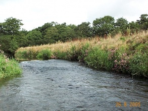
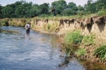
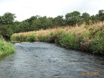
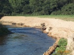
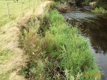
A range of bioengineering techniques were used based on the local reach scale erosion process, water depth and stream power. In areas with low stream power these included bank grading and toe protection using live willow bundles (faggots/fascines), whilst in areas with greater erosive energy whole upturned tree roots with 2 metres of trunk still attached were installed to act as physical revetments and also deflect flow away from eroding banks (40 tree roots used in total). All the trees used were grey willow (Salix cinerea) or crack willow (Salix fragilis) and have since grown to provide excellent habitat and cover. In addition the entire reach was fenced in order to keep livestock off the banks. Living plant material was obtained from the Cleddau catchments.
The project has been successful in demonstrating soft bio-engineering methods. The Pembrokeshire Rivers Trust and Salix report that 80-90% of planted material has survived, with a mix of other vegetation also colonising the site. Salix have since identified some issues with Himalayan balsam competing with native planting, but this has been acknowledged as a catchment wide problem (see evidence in photos).
The River Restoration Centre would like to thank Salix River & Wetland Services Ltd for providing the content and photographs for this case study.
Monitoring surveys and results
Lessons learnt
Image gallery
|
Catchment and subcatchmentSelect a catchment/subcatchment
Catchment
Subcatchment
Site
Project background
Cost for project phases
Reasons for river restoration
Measures
MonitoringHydromorphological quality elements
Biological quality elements
Physico-chemical quality elements
Any other monitoring, e.g. social, economic
Monitoring documents
Additional documents and videos
Additional links and references
Supplementary InformationEdit Supplementary Information
| ||||||||||||||||||||||||||||||||||||||||||||||||||||||||||||||||||||||||||||||||||||||||||||||||||||||||||||||||||||||||||||||||||||||||||||||||||||||||||||||||||||||||||||||||||||||||||||||||

