Case study:Guadiato Life project Model for restoring and integrating water resources in a mining area, actions for an alternative development: Difference between revisions
No edit summary |
m (Ascarr moved page Case study:Guadiato Life project: model for restoring and integrating water resources in a mining area; actions for an alternative development. to [[Case study:Guadiato Life project Model for restoring and integrating water resour...) |
||
| (3 intermediate revisions by 2 users not shown) | |||
| Line 200: | Line 200: | ||
|Floodplain / River corridor=Reforestation and restoration of watercourses, Restoring riparian vegetation, | |Floodplain / River corridor=Reforestation and restoration of watercourses, Restoring riparian vegetation, | ||
|Other technical measure=Install a "green filter" to treat waste water | |Other technical measure=Install a "green filter" to treat waste water | ||
|Social measures=Improve forest management and agricultural, | |Social measures=Improve forest management and agricultural, Community Education, | ||
|Wider stakeholder / citizen engagement=Agenda 21 | |Wider stakeholder / citizen engagement=Agenda 21 | ||
}} | }} | ||
Latest revision as of 12:21, 21 March 2018
Project overview
| Status | Complete |
|---|---|
| Project web site | |
| Themes | Economic aspects, Habitat and biodiversity, Hydromorphology, Social benefits |
| Country | Spain |
| Main contact forename | José Luis |
| Main contact surname | Mora Castaño |
| Main contact user ID | |
| Contact organisation | Mancomunidad de Municipios Valle del Guadiato |
| Contact organisation web site | |
| Partner organisations | |
| Parent multi-site project | |
| This is a parent project encompassing the following projects |
No |
Project summary
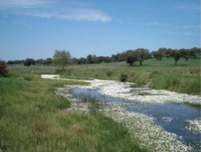
The project sought to counterbalance the adverse impacts being inflicted on the river Guadiato’s environment. It had the following objectives: 1. To foster alternative, environmentally-friendly, economic activities in the district. 2. To demonstrate suitable techniques for preventing erosion. 3. To initiate a restoration process for the banks of the River Guadiato, which were highly degraded in some areas and almost without vegetation in others. 4. To raise the community’s awareness of the need to improve the river’s environment, and to encourage participation in its revival. 5. To encourage the population to enjoy using the river. 6. To create jobs and discourage emigration from rural areas. 7. To contribute to the protection and conservation of fauna and flora inhabiting the riverbanks.
This project counts with the support of local, regional, national and European institutions. The total budget for carry out the rehabilitation is 1.438.852'96 € and the financing comes from the LIFE initiative 587,287€ and the Consejería of Environment, Andalucía.
Work included educating the community on environmental protection and promoting environmentally-friendly behaviour.
Monitoring surveys and results
Lessons learnt
Image gallery
|
Catchment and subcatchmentSelect a catchment/subcatchment
Catchment
Subcatchment
Site
Project background
Cost for project phases
Reasons for river restoration
Measures
MonitoringHydromorphological quality elements
Biological quality elements
Physico-chemical quality elements
Any other monitoring, e.g. social, economic
Monitoring documents
Additional documents and videos
Additional links and references
Supplementary InformationEdit Supplementary Information
| ||||||||||||||||||||||||||||||||||||||||||||||||||||||||||||||||||||||||||||||||||||||||||||||||||||||||||||||||||||||||||||||||||||||||||||||||||||||||||||||||||||||||||||||||||||||||||||||||||||||||


