Case study:Restoration of the River Paasonjoki: Difference between revisions
(Created page with "{{Case study status |Approval status=Draft }} {{Location}} {{Project overview |Project title=Restoration of the River Paasonjoki |Status=Complete |Country=Finland |Main contac...") |
No edit summary |
||
| (9 intermediate revisions by the same user not shown) | |||
| Line 1: | Line 1: | ||
{{Case study status | {{Case study status | ||
|Approval status= | |Approval status=Approved | ||
}} | |||
{{Location | |||
|Location=66.09574709344108, 27.3759126663208 | |||
}} | }} | ||
{{Project overview | {{Project overview | ||
|Status=Complete | |Status=Complete | ||
|Themes=Fisheries, Habitat and biodiversity, Hydromorphology | |||
|Country=Finland | |Country=Finland | ||
|Main contact forename=Jarmo | |Main contact forename=Jarmo | ||
| Line 12: | Line 14: | ||
|Contact organisation=Centre for Economic Development, Transport and the Environment for Lapland | |Contact organisation=Centre for Economic Development, Transport and the Environment for Lapland | ||
|Multi-site=No | |Multi-site=No | ||
|Project picture=Paasonjoki After.JPG | |||
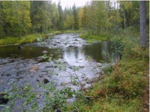
|Picture description=The River Paasonjoki after the restoration (photo J. Huhtala) | |||
|Project summary=The River Paasonjoki is 4 930 meters long and it flows though forest areas from the Lake Paasonjärvi to the Lake Yli-Soppanajärvi. The catchment area is 97,92 km2. | |||
The river bed is mainly sand and contains rocks and gravel. A big part of the river is marked as nature conservation area. The water quality in the river is good or very good. | |||
The Centre for Economic Development, Transport and the Environment for Lapland restored four sections in the River. | |||
The restoration was made to improve the living conditions of the fish and other species. Rocks and gravel was placed to the river to make rapid areas more suitable for the trouts to reproduce. The aim of the retoration was to improve the living conditions of migratory fish and to make the river more nature-like and closer to its natural state. | |||
Trouts, grayling and macro invertebrates will benefit from the restoration and not only in the river but also in the nearby lakes. The rivers in the area are straightened for log floating since 1900 century. Also the natural state in the rivers are altered because of intense forestry and bog drainage. | |||
The restoration plan was accepted 4.3.2011 and the work started immediately. The plan was restore six rivers in the area. The area is highly appreciated among the fly fishers and its very popular recreational area. | |||
The restoration plan aimed to slow down the current and produce suitable nesting habitats for the trouts and shelter places for the juveniles. Also versatility to the river bed was improved by digging few wider areas. Gravel was brought approximately 40 m3 and placed to the river in several places bed to ensure the nesting habitats for the migratory fish. Before the restoration many stones were taken away from from the river and places a side of the river. All the stones that were piled up next to the river were used in the restoration work. | |||
Also in the section three, the channel curve was altered in few places so that the erosion that occured in the channel would be protected from further erosion. Also in the section four the river was made more curvy to reduce the erosion in the channel and to protect the sand from accumulating to the river bed. | |||
The lenght of the first restored area is 430 meters and the width is 4,3 in average. The restored rapid area in the totally was 1900 m2. The Second was 540 meters long, width 6 meters and the area in total was 3 240 m2. The thirds section was 300 meters, width 6 meters and the area was 1 800 m2. The last section was 570 meters long, width 8 meters and the total area reached up to 4 560 m2. The elevations difference in the restored area was 18 meters. | |||
}} | }} | ||
{{Image gallery}} | {{Image gallery}} | ||
{{Case study image | |||
|File name=Paasonjoki before.JPG | |||
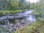
|Caption=The River Paasonjoki before the restoration (Photo Huhtala) | |||
}} | |||
{{Image gallery end}} | {{Image gallery end}} | ||
{{Toggle button}} | {{Toggle button}} | ||
{{Toggle content start}} | {{Toggle content start}} | ||
{{Case study subcatchment}} | {{Case study subcatchment}} | ||
{{Site}} | {{Site | ||
|Heavily modified water body=No | |||
|Protected species present=Yes | |||
|Invasive species present=Yes | |||
|Species=Brown trout (Salmo trutta), Brook trout, grayling (Thymallus thymallus), | |||
|Average bankfull channel width category=5 - 10 m | |||
}} | |||
{{Project background}} | {{Project background}} | ||
{{Motivations}} | {{Motivations | ||
|Hydromorphological quality elements=Channel pattern/planform, Width & depth variation, Flow velocities, | |||
|Biological quality elements=Fish, Invertebrates, | |||
}} | |||
{{Measures}} | {{Measures}} | ||
{{Hydromorphological quality elements header}} | {{Hydromorphological quality elements header}} | ||
Latest revision as of 10:42, 19 December 2013
Project overview
| Status | Complete |
|---|---|
| Project web site | |
| Themes | Fisheries, Habitat and biodiversity, Hydromorphology |
| Country | Finland |
| Main contact forename | Jarmo |
| Main contact surname | Huhtala |
| Main contact user ID | User:Kasvio |
| Contact organisation | Centre for Economic Development, Transport and the Environment for Lapland |
| Contact organisation web site | |
| Partner organisations | |
| Parent multi-site project | |
| This is a parent project encompassing the following projects |
No |
Project summary
The River Paasonjoki is 4 930 meters long and it flows though forest areas from the Lake Paasonjärvi to the Lake Yli-Soppanajärvi. The catchment area is 97,92 km2.
The river bed is mainly sand and contains rocks and gravel. A big part of the river is marked as nature conservation area. The water quality in the river is good or very good.
The Centre for Economic Development, Transport and the Environment for Lapland restored four sections in the River. The restoration was made to improve the living conditions of the fish and other species. Rocks and gravel was placed to the river to make rapid areas more suitable for the trouts to reproduce. The aim of the retoration was to improve the living conditions of migratory fish and to make the river more nature-like and closer to its natural state. Trouts, grayling and macro invertebrates will benefit from the restoration and not only in the river but also in the nearby lakes. The rivers in the area are straightened for log floating since 1900 century. Also the natural state in the rivers are altered because of intense forestry and bog drainage.
The restoration plan was accepted 4.3.2011 and the work started immediately. The plan was restore six rivers in the area. The area is highly appreciated among the fly fishers and its very popular recreational area.
The restoration plan aimed to slow down the current and produce suitable nesting habitats for the trouts and shelter places for the juveniles. Also versatility to the river bed was improved by digging few wider areas. Gravel was brought approximately 40 m3 and placed to the river in several places bed to ensure the nesting habitats for the migratory fish. Before the restoration many stones were taken away from from the river and places a side of the river. All the stones that were piled up next to the river were used in the restoration work.
Also in the section three, the channel curve was altered in few places so that the erosion that occured in the channel would be protected from further erosion. Also in the section four the river was made more curvy to reduce the erosion in the channel and to protect the sand from accumulating to the river bed.
The lenght of the first restored area is 430 meters and the width is 4,3 in average. The restored rapid area in the totally was 1900 m2. The Second was 540 meters long, width 6 meters and the area in total was 3 240 m2. The thirds section was 300 meters, width 6 meters and the area was 1 800 m2. The last section was 570 meters long, width 8 meters and the total area reached up to 4 560 m2. The elevations difference in the restored area was 18 meters.
Monitoring surveys and results
Lessons learnt
Image gallery
|
Catchment and subcatchment
Site
Project background
Cost for project phases
Reasons for river restoration
Measures
MonitoringHydromorphological quality elements
Biological quality elements
Physico-chemical quality elements
Any other monitoring, e.g. social, economic
Monitoring documents
Additional documents and videos
Additional links and references
Supplementary InformationEdit Supplementary Information
| ||||||||||||||||||||||||||||||||||||||||||||||||||||||||||||||||||||||||||||||||||||||||||||||||||||||||||||||||||||||||||||||||||||||||||||||||||||||||||||||||||||||||||||||||||


