Case study:River Ogwen and Nant Francon: Difference between revisions
No edit summary |
Hazel Wilson (talk | contribs) No edit summary |
||
| Line 40: | Line 40: | ||
|Name=River Ogwen | |Name=River Ogwen | ||
|WFD water body code=GB110065054160 | |WFD water body code=GB110065054160 | ||
|WFD water body name=Ogwen - upper | |||
|Pre-project morphology=Over deepened | |Pre-project morphology=Over deepened | ||
|Reference morphology=Pool-riffle | |Reference morphology=Pool-riffle | ||
| Line 46: | Line 47: | ||
|Invasive species present=No | |Invasive species present=No | ||
|Species=Salmonids | |Species=Salmonids | ||
|Dominant substrate=Gravel, | |Dominant substrate=Gravel, | ||
|River corridor land use=Agricultural (Livestock) | |River corridor land use=Agricultural (Livestock) | ||
}} | }} | ||
Latest revision as of 15:14, 23 October 2015
Project overview
| Status | Complete |
|---|---|
| Project web site | |
| Themes | Fisheries, Flood risk management, Land use management - agriculture |
| Country | Wales |
| Main contact forename | Hugh |
| Main contact surname | Jones |
| Main contact user ID | |
| Contact organisation | Natural Resources Wales |
| Contact organisation web site | http://naturalresourceswales.gov.uk/ |
| Partner organisations | National Trust, Environment Agency |
| Parent multi-site project | |
| This is a parent project encompassing the following projects |
No |
Project summary
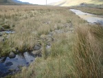
The Ogwen is in a mountainous location of Snowdonia below Llyn Ogwen (Lake Ogwen), and flows northwards through the Nant Ffrancon valley.
During the 1960s the river was deepened by dredging over a 4km length downstream of the waterfall in an attempt to reduce the frequency of flooding over the valley floor to improve livestock grazing. Over the following 30 years the river flushed virtually all bed gravels through the system and scoured the river bed and banks. The reach became severely denuded of any stable habitat for flora and fauna, the once thriving salmon fishery declined and flooding was still troublesome to farmers.
Four boulder cascades were created and pool and riffle sequences created in the upper reach. Some runs of gravel were introduced and shoals were created on the inside of bends. A major erosion site was reinstated using a willow mattress technique.
Monitoring surveys and results
Lessons learnt
Image gallery
|
Catchment and subcatchmentSelect a catchment/subcatchment
Catchment
Subcatchment
Site
Project background
Cost for project phases
Supplementary funding informationOf the £48,000 (€56,000) project cost- £8,000 (€9,300) was spent on a flood model and £5,000 (€5,800) was spent on design.
Reasons for river restoration
Measures
MonitoringHydromorphological quality elements
Biological quality elements
Physico-chemical quality elements
Any other monitoring, e.g. social, economic
Monitoring documents
Additional documents and videos
Additional links and references
Supplementary InformationEdit Supplementary Information
| |||||||||||||||||||||||||||||||||||||||||||||||||||||||||||||||||||||||||||||||||||||||||||||||||||||||||||||||||||||||||||||||||||||||||||||||||||||||||||||||||||||||||||||||||||||||||||||||||||||||||||||||||||


