Case study:Diversion of the River Nith: Difference between revisions
Mattleeson (talk | contribs) (Created page with "{{Case study status |Approval status=Draft }} {{Location |Location=55.38474682150196, -4.290631399505628 }} {{Project overview |Project title=Diversion of the River Nith |Stat...") |
No edit summary |
||
| (55 intermediate revisions by 5 users not shown) | |||
| Line 1: | Line 1: | ||
{{Case study status | {{Case study status | ||
|Approval status= | |Approval status=Approved | ||
}} | }} | ||
{{Location | {{Location | ||
|Location=55. | |Location=55.378464490902, -4.3031544685364 | ||
|Kml file=2000 & 2004 Channels.kml | |||
}} | }} | ||
{{Project overview | {{Project overview | ||
|Status=Complete | |Status=Complete | ||
|Themes=Economic aspects, Habitat and biodiversity | |Themes=Economic aspects, Habitat and biodiversity | ||
|Country= | |Country=Scotland | ||
|Main contact forename= | |Main contact forename=Charles | ||
|Main contact surname= | |Main contact surname=Perfect | ||
|Contact organisation=River Restoration Centre | |Contact organisation=Centre for River EcoSystem Science | ||
|Partner organisations=East Ayrshire Council, SEPA, Scottish Natural Heritage, RSPB, Nith Salmon Fisheries Board, New Cumnock Angling Association, Halcrow, River Restoration Centre | |||
|Multi-site=No | |Multi-site=No | ||
|Project picture=Nith Diversion.png | |||
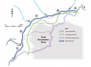
|Picture description=Plan of 2000 Nith channel diversion. From RRC Manual of Techniques (2002) - courtesy of the River Restoration Centre. | |||
|Project summary=PHASE 1: 2000 - Temporary diversion of the Nith to the north west of its current floodplain to allow for coal extraction by Scottish Coal. | |||
The Nith is an important salmon and trout fishery, however overgrazing, agriculture and past open-cast mining along the reach have affected invertebrate populations and fish spawning grounds. | |||
The primary restoration criteria for the 2000 restoration were: | |||
- design which would convey a 1 in 50 year flood. | |||
- channel which would not dry up during low flow. | |||
- design mimicing pre-diversion channel - ie. similar meander loops, pool-riffle-run sequences and channel profiles. | |||
- design which would create opportunities for enhancement of biodiversity (over and above pre-diversion conditions). | |||
Work commenced in April 2000 and was completed during September of the same year. | |||
PHASE 2: During 2004, the former course was enhanced and reconnected to the rest of the river and the temporary channel cut off to allow mining to progress across the floodplain. The site was subject to significant post-restoration biological monitoring as part of a PhD programme through CRESS (Centre for River Ecosystem Science - University of Stirling) - to ensure the new channel was performing well, ecologically. | |||
2000: channel bed/ground layer consisted of existing substrate with clay lining. 2004: Geotextile reinforcement of banks, to reduce bank erosion. Clay mattress lining to prevent water percolating through unconsolidated substrate and flowing as groundwater through potentially contaminated mine tailings. Gravel added to bed to create habitat diversity for invertebrates and fish. 2000: Containment bund constructed to prevent flooding of mine workings. | |||
}} | |||
{{Image gallery}} | |||
{{Case study image | |||
|File name=300mldsjul2000.jpg | |||
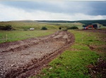
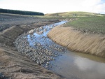
|Caption=Channel diversion in construction (2000). Courtesy of the River Restoration Centre. | |||
}} | |||
{{Case study image | |||
|File name=300mldsnov2000.jpg | |||
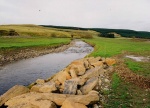
|Caption=Diverted channel once connected (2000). Courtesy of the River Restoration Centre. | |||
}} | |||
{{Case study image | |||
|File name=Nith23a.jpg | |||
|Caption=Diversion channel prior to connection - rip-rap and riffle visible (2000). Courtesy of the River Restoration Centre. | |||
}} | |||
{{Case study image | |||
|File name=Img 2986.jpg | |||
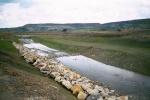
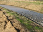
|Caption=Diversion channel (2004) showing geotextile bank reinforcement and profiled gravel bed for habitat enhancement. Courtesy of the River Restoration Centre. | |||
}} | |||
{{Case study image | |||
|File name=Img 2990.jpg | |||
|Caption=Diversion channel (2004) showing geotextile bank reinforcement, profiled gravel bed and in-channel boulder placement for habitat enhancement. Courtesy of the River Restoration Centre. | |||
}} | |||
{{Image gallery end}} | |||
{{Toggle button}} | |||
{{Toggle content start}} | |||
{{Case study subcatchment | |||
|Subcatchment=Nith | |||
}} | |||
{{Site | |||
|Name=Nith, west of New Cumnock | |||
|WFD water body code=10612 | |||
|WFD (national) typology=Mid, Small, Calcareous | |||
|WFD water body name=River Nith (u/s New Cumnock) | |||
|Reference morphology=Reproduce hydromorphology and planform of former channel. | |||
|Heavily modified water body=No | |||
|Protected species present=No | |||
|Invasive species present=No | |||
|Species=Primarily salmon and brown trout. | |||
|Dominant substrate=Mixed gravel, pebble and boulder | |||
|River corridor land use=Pasture and open-cast mining. | |||
|Average bankfull channel width category=2 - 5 m | |||
|Avrg bankfull channel width=4.5 | |||
}} | |||
{{Project background | |||
|Reach length directly affected=3000 | |||
|Works started=2000/04/01 | |||
|Works completed=2000/09/01 | |||
|Total cost category=more than 10000 k€ | |||
|Total1 cost=3900000 | |||
|Funding sources=Scottish Coal | |||
|Investigation and design Lead organisation=Halcrow | |||
|Works and supervision Lead organisation=Morrison | |||
|Monitoring Lead organisation=University of Stirling | |||
|Supplementary funding information=Phase 1: 3900000 (thousands of euros) | |||
}} | |||
{{Motivations | |||
|Other motivation=Original course running over coal deposits. Channel diverted to exploit resource, while maintaining WFD status. | |||
}} | |||
{{Measures | |||
|Bank and bed modifications measure=Introduction of gravel, Habitat diversification, Bank stabilisation, Bank protection, | |||
|Floodplain / River corridor=Containment bund to prevent flooding | |||
|Other technical measure=Addition of boulders to bed, Fish habitat restoration, | |||
}} | }} | ||
{{Hydromorphological quality elements header}} | {{Hydromorphological quality elements header}} | ||
{{End table}} | {{End table}} | ||
{{Biological quality elements header}} | {{Biological quality elements header}} | ||
{{Biological quality element table row | |||
|Element=Macrophytes | |||
|Monitored before=Yes | |||
|Monitored after=Yes | |||
|Qualitative monitoring=No | |||
|Quantitative monitoring=Yes | |||
|Control site used=Yes | |||
|Result=Awaiting results | |||
}} | |||
{{Biological quality element table row | |||
|Element=Invertebrates | |||
|Monitored before=Yes | |||
|Monitored after=Yes | |||
|Qualitative monitoring=No | |||
|Quantitative monitoring=Yes | |||
|Control site used=Yes | |||
|Result=Awaiting results | |||
}} | |||
{{End table}} | {{End table}} | ||
{{Physico-chemical quality elements header}} | {{Physico-chemical quality elements header}} | ||
{{End table}} | {{End table}} | ||
{{Other responses header}} | {{Other responses header}} | ||
{{Other response table row | |||
|Element=Channel bed morphology. | |||
|Monitored before=Yes | |||
|Monitored after=Yes | |||
|Qualitative monitoring=No | |||
|Quantitative monitoring=Yes | |||
|Control site used=No | |||
}} | |||
{{Other response table row | |||
|Element=Substrate particle size/composition. | |||
|Monitored before=No | |||
|Monitored after=Yes | |||
|Qualitative monitoring=No | |||
|Quantitative monitoring=Yes | |||
|Control site used=No | |||
}} | |||
{{End table}} | {{End table}} | ||
{{Monitoring documents}} | {{Monitoring documents}} | ||
{{Monitoring documents end}} | {{Monitoring documents end}} | ||
{{Additional Documents}} | {{Additional Documents}} | ||
{{Additional Documents end}} | {{Additional Documents end}} | ||
{{Additional links and references header}} | {{Additional links and references header}} | ||
{{Additional links and references | |||
|Link=www.cress.stir.ac.uk/news/documents/CharlesPerfect.pdf | |||
|Description=Macroinvert. Monitoring | |||
}} | |||
{{Additional links and references | |||
|Link=www.bbc.co.uk/radioscotland/gallery/landscapes_water/ | |||
|Description=2004 Diversion Image Gallery - BBC Scotland | |||
}} | |||
{{Additional links and references | |||
|Link=www.therrc.co.uk/MOT/Final_Versions_(Secure)/11.2_Nith.pdf | |||
|Description=RRC - Manual of Techniques (2013 update) | |||
}} | |||
{{Additional links and references footer}} | {{Additional links and references footer}} | ||
{{Supplementary Information}} | {{Supplementary Information}} | ||
{{Toggle content end}} | |||
Latest revision as of 15:47, 2 January 2019
Project overview
| Status | Complete |
|---|---|
| Project web site | |
| Themes | Economic aspects, Habitat and biodiversity |
| Country | Scotland |
| Main contact forename | Charles |
| Main contact surname | Perfect |
| Main contact user ID | |
| Contact organisation | Centre for River EcoSystem Science |
| Contact organisation web site | |
| Partner organisations | East Ayrshire Council, SEPA, Scottish Natural Heritage, RSPB, Nith Salmon Fisheries Board, New Cumnock Angling Association, Halcrow, River Restoration Centre |
| Parent multi-site project | |
| This is a parent project encompassing the following projects |
No |
Project summary
PHASE 1: 2000 - Temporary diversion of the Nith to the north west of its current floodplain to allow for coal extraction by Scottish Coal.
The Nith is an important salmon and trout fishery, however overgrazing, agriculture and past open-cast mining along the reach have affected invertebrate populations and fish spawning grounds.
The primary restoration criteria for the 2000 restoration were:
- design which would convey a 1 in 50 year flood.
- channel which would not dry up during low flow.
- design mimicing pre-diversion channel - ie. similar meander loops, pool-riffle-run sequences and channel profiles.
- design which would create opportunities for enhancement of biodiversity (over and above pre-diversion conditions).
Work commenced in April 2000 and was completed during September of the same year.
PHASE 2: During 2004, the former course was enhanced and reconnected to the rest of the river and the temporary channel cut off to allow mining to progress across the floodplain. The site was subject to significant post-restoration biological monitoring as part of a PhD programme through CRESS (Centre for River Ecosystem Science - University of Stirling) - to ensure the new channel was performing well, ecologically.
2000: channel bed/ground layer consisted of existing substrate with clay lining. 2004: Geotextile reinforcement of banks, to reduce bank erosion. Clay mattress lining to prevent water percolating through unconsolidated substrate and flowing as groundwater through potentially contaminated mine tailings. Gravel added to bed to create habitat diversity for invertebrates and fish. 2000: Containment bund constructed to prevent flooding of mine workings.
Monitoring surveys and results
Lessons learnt
Image gallery
|
Catchment and subcatchmentSelect a catchment/subcatchment
Catchment
Subcatchment
Site
Project background
Cost for project phases
Supplementary funding informationPhase 1: 3900000 (thousands of euros)
Reasons for river restoration
Measures
MonitoringHydromorphological quality elements
Biological quality elements
Physico-chemical quality elements
Any other monitoring, e.g. social, economic
Monitoring documents
Additional documents and videos
Additional links and references
Supplementary InformationEdit Supplementary Information
| ||||||||||||||||||||||||||||||||||||||||||||||||||||||||||||||||||||||||||||||||||||||||||||||||||||||||||||||||||||||||||||||||||||||||||||||||||||||||||||||||||||||||||||||||||||||||||||||||||||||||||||||||||||||||||||||||


