Case study:Isar-Plan: Difference between revisions
Jump to navigation
Jump to search
No edit summary |
No edit summary |
||
| (19 intermediate revisions by 6 users not shown) | |||
| Line 8: | Line 8: | ||
|Status=Complete | |Status=Complete | ||
|Project web site url=www.wwa-m.bayern.de/projekte_und_programme/isarplan/index.htm | |Project web site url=www.wwa-m.bayern.de/projekte_und_programme/isarplan/index.htm | ||
|Themes=Flood risk management, Habitat and biodiversity, Hydropower, Hydromorphology, Land use management - forestry, Monitoring, Social benefits, Spatial planning, Water quality | |Themes=Fisheries, Flood risk management, Habitat and biodiversity, Hydropower, Hydromorphology, Land use management - forestry, Monitoring, Social benefits, Spatial planning, Water quality, Urban | ||
|Country=Germany | |Country=Germany | ||
|Main contact forename= | |Main contact forename=Matthias | ||
|Main contact surname= | |Main contact surname=Junge | ||
|Contact organisation=State Office for Water Management Munich | |Contact organisation=State Office for Water Management Munich | ||
|Contact organisation url=www.wwa-m.bayern.de/index.htm | |Contact organisation url=www.wwa-m.bayern.de/index.htm | ||
|Partner organisations= | |Partner organisations=River Restoration Centre, | ||
|Multi-site=No | |Multi-site=No | ||
|Project picture=Before-After Isar.png | |Project picture=Before-After Isar.png | ||
| Line 23: | Line 22: | ||
2) Enhancing Species diversity and ecological restoration | 2) Enhancing Species diversity and ecological restoration | ||
3) Improving leisure and recreation | 3) Improving leisure and recreation | ||
|Monitoring surveys and results=The project is being currently monitored. | |||
The project is being currently monitored. | |||
}} | }} | ||
{{Image gallery}} | |||
{{Case study image | |||
|File name=Isar river.JPG | |||
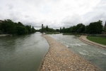
|Caption=Isar river in Munich 2013 | |||
}} | |||
{{Case study image | |||
|File name=IMG 6876.JPG | |||
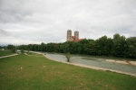
|Caption=Isar River | |||
}} | |||
{{Case study image | |||
|File name=IMG 6889.JPG | |||
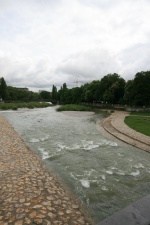
|Caption=Isar River Munich | |||
}} | |||
{{Image_gallery_end}} | |||
{{Toggle button}} | |||
{{Toggle content start}} | |||
{{Case_study_subcatchment | {{Case_study_subcatchment | ||
|Subcatchment= | |Subcatchment= | ||
| Line 40: | Line 54: | ||
|Heavily modified water body=No | |Heavily modified water body=No | ||
|Site designation=Germany - Landschaftschutzgebiet | |Site designation=Germany - Landschaftschutzgebiet | ||
|Local site designation= | |Local site designation=Landschaftsschutzgebiet/ Naturschutzgebiet | ||
|Protected species present=Yes | |Protected species present=Yes | ||
|Invasive species present=Yes | |Invasive species present=Yes | ||
| Line 46: | Line 60: | ||
|Dominant hydrology=Quick and varying run-off | |Dominant hydrology=Quick and varying run-off | ||
|Dominant substrate=Gravel- largely limestone | |Dominant substrate=Gravel- largely limestone | ||
|River corridor land use=Urban, Forest | |River corridor land use=Urban, Forest, Flood plains | ||
|Average bankfull channel width category=more than 50 m | |Average bankfull channel width category=more than 50 m | ||
|Average bankfull channel depth category=0.5 - 2 m | |Average bankfull channel depth category=0.5 - 2 m | ||
| Line 84: | Line 98: | ||
}} | }} | ||
{{Measures | {{Measures | ||
|Bank and bed modifications measure= | |Bank and bed modifications measure=Deepening of river floor, Removal of bank reinforcements, Creation of gravel banks, Bank reprofiling, | ||
|Floodplain / River corridor=Large scale planting of native species, | |Floodplain / River corridor=Large scale planting of native species, Creation of a flood expansion area, | ||
|Planform / Channel pattern=Channel widening,Creation of willow island,Creation of braided channel, | |Planform / Channel pattern=Channel widening,Creation of willow island,Creation of braided channel, Channel naturalisation, | ||
|Other technical measure=embedding of rootballs and tree trunks, | |Other technical measure=embedding of rootballs and tree trunks, Creation of new bicycle path, natural seating stones places on banks | ||
|Management interventions=Waste management, provision of temporary toilet facilities | |Management interventions=Waste management, provision of temporary toilet facilities | ||
|Social measures= | |Social measures=Information for the public | ||
}} | }} | ||
{{Hydromorphological_quality_elements_header}} | {{Hydromorphological_quality_elements_header}} | ||
| Line 162: | Line 176: | ||
{{Monitoring_documents}} | {{Monitoring_documents}} | ||
{{Monitoring_documents_end}} | {{Monitoring_documents_end}} | ||
{{Additional_Documents}} | {{Additional_Documents}} | ||
{{Additional_Documents_end}} | {{Additional_Documents_end}} | ||
{{ | {{Additional links and references header}} | ||
{{Additional links and references | |||
|Link=www.restorerivers.eu/Portals/27/NiveditaMahida_session05_ECRR2013_Isar-Plan.pdf | |||
|Description=presentation by N. Mahida | |||
}} | |||
{{Additional links and references | |||
|Link=www.youtube.com/watch?v=JV4Yt9j-h_Y&feature=youtu.be | |||
|Description=N. Mahida talking on you Tube about the Isar | |||
}} | |||
{{Additional_links_and_references_footer}} | {{Additional_links_and_references_footer}} | ||
{{Supplementary_Information | {{Supplementary_Information | ||
| Line 184: | Line 204: | ||
}} | }} | ||
{{Case_study_upload}} | {{Case_study_upload}} | ||
{{Toggle content end}} | |||
Latest revision as of 16:01, 2 January 2019
Location: 48° 7' 40.09" N, 11° 34' 41.73" E
Left click to look around in the map, and use the wheel of your mouse to zoom in and out.
Project overview
| Status | Complete |
|---|---|
| Project web site | http://www.wwa-m.bayern.de/projekte_und_programme/isarplan/index.htm |
| Themes | Fisheries, Flood risk management, Habitat and biodiversity, Hydropower, Hydromorphology, Land use management - forestry, Monitoring, Social benefits, Spatial planning, Water quality, Urban |
| Country | Germany |
| Main contact forename | Matthias |
| Main contact surname | Junge |
| Main contact user ID | |
| Contact organisation | State Office for Water Management Munich |
| Contact organisation web site | http://www.wwa-m.bayern.de/index.htm |
| Partner organisations | River Restoration Centre |
| Parent multi-site project | |
| This is a parent project encompassing the following projects |
No |
Project summary
Edit project overview to modify the project summary.
The Isar Plan Project is a river restoration project on a stretch of 8Km in the inner city of Munich. The Project was initiated in 2000 and the last site was completed by 2011. The three main goals of the project were:
1) Flood protection
2) Enhancing Species diversity and ecological restoration
3) Improving leisure and recreation
Monitoring surveys and results
Edit project overview to modify the Monitoring survey and results.
The project is being currently monitored.
Lessons learnt
This case study hasn’t got any lessons learnt, you can add some by editing the project overview.
Image gallery
|
Catchment and subcatchmentSelect a catchment/subcatchment
Catchment
Subcatchment
Site
Project background
Cost for project phases
Reasons for river restoration
Measures
MonitoringHydromorphological quality elements
Biological quality elements
Physico-chemical quality elements
Any other monitoring, e.g. social, economic
Monitoring documents
Additional documents and videos
Additional links and references
Supplementary InformationEdit Supplementary Information
| |||||||||||||||||||||||||||||||||||||||||||||||||||||||||||||||||||||||||||||||||||||||||||||||||||||||||||||||||||||||||||||||||||||||||||||||||||||||||||||||||||||||||||||||||||||||||||||||||||||||||||||||||||||||


