Case study:Scolo Desolino restoration project: Difference between revisions
No edit summary |
No edit summary |
||
| Line 83: | Line 83: | ||
{{Additional links and references header}} | {{Additional links and references header}} | ||
{{Additional links and references | {{Additional links and references | ||
|Link= | |Link=www.cirf.org/rf2012/atti/rischio_Cornelio.pdf | ||
|Description=Paper describing the project presented at the II Conference on river restoration in Italy (2012) - In Italian | |Description=Paper describing the project presented at the II Conference on river restoration in Italy (2012) - In Italian | ||
}} | }} | ||
{{Additional links and references | {{Additional links and references | ||
|Link= | |Link=www.acquerisorgive.it/page.asp?m=18 | ||
|Description=A website section dedicated to river restoration projects, studies and monitoring results by Consorzio Acque Risorgive | |Description=A website section dedicated to river restoration projects, studies and monitoring results by Consorzio Acque Risorgive | ||
}} | }} | ||
{{Additional links and references footer}} | {{Additional links and references footer}} | ||
{{Supplementary Information}} | {{Supplementary Information}} | ||
Revision as of 16:28, 24 April 2013
Project overview
| Status | Complete |
|---|---|
| Project web site | |
| Themes | Flood risk management, Habitat and biodiversity, Land use management - agriculture, Land use management - forestry, Monitoring, Water quality |
| Country | Italy |
| Main contact forename | Paolo |
| Main contact surname | Cornelio |
| Main contact user ID | |
| Contact organisation | Consorzio di Bonifica Acque Risorgive |
| Contact organisation web site | http://http://www.acquerisorgive.it/ |
| Partner organisations | |
| Parent multi-site project | |
| This is a parent project encompassing the following projects |
No |
Project summary
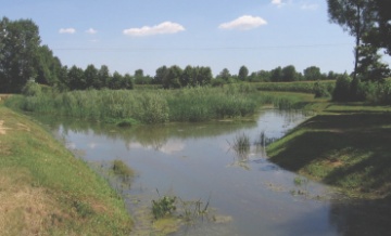
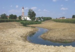
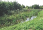
The main objectives of this project concerned the reduction of flood risk and of nutrients supply to Venice Lagoon to avoid eutrophication; in the same time an increase of biodiversity was expected. These different objectives have been reached by a number of restoration actions: river section enlargement, increase of sinuosity by the creation of new meanders,in-stream and out-stream wetlands and adoption of new practices in river management to permit a complete or partial preservation of aquatic vegetation; the creation of 4220 m.of new woody riparian buffer was mainly done for nutrient removal.
Monitoring surveys and results
Lessons learnt
Catchment and subcatchment
Edit the catchment and subcatchment details
(affects all case studies in this subcatchment)
Catchment
| River basin district | Alpi Orientali |
|---|---|
| River basin | Bacino scolante della Laguna di Venezia |
Subcatchment
| River name | Bacino scolante della Laguna di Venezia |
|---|---|
| Area category | 1000 - 10000 km² |
| Area (km2) | 2,0382,038 km² <br />203,800 ha <br /> |
| Maximum altitude category | 100 - 200 m |
| Maximum altitude (m) | |
| Dominant geology | |
| Ecoregion | Italy and Corsica |
| Dominant land cover | Intensive agriculture (arable) |
| Waterbody ID |
Other case studies in this subcatchment: Pagana canal restoration project, Rio San Martino and Piovega di Scandolara restoration project, Rio Sant'Ambrogio restoration project, Salzano wetland and Marzenego river restoration project, Zero river restoration project
Site
| Name | Scolo Desolino |
|---|---|
| WFD water body codes | 672_30 |
| WFD (national) typology | |
| WFD water body name | Fiume Dese |
| Pre-project morphology | Plane bed |
| Reference morphology | Low gradient passively meandering |
| Desired post project morphology | |
| Heavily modified water body | Yes |
| National/international site designation | |
| Local/regional site designations | |
| Protected species present | Yes |
| Invasive species present | Yes |
| Species of interest | |
| Dominant hydrology | Artificially regulated |
| Dominant substrate | Sand |
| River corridor land use | Intensive agriculture (arable) |
| Average bankfull channel width category | 2 - 5 m |
| Average bankfull channel width (m) | |
| Average bankfull channel depth category | 0.5 - 2 m |
| Average bankfull channel depth (m) | |
| Mean discharge category | 0.1 - 1.0 m³/s |
| Mean annual discharge (m3/s) | |
| Average channel gradient category | 0.001 - 0.01 |
| Average channel gradient | |
| Average unit stream power (W/m2) |
Project background
| Reach length directly affected (m) | |
|---|---|
| Project started | 2005 |
| Works started | |
| Works completed | |
| Project completed | 2009/01/01 |
| Total cost category | 1 - 10 k€ |
| Total cost (k€) | |
| Benefit to cost ratio | |
| Funding sources | Veneto Region - “Piano per la prevenzione dell’inquinamento ed il risanamento delle acque del bacino idrografico immediatamente sversante in Laguna – Piano Direttore 2000” |
Cost for project phases
| Phase | cost category | cost exact (k€) | Lead organisation | Contact forename | Contact surname |
|---|---|---|---|---|---|
| Investigation and design | |||||
| Stakeholder engagement and communication | |||||
| Works and works supervision | |||||
| Post-project management and maintenance | |||||
| Monitoring |
Reasons for river restoration
Measures
Structural measures
| |
|---|---|
| Bank/bed modifications | Bed enlargement |
| Floodplain / River corridor | Creation and riconnection of floodplain and new buffer strips |
| Planform / Channel pattern | Channel naturalisation; Creation of new meandering channel |
| Other | Creation of in-stream and out-stream wetland |
Non-structural measures
| |
| Management interventions | Adoption of new practices for acquatic vegetation management |
| Social measures (incl. engagement) | Involvement of farmers in buffer strips plantation |
| Other | |
Monitoring
Hydromorphological quality elements
| Element | When monitored | Type of monitoring | Control site used | Result | ||
|---|---|---|---|---|---|---|
| Before measures | After measures | Qualitative | Quantitative | |||
Biological quality elements
| Element | When monitored | Type of monitoring | Control site used | Result | ||
|---|---|---|---|---|---|---|
| Before measures | After measures | Qualitative | Quantitative | |||
Physico-chemical quality elements
| Element | When monitored | Type of monitoring | Control site used | Result | ||
|---|---|---|---|---|---|---|
| Before measures | After measures | Qualitative | Quantitative | |||
Any other monitoring, e.g. social, economic
| Element | When monitored | Type of monitoring | Control site used | Result | ||
|---|---|---|---|---|---|---|
| Before measures | After measures | Qualitative | Quantitative | |||
Monitoring documents
Image gallery
Additional documents and videos
Additional links and references
| Link | Description |
|---|---|
| http://www.cirf.org/rf2012/atti/rischio Cornelio.pdf | Paper describing the project presented at the II Conference on river restoration in Italy (2012) - In Italian |
| http://www.acquerisorgive.it/page.asp?m=18 | A website section dedicated to river restoration projects, studies and monitoring results by Consorzio Acque Risorgive |
Supplementary Information
Edit Supplementary Information


