Case study:Rinya water-system reconstruction: Difference between revisions
Jump to navigation
Jump to search
No edit summary |
No edit summary |
||
| (7 intermediate revisions by 3 users not shown) | |||
| Line 1: | Line 1: | ||
{{ | {{Case study status | ||
|Approval status= | |Approval status=Approved | ||
}} | }} | ||
{{Location | {{Location | ||
| Line 21: | Line 16: | ||
|Project summary=The main aim of the project is the flood protection of the towns of Babócsa, Lábod, Szabás and Nagyatád. As a result the channels will be able to handle the reference flood water output levels. On the deepening sections, further deviances will be stopped by raising and stabilizing parts of the bed. Small rivulets will be restored on an ecological basis, taking into account the wildlife of the river, for example with ensuring longitudinal penetrability for fishes by means of fish passes. | |Project summary=The main aim of the project is the flood protection of the towns of Babócsa, Lábod, Szabás and Nagyatád. As a result the channels will be able to handle the reference flood water output levels. On the deepening sections, further deviances will be stopped by raising and stabilizing parts of the bed. Small rivulets will be restored on an ecological basis, taking into account the wildlife of the river, for example with ensuring longitudinal penetrability for fishes by means of fish passes. | ||
}} | }} | ||
{{Image gallery}} | |||
{{Case study image | |||
|File name=Rinya1.JPG | |||
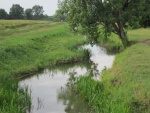
|Caption=Rinya river_1 | |||
}} | |||
{{Case study image | |||
|File name=Rinya2.JPG | |||
|Caption=Rinya river_2 | |||
}} | |||
{{Image_gallery_end}} | |||
{{Toggle button}} | |||
{{Toggle content start}} | |||
{{Case_study_subcatchment | {{Case_study_subcatchment | ||
|Subcatchment= | |Subcatchment= | ||
| Line 77: | Line 84: | ||
}} | }} | ||
{{ | {{Project background | ||
|Reach length directly affected= | |Reach length directly affected=37000 m | ||
|Project started=2008/04/01 | |||
|Works completed=2011/12/01 | |||
|Total cost category=1000 - 5000 k€ | |||
|Project started= | |Total1 cost=1856 k€ | ||
|Funding sources=European Union, European Regional Development Fund | |||
|Investigation and design Lead organisation=South-Transdanubian Environmental Protection and Water Management Directorate | |||
|Stakeholder engagement Lead organisation=South-Transdanubian Environmental Protection and Water Management Directorate | |||
|Works completed= | |Works and supervision Lead organisation=South-Transdanubian Environmental Protection and Water Management Directorate | ||
|Post-project management and maintenance Lead organisation=South-Transdanubian Environmental Protection and Water Management Directorate | |||
|Total cost category= | |||
|Total1 cost= | |||
|Funding sources= | |||
|Investigation and design Lead organisation= | |||
|Stakeholder engagement Lead organisation= | |||
|Works and supervision Lead organisation= | |||
|Post-project management and maintenance Lead organisation= | |||
}} | }} | ||
{{Motivations | {{Motivations | ||
| Line 164: | Line 111: | ||
}} | }} | ||
{{Measures | {{Measures | ||
|Bank and bed modifications measure= | |Bank and bed modifications measure=Reduction of bank slope,Reventment renewal,Creation of fish ladders,Riverbed stabilization, Weir construction, | ||
|Floodplain / River corridor=Riparian planting, Removal of exotic plants, | |||
|Planform / Channel pattern=Channel widening | |||
|Management interventions=Ensuring biodiversity | |||
|Floodplain / River corridor= | |Social measures=Recreation,Decreased flood risk | ||
|Planform / Channel pattern= | |||
|Management interventions= | |||
|Social measures= | |||
}} | }} | ||
{{Hydromorphological_quality_elements_header}} | {{Hydromorphological_quality_elements_header}} | ||
| Line 248: | Line 184: | ||
{{Monitoring_documents}} | {{Monitoring_documents}} | ||
{{Monitoring_documents_end}} | {{Monitoring_documents_end}} | ||
{{Additional_Documents}} | {{Additional_Documents}} | ||
{{Additional_Documents_end}} | {{Additional_Documents_end}} | ||
| Line 306: | Line 232: | ||
}} | }} | ||
{{Case_study_upload}} | {{Case_study_upload}} | ||
{{Toggle content end}} | |||
Latest revision as of 14:48, 2 January 2019
Location: 46° 2' 19.62" N, 17° 21' 12.01" E
Left click to look around in the map, and use the wheel of your mouse to zoom in and out.
Project overview
| Status | Complete |
|---|---|
| Project web site | http://www.ddkovizig.hu/tartalom/rinya_water-system_reconstruction_/263 |
| Themes | Flood risk management, Habitat and biodiversity |
| Country | Hungary |
| Main contact forename | Ildikó |
| Main contact surname | Gscheidt |
| Main contact user ID | |
| Contact organisation | South-Transdanubian Environmental Protection and Water Management Directorate |
| Contact organisation web site | |
| Partner organisations | |
| Parent multi-site project | |
| This is a parent project encompassing the following projects |
No |
This case study hasn’t got a picture, you can add one by editing the project overview.
Project summary
Edit project overview to modify the project summary.
The main aim of the project is the flood protection of the towns of Babócsa, Lábod, Szabás and Nagyatád. As a result the channels will be able to handle the reference flood water output levels. On the deepening sections, further deviances will be stopped by raising and stabilizing parts of the bed. Small rivulets will be restored on an ecological basis, taking into account the wildlife of the river, for example with ensuring longitudinal penetrability for fishes by means of fish passes.
Monitoring surveys and results
This case study hasn’t got any Monitoring survey and results, you can add some by editing the project overview.
Lessons learnt
This case study hasn’t got any lessons learnt, you can add some by editing the project overview.
Image gallery
|
Catchment and subcatchmentSelect a catchment/subcatchment
Catchment
Subcatchment
Site
Project background
Cost for project phases
Reasons for river restoration
Measures
MonitoringHydromorphological quality elements
Biological quality elements
Physico-chemical quality elements
Any other monitoring, e.g. social, economic
Monitoring documents
Additional documents and videos
Additional links and references
Supplementary InformationEdit Supplementary Information
| |||||||||||||||||||||||||||||||||||||||||||||||||||||||||||||||||||||||||||||||||||||||||||||||||||||||||||||||||||||||||||||||||||||||||||||||||||||||||||||||||||||||||||||||||||||||||||||||||||||||||||||||||||||||||||||||


