Case study:The Bowmont Catchment: Difference between revisions
No edit summary |
No edit summary |
||
| (2 intermediate revisions by the same user not shown) | |||
| Line 1: | Line 1: | ||
{{Case study status | {{Case study status | ||
|Approval status= | |Approval status=Approved | ||
}} | }} | ||
{{Location | {{Location | ||
| Line 38: | Line 38: | ||
{{Motivations | {{Motivations | ||
|Specific mitigation=Flood risk management, | |Specific mitigation=Flood risk management, | ||
|Hydromorphological quality elements=Channel pattern/planform, | |||
}} | }} | ||
{{Measures | {{Measures | ||
|Bank and bed modifications measure=Deflectors, | |Bank and bed modifications measure=Deflectors, | ||
|Floodplain / River corridor=Tree planting, | |||
|Planform / Channel pattern=leaky woody dams, | |Planform / Channel pattern=leaky woody dams, | ||
}} | }} | ||
Latest revision as of 15:05, 1 November 2018
Project overview
| Status | Complete |
|---|---|
| Project web site | http://www.therrc.co.uk/sites/default/files/projects/14_bowmont.pdf |
| Themes | Flood risk management, Habitat and biodiversity, Hydromorphology, Land use management - agriculture, Land use management - forestry, Monitoring |
| Country | Scotland |
| Main contact forename | Mark |
| Main contact surname | Wilkinson |
| Main contact user ID | |
| Contact organisation | James Hutton Institute |
| Contact organisation web site | http://www.hutton.ac.uk/ |
| Partner organisations | Tweed Forum |
| Parent multi-site project | |
| This is a parent project encompassing the following projects |
No |
Project summary
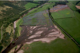
The Bowmont Water is a tributary of the River Tweed. The valley has a history of significant flood events. Following extreme floods in 2008 and 2009, the Tweed Forum (through the Cheviot Futures initiative) began to look at more natural ways to tackle coarse sediment problems and manage flood risk. Measures such as bank protection engineered log jams (ELJs), bar apex ELJs and flow restrictors have been installed in the catchment. Alongside this, large areas of trees have been planted on the floodplains of the catchment coupled with pockets of upland planting. Over the 4-year period of monitoring, 78 leaky barrier structures have been installed to capture and stabilise sediment and attenuate flows. A total of 53ha of native riparian and floodplain forest have been planted.
Monitoring surveys and results
Lessons learnt
Image gallery
|
Catchment and subcatchment
Site
Project background
Cost for project phases
Reasons for river restoration
Measures
MonitoringHydromorphological quality elements
Biological quality elements
Physico-chemical quality elements
Any other monitoring, e.g. social, economic
Monitoring documents
Additional documents and videos
Additional links and references
Supplementary InformationEdit Supplementary Information
| ||||||||||||||||||||||||||||||||||||||||||||||||||||||||||||||||||||||||||||||||||||||||||||||||||||||||||||||||||||||||||||||||||||||||||||||||||||||||||||||||||||||||||||||||||

