Case study:Irpin river restoration: Difference between revisions
No edit summary |
No edit summary |
||
| (21 intermediate revisions by 5 users not shown) | |||
| Line 1: | Line 1: | ||
{{Case study status | {{Case study status | ||
|Approval status= | |Approval status=Approved | ||
}} | }} | ||
{{Location | {{Location | ||
|Location=50.076653106038, 29.548450469447 | |Location=50.076653106038, 29.548450469447 | ||
|Kml file= | |Kml file=Irpinbasinsub.kml | ||
}} | }} | ||
{{Project overview | {{Project overview | ||
| Line 20: | Line 20: | ||
|Project summary=The full name of the project is: ''Integrated Planning of water resources use within the Irpin River basin'', subtitle: Irpin River restoration via integrated river basin management - Balancing nature, agriculture and recreation. The project was presented on the RR conference in Vienna 2013. | |Project summary=The full name of the project is: ''Integrated Planning of water resources use within the Irpin River basin'', subtitle: Irpin River restoration via integrated river basin management - Balancing nature, agriculture and recreation. The project was presented on the RR conference in Vienna 2013. | ||
The project idea was developed on the basis of results from a comprehensive technical/hydrological study of the whole river basin in the years 2009-2012. In 2013 the Ukrainian Centre for River Restoration (UCRR) was established at the Institute | *'''Zome map out to 10km to see the outline of the exent of the project.''' | ||
The project idea was developed on the basis of results from a comprehensive technical/hydrological study of the whole river basin in the years 2009-2012. In 2013 the Ukrainian Centre for River Restoration (UCRR) was established at the Institute of Water Problems and Land Reclamation, Kiev. The Irpin river project was selected as a first official project of the UCRR. | |||
The project implementation has started with the participation and consultation of stakeholders in a special workshop in April 2014. Before, during and after this workshop all kind of information has been collected and used to set up a database for the use of GIS visualisation, GIS-based modelling and first characterisation of the catchments. | The project implementation has started with the participation and consultation of stakeholders in a special workshop in April 2014. Before, during and after this workshop all kind of information has been collected and used to set up a database for the use of GIS visualisation, GIS-based modelling and first characterisation of the catchments. | ||
|Monitoring surveys and results=A regular monitoring as foreseen for the WFD was not yet implemented. Existing results of former studies are mainly related to river discharge and random samplings | |Monitoring surveys and results=A regular monitoring as foreseen for the WFD was not yet implemented. Existing results of former studies are mainly related to river discharge and random samplings for water quality controls. Further monitoring results are collected by several departments of the Ministry of Ecology and Natural Resources of Ukraine. The sampling stations are however further downriver of the subbasin border. | ||
|Lessons learn=The big number of problems and open questions is beyond the personnel and financial capacity of Ukrainian state institutions. International cooperation will help to gain or exchange best practices in river restoration but it is also clear that a much smaller subbasin of the river had to be selected to start with. | |Lessons learn=The big number of problems and open questions is beyond the personnel and financial capacity of Ukrainian state institutions. International cooperation will help to gain or exchange best practices in river restoration but it is also clear that a much smaller subbasin of the river had to be selected to start with. | ||
}} | }} | ||
| Line 30: | Line 32: | ||
{{Case study image | {{Case study image | ||
|File name=Bankburned.jpg | |File name=Bankburned.jpg | ||
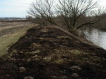
|Caption=Landuse pressures will be identified and solutions proposed | |Caption=Landuse pressures will be identified and solutions proposed (photo Vasiliy Kostiushyn) | ||
}} | }} | ||
{{Case study image | {{Case study image | ||
|File name=Irpen-sluise.jpg | |File name=Irpen-sluise.jpg | ||
|Caption=One of 17 massive concrete constructions built to regulate water flow and to avoid flooding downstream (photo Vasiliy | |Caption=One of 17 massive concrete constructions built to regulate water flow and to avoid flooding downstream (photo Vasiliy Kostiushyn) | ||
}} | |||
{{Case study image | |||
|File name=Residents.jpg | |||
|Caption=Private buildings in the river valley (photo Vasiliy Kostiushyn) | |||
}} | |||
{{Case study image | |||
|File name=Landuseag.jpg | |||
|Caption=Agriculture is the main landuse in the subbasin | |||
}} | |||
{{Case study image | |||
|File name=Nitratepaths.png | |||
|Caption=Canalisation is still missing. Groundwater pollution from living places is assessed by GIS-based modelling. | |||
}} | }} | ||
{{Image gallery end}} | {{Image gallery end}} | ||
| Line 40: | Line 54: | ||
{{Toggle content start}} | {{Toggle content start}} | ||
{{Case study subcatchment}} | {{Case study subcatchment}} | ||
{{Site}} | {{Site | ||
{{Project background}} | |Name=Irpin River subbasin | ||
|WFD water body code=UA0112/xx | |||
|WFD (national) typology=HMWB, Type 15: small sand-dominated lowland river, | |||
|Pre-project morphology=low land river of the Eastern Plains, impounded, | |||
|Reference morphology=Actively meandering, | |||
|Desired post project morphology=improved connectivity | |||
|Heavily modified water body=Yes | |||
|Protected species present=Yes | |||
|Invasive species present=Yes | |||
|Dominant hydrology=Artificially regulated, | |||
|Dominant substrate=Sand, | |||
|River corridor land use=Intensive agriculture (arable), forestry, pastures, settlements | |||
|Mean discharge category=1 - 10 m³/s | |||
|Average channel gradient category=0.001 - 0.01 | |||
}} | |||
{{Project background | |||
|Reach length directly affected=10000 | |||
|Project started=2013/04/01 | |||
|Works started=2013/04/01 | |||
|Stakeholder1 engagement cost category=Less than 1 k€ | |||
|Supplementary funding information=The project is still in the planning phase; funds not yet available | |||
}} | |||
{{Motivations | {{Motivations | ||
|Hydromorphological quality elements=The | |Hydromorphological quality elements=Channel pattern/planform, The River Irpin must be considered as heavily modified (HMWB) due to dam constructions, intensive agriculture a.o. | ||
|Physico-chemical quality elements=water quality influenced by diffuse pollution sources (agriculture, urbanisation) | |Physico-chemical quality elements=Nutrient concentrations, water quality influenced by diffuse pollution sources (agriculture, urbanisation) | ||
|Other motivation=Community demand, recreation, landscape enhancement | |Other motivation=Community demand, recreation, landscape enhancement | ||
}} | }} | ||
{{Measures | {{Measures | ||
| | |Bank and bed modifications measure=Weir removal, Dam removal, | ||
|Management interventions=landuse changes | |Management interventions=landuse changes | ||
|Wider stakeholder / citizen engagement=cooperation with local or regional investors | |Wider stakeholder / citizen engagement=cooperation with local or regional investors | ||
| Line 65: | Line 100: | ||
{{Additional Documents end}} | {{Additional Documents end}} | ||
{{Additional links and references header}} | {{Additional links and references header}} | ||
{{Additional links and references | |||
|Link=www.researchgate.net/publication/321192989_HYDROMORPHOLOGICAL_ASSESSMENTS_AT_THE_IRPIN_RIVER-METHODOLOGICAL_HINTS_AND_FIRST_FINDINGS | |||
|Description=1st habitat assessment of a reach of the R. Irpin | |||
}} | |||
{{Additional links and references footer}} | {{Additional links and references footer}} | ||
{{Supplementary Information}} | {{Supplementary Information}} | ||
{{Toggle content end}} | {{Toggle content end}} | ||
Latest revision as of 14:18, 29 November 2017
Project overview
| Status | Planned |
|---|---|
| Project web site | |
| Themes | Economic aspects, Flood risk management, Hydromorphology, Land use management - agriculture, Social benefits, Spatial planning |
| Country | Ukraine |
| Main contact forename | Michael |
| Main contact surname | Hoffmann |
| Main contact user ID | User:Miho-kiev |
| Contact organisation | Institute of Water Problems and Land Reclamation |
| Contact organisation web site | http://igim.org.ua |
| Partner organisations | |
| Parent multi-site project | |
| This is a parent project encompassing the following projects |
No |
Project summary
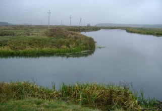
The full name of the project is: Integrated Planning of water resources use within the Irpin River basin, subtitle: Irpin River restoration via integrated river basin management - Balancing nature, agriculture and recreation. The project was presented on the RR conference in Vienna 2013.
- Zome map out to 10km to see the outline of the exent of the project.
The project idea was developed on the basis of results from a comprehensive technical/hydrological study of the whole river basin in the years 2009-2012. In 2013 the Ukrainian Centre for River Restoration (UCRR) was established at the Institute of Water Problems and Land Reclamation, Kiev. The Irpin river project was selected as a first official project of the UCRR.
The project implementation has started with the participation and consultation of stakeholders in a special workshop in April 2014. Before, during and after this workshop all kind of information has been collected and used to set up a database for the use of GIS visualisation, GIS-based modelling and first characterisation of the catchments.
Monitoring surveys and results
A regular monitoring as foreseen for the WFD was not yet implemented. Existing results of former studies are mainly related to river discharge and random samplings for water quality controls. Further monitoring results are collected by several departments of the Ministry of Ecology and Natural Resources of Ukraine. The sampling stations are however further downriver of the subbasin border.
Lessons learnt
The big number of problems and open questions is beyond the personnel and financial capacity of Ukrainian state institutions. International cooperation will help to gain or exchange best practices in river restoration but it is also clear that a much smaller subbasin of the river had to be selected to start with.
Image gallery
|
Catchment and subcatchment
Site
Project background
Cost for project phases
Supplementary funding informationThe project is still in the planning phase; funds not yet available
Reasons for river restoration
Measures
MonitoringHydromorphological quality elements
Biological quality elements
Physico-chemical quality elements
Any other monitoring, e.g. social, economic
Monitoring documents
Additional documents and videos
Additional links and references
Supplementary InformationEdit Supplementary Information
| ||||||||||||||||||||||||||||||||||||||||||||||||||||||||||||||||||||||||||||||||||||||||||||||||||||||||||||||||||||||||||||||||||||||||||||||||||||||||||||||||||||||||||


