Case study:Craigton Riparian and NFM Orchard Planting: Difference between revisions
No edit summary |
No edit summary |
||
| (13 intermediate revisions by 3 users not shown) | |||
| Line 1: | Line 1: | ||
{{Case study status | {{Case study status | ||
|Approval status= | |Approval status=Approved | ||
}} | }} | ||
{{Location | {{Location | ||
|Location=56.2186746, -3. | |Location=56.2186746, -3.9533262 | ||
}} | }} | ||
{{Project overview | {{Project overview | ||
| Line 18: | Line 18: | ||
|Project picture=SAM 1806.JPG | |Project picture=SAM 1806.JPG | ||
|Picture description=Riparian trees planted along the bank of the river, connecting to remnant riparian woodland and covering areas of the bank embankment that are breached earliest by out of channel flow. | |Picture description=Riparian trees planted along the bank of the river, connecting to remnant riparian woodland and covering areas of the bank embankment that are breached earliest by out of channel flow. | ||
|Project summary=Craigton Farm sits inside a large meander of the Allan Water between the villages of Ashfield and Kinbuck. The Allan Water has two large areas downstream of Craigton classified as Potentially Vulnerable Areas to flooding, | |Project summary=Craigton Farm sits inside a large meander of the Allan Water between the villages of Ashfield and Kinbuck. The Allan Water has two large areas downstream of Craigton classified as Potentially Vulnerable Areas to flooding, which include the townships of Dunblane and Bridge of Allan. During flood events, out of channel flow passes across the Craigton Farm fields where little rugosity exists to attenuate the flood water. | ||
Click the link to see video footage of flood water flowing back into the Allan Water at the downstream side of the meander encompassing Craigton Farm: https://www.youtube.com/watch?v=Pk-AUS_9r60 | |||
Objectives of the project were: to reduce the speed of the out of channel flow across the farm fields; restore and increase natural riparian habitat that will benefit terrestrial and aquatic biodiversity; increase the opportunity for woody debris interaction in the river system that will benefit fisheries and habitat diversity; create an area of enhanced natural beauty for local communities to enjoy; provide an opportunity for local people to be able to learn, manage and harvest a locally sustainable food resource through the Craigton Community Orchard Group; and an opportunity to engage with local residents about Natural Flood Management by obtaining local volunteers to carry out the tree planting. | Objectives of the project were: to reduce the speed of the out of channel flow across the farm fields; restore and increase natural riparian habitat that will benefit terrestrial and aquatic biodiversity; increase the opportunity for woody debris interaction in the river system that will benefit fisheries and habitat diversity; create an area of enhanced natural beauty for local communities to enjoy; provide an opportunity for local people to be able to learn, manage and harvest a locally sustainable food resource through the Craigton Community Orchard Group; and an opportunity to engage with local residents about Natural Flood Management by obtaining local volunteers to carry out the tree planting. | ||
Work carried out: 420 riparian tree species including downy birch, goat willow, osier, hawthorn, rowan and hazel were planted on the banks of the Allan Water at Craigton Farm inline with | Work carried out: 420 riparian tree species including downy birch, goat willow, osier, hawthorn, rowan and hazel were planted on the banks of the Allan Water at Craigton Farm inline with breaches in the embankment at the upstream end of the meander, and where flood water flows back into the river at the downstream end. 300 trees were planted on the upstream side of the site and the remaining 120 trees were planted on the downstream side. Trees were planted by volunteers with emphasis given to plant trees at random spacing and in dense clumps inline with out of channel flow pathways. The width of the tree planting is around 5m for the majority of the two sections, however there is a fenced area on the upstream side of the meander that has been planted up to 30m width at points, bringing the planted area to around 0.5ha. | ||
In addition, willow cuttings/whips 6-9inches long were collected from local willows and planted in parts of the river bank that would have a lot of flow interaction such as at the water's edge, | In addition, willow cuttings/whips 6-9inches long were collected from local willows and planted in parts of the river bank that would have a lot of flow interaction such as at the water's edge, eroded bank faces or inline with out of channel flow pathways to increase rugosity without risking more valuable tree species. | ||
23 orchard trees were planted in an old disused horse field in the flood pathway on the upstream side of the farm. The orchard was designed so that no distinct channels or rows | 23 orchard trees were planted in an old disused horse field in the flood pathway on the upstream side of the farm. The orchard was designed so that no distinct channels or rows existed facing the direction of flow flood water would come from. This resulted in a ping-pong table planting design that is aimed to dissipate energy from flood water passing through the orchard. Mound planting was used to elevate the root ball of the orchard trees above the ground level to help protect the roots from being submerged for long periods in flood water, and therefore affecting the orchard trees survival. Orchard trees were planted 10m apart to allow room for growth, and ease of access, maintenance and harvest in the future. | ||
In addition, 105 wild harvest shrub species were planted in a similar ping-pong table style design, behind the orchard trees. The wild harvest trees create another obstacle for flowing flood water to pass through dissipating more energy. The field that comprises the orchard and wild harvest trees covers 1ha. | In addition, 105 wild harvest shrub species were planted in a similar ping-pong table style design, behind the orchard trees. The wild harvest trees create another obstacle for flowing flood water to pass through dissipating more energy. The field that comprises the orchard and wild harvest trees covers 1ha. | ||
Challenges included managing volunteers | Challenges included managing volunteers in a fun manner whilst also ensuring they plant trees correctly, and continual maintenance and care of trees over the long term. | ||
Funding: | Funding: | ||
420 wet woodland trees obtained through the Woodland Trust's Free Trees Grant; | *420 wet woodland trees obtained through the Woodland Trust's Free Trees Grant; | ||
23 orchard trees obtained from the Central Scotland Green Network's Orchard Grant Scheme; | *23 orchard trees obtained from the Central Scotland Green Network's Orchard Grant Scheme; | ||
and 120 wild harvest obtained through the Woodland Trust's Free Trees Grant. | *and 120 wild harvest obtained through the Woodland Trust's Free Trees Grant. | ||
|Monitoring surveys and results=Monitoring of the tree establishment success rate will be carried out. | |Monitoring surveys and results=Monitoring of the tree establishment success rate will be carried out. | ||
|Lessons learn=* Willow cuttings look like they have had a low success rate, potentially spiral guard and cane may improve success. | |||
* Thicker willow cuttings, may also have produced larger survival rates. | |||
* Weed killer on planting positions weeks before being planted may have improved the success rate of riparian and wild harvest trees by reducing competition from grasses | |||
}} | }} | ||
{{Image gallery}} | {{Image gallery}} | ||
| Line 76: | Line 79: | ||
{{Toggle content start}} | {{Toggle content start}} | ||
{{Case study subcatchment}} | {{Case study subcatchment}} | ||
{{Site}} | {{Site | ||
{{Project background}} | |Name=Allan Water | ||
{{Motivations}} | |WFD water body name=Allan Water | ||
{{Measures}} | |Heavily modified water body=No | ||
|Protected species present=No | |||
|Invasive species present=Yes | |||
|River corridor land use=Improved/semi-improved grassland/pasture, Rough unimproved grassland/pasture, Broadleaf/mixed woodland (semi natural), | |||
}} | |||
{{Project background | |||
|Reach length directly affected=475m | |||
|Project started=2013/08/01 | |||
|Works started=2013/11/17 | |||
|Works completed=2014/03/08 | |||
|Project completed=2014/03/08 | |||
|Total1 cost=0.639 | |||
|Investigation and design Lead organisation=TCV and CRESS | |||
}} | |||
{{Motivations | |||
|Other motivation=Flood mitigation downstream, Landscape enhancement, Bank erosion, biodiversity | |||
}} | |||
{{Measures | |||
|Floodplain / River corridor=Creation of wet woodland, orchard | |||
|Social measures=Volunteer engagement, | |||
}} | |||
{{Hydromorphological quality elements header}} | {{Hydromorphological quality elements header}} | ||
{{End table}} | {{End table}} | ||
Latest revision as of 07:52, 6 June 2017
Project overview
| Status | Complete |
|---|---|
| Project web site | http://www.cress.stir.ac.uk/allanwater/ |
| Themes | Economic aspects, Fisheries, Flood risk management, Habitat and biodiversity, Social benefits |
| Country | Scotland |
| Main contact forename | Lawrence |
| Main contact surname | Belleni |
| Main contact user ID | User:Lbelleni |
| Contact organisation | The Conservation Volunteers and the Centre for River Ecosystem Science |
| Contact organisation web site | http://www.tcv.org.uk/scotland |
| Partner organisations | |
| Parent multi-site project | |
| This is a parent project encompassing the following projects |
No |
Project summary
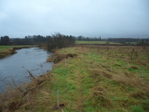
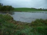
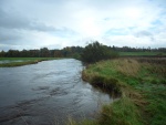
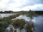
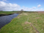
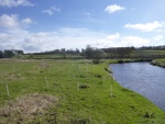
Craigton Farm sits inside a large meander of the Allan Water between the villages of Ashfield and Kinbuck. The Allan Water has two large areas downstream of Craigton classified as Potentially Vulnerable Areas to flooding, which include the townships of Dunblane and Bridge of Allan. During flood events, out of channel flow passes across the Craigton Farm fields where little rugosity exists to attenuate the flood water.
Click the link to see video footage of flood water flowing back into the Allan Water at the downstream side of the meander encompassing Craigton Farm: https://www.youtube.com/watch?v=Pk-AUS_9r60
Objectives of the project were: to reduce the speed of the out of channel flow across the farm fields; restore and increase natural riparian habitat that will benefit terrestrial and aquatic biodiversity; increase the opportunity for woody debris interaction in the river system that will benefit fisheries and habitat diversity; create an area of enhanced natural beauty for local communities to enjoy; provide an opportunity for local people to be able to learn, manage and harvest a locally sustainable food resource through the Craigton Community Orchard Group; and an opportunity to engage with local residents about Natural Flood Management by obtaining local volunteers to carry out the tree planting.
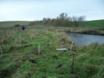
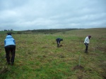
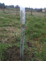
Work carried out: 420 riparian tree species including downy birch, goat willow, osier, hawthorn, rowan and hazel were planted on the banks of the Allan Water at Craigton Farm inline with breaches in the embankment at the upstream end of the meander, and where flood water flows back into the river at the downstream end. 300 trees were planted on the upstream side of the site and the remaining 120 trees were planted on the downstream side. Trees were planted by volunteers with emphasis given to plant trees at random spacing and in dense clumps inline with out of channel flow pathways. The width of the tree planting is around 5m for the majority of the two sections, however there is a fenced area on the upstream side of the meander that has been planted up to 30m width at points, bringing the planted area to around 0.5ha.
In addition, willow cuttings/whips 6-9inches long were collected from local willows and planted in parts of the river bank that would have a lot of flow interaction such as at the water's edge, eroded bank faces or inline with out of channel flow pathways to increase rugosity without risking more valuable tree species.
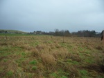
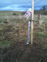
23 orchard trees were planted in an old disused horse field in the flood pathway on the upstream side of the farm. The orchard was designed so that no distinct channels or rows existed facing the direction of flow flood water would come from. This resulted in a ping-pong table planting design that is aimed to dissipate energy from flood water passing through the orchard. Mound planting was used to elevate the root ball of the orchard trees above the ground level to help protect the roots from being submerged for long periods in flood water, and therefore affecting the orchard trees survival. Orchard trees were planted 10m apart to allow room for growth, and ease of access, maintenance and harvest in the future.
In addition, 105 wild harvest shrub species were planted in a similar ping-pong table style design, behind the orchard trees. The wild harvest trees create another obstacle for flowing flood water to pass through dissipating more energy. The field that comprises the orchard and wild harvest trees covers 1ha.
Challenges included managing volunteers in a fun manner whilst also ensuring they plant trees correctly, and continual maintenance and care of trees over the long term.
Funding:
- 420 wet woodland trees obtained through the Woodland Trust's Free Trees Grant;
- 23 orchard trees obtained from the Central Scotland Green Network's Orchard Grant Scheme;
- and 120 wild harvest obtained through the Woodland Trust's Free Trees Grant.
Monitoring surveys and results
Monitoring of the tree establishment success rate will be carried out.
Lessons learnt
- Willow cuttings look like they have had a low success rate, potentially spiral guard and cane may improve success.
- Thicker willow cuttings, may also have produced larger survival rates.
- Weed killer on planting positions weeks before being planted may have improved the success rate of riparian and wild harvest trees by reducing competition from grasses
Image gallery
|
Catchment and subcatchment
Site
Project background
Cost for project phases
Reasons for river restoration
Measures
MonitoringHydromorphological quality elements
Biological quality elements
Physico-chemical quality elements
Any other monitoring, e.g. social, economic
Monitoring documents
Additional documents and videos
Additional links and references
Supplementary InformationEdit Supplementary Information
| ||||||||||||||||||||||||||||||||||||||||||||||||||||||||||||||||||||||||||||||||||||||||||||||||||||||||||||||||||||||||||||||||||||||||||||||||||||||||||||||||||||||||||||||||||

